Liguria is a long, narrow strip of land curving around the Gulf of Genoa: the sea on one side, mountains rising straight behind the coast on the other. It runs from the French border at Ventimiglia to Sarzana on the border with Tuscany. Genoa sits in the middle and splits the region in two: the Riviera di Ponente to the west and the Riviera di Levante to the east.
The interactive map below shows every town, village and point of interest in our guide. Further down you’ll find how the region is laid out, its provinces, the Rivieras and real travel distances to help you plan.
Interactive map of Liguria
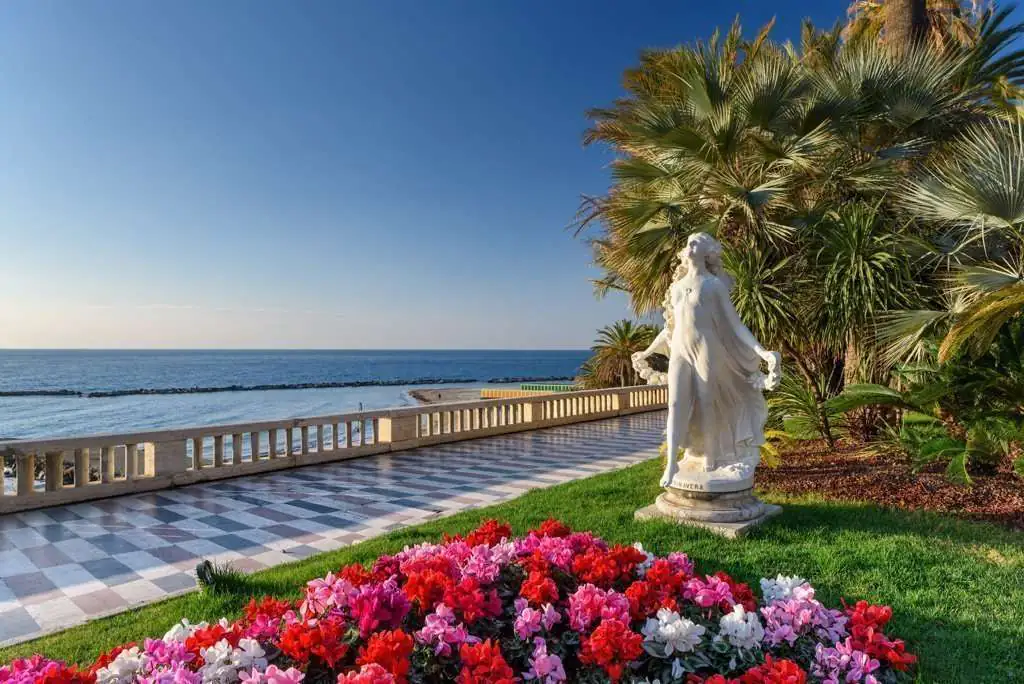 Riviera dei Fiori
Imperia
Sanremo e Bordighera, i giardini sul mare e i borghi arroccati dell’entroterra, a un passo dalla Francia.
Ventimiglia · Bordighera · Sanremo · Dolceacqua · Apricale · TrioraDiscover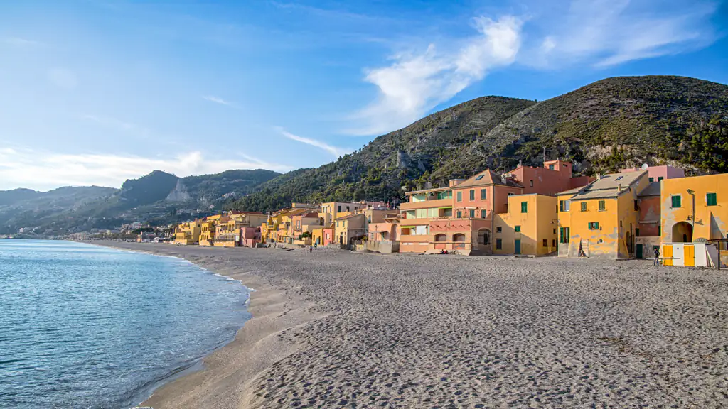 Riviera delle Palme
Savona
Lunghe spiagge di sabbia da Varazze ad Alassio, il borgo medievale di Finalborgo e le Grotte di Toirano.
Alassio · Albenga · Finale Ligure · Varigotti · Noli · VarazzeDiscover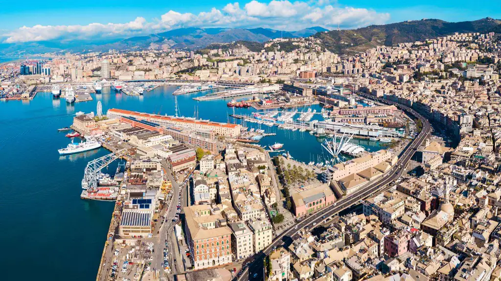 Il capoluogo e il Tigullio
Genova
Il porto antico, i caruggi e l’Acquario. Verso levante Camogli, Portofino e il Golfo del Tigullio.
Genova · Camogli · Portofino · Santa Margherita · Rapallo · Sestri LevanteDiscover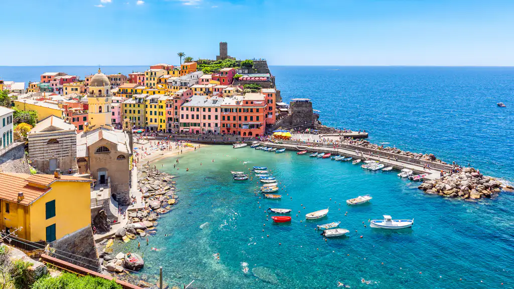 Cinque Terre e Golfo dei Poeti
La Spezia
Le Cinque Terre, Portovenere e il Golfo dei Poeti fino a Lerici e Sarzana, al confine con la Toscana.
Monterosso · Vernazza · Corniglia · Manarola · Riomaggiore · LericiDiscoverHow to use the map
The map shows seaside towns, inland villages and the main sights, such as museums, monuments and well-known trails. On a computer you see the whole region; on a phone, swipe the map sideways. Use the buttons at the top to show or hide towns, villages and sights, then click a marker: a card opens with a photo, a short description and a link to the guide. Hover over (or tap) a province to highlight its card below the map, with its main towns.
It also works the other way round: on each destination page you’ll find a “See on the map” button that brings you here with that place highlighted. It’s the quickest way to see what’s near your hotel and which places you can combine in one day.
Map of Liguria with provinces
If you want a map you can take in at a glance, or save to your phone before you travel, here is a political map of Liguria: the four provinces and their borders, the provincial capitals and the main towns on the coast and inland, with a scale in kilometres. Click the image to open it at full resolution.
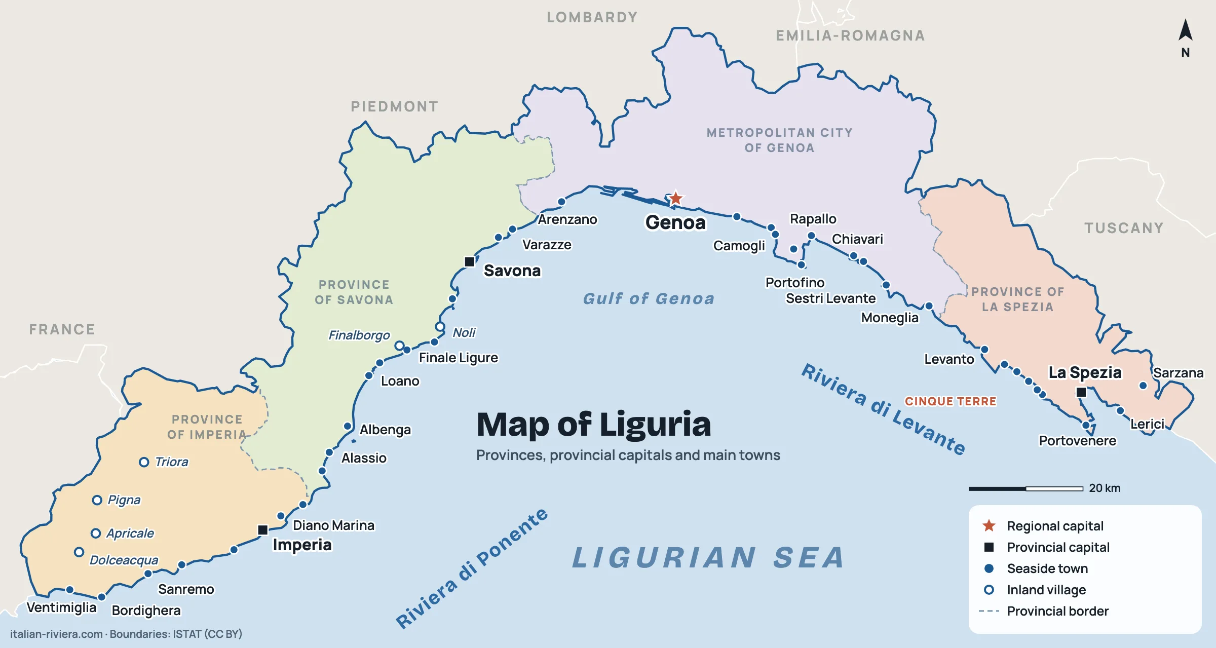
Further down, in the section on the two Rivieras, you’ll find detailed maps of the Riviera di Ponente and the Riviera di Levante with every town in this guide.
How Liguria is laid out

It’s one of Italy’s smallest regions, about 5,400 km², with around 1.5 million people, more than a third of them in Genoa. Behind the coast rise the Ligurian Alps to the west and the Apennines to the east: there are almost no plains, and towns are squeezed between sea and hills, linked by a single coastal railway and two seaside motorways, the A10 to the west and the A12 to the east.
This shape explains most of the travel logistics: along the coast the train works well, while inland you need a car, on narrow, winding roads. Distances look short on paper, but journeys take longer than you’d expect.
Hotels, B&Bs and apartments all over Liguria: compare prices and availability.
The four provinces
- Imperia: the westernmost, on the French border. The Riviera dei Fiori coast with Sanremo, Bordighera and Imperia, plus inland villages such as Dolceacqua, Apricale and Triora.
- Savona: the coast with the widest beaches, from Alassio to Varazze, with Finale Ligure, Noli and the city of Savona.
- Genoa (metropolitan city): the regional capital Genoa and, to the east, the Golfo Paradiso and Tigullio with Camogli, Portofino, Rapallo and Sestri Levante.
- La Spezia: the easternmost, with the Cinque Terre, Portovenere, Lerici and the Gulf of Poets, and Sarzana towards Tuscany.
List of places by province
Every place marked on the map, grouped by province, with a link to its guide.
Province of Imperia
Towns: Arma di Taggia · Bordighera · Cervo · Diano Marina · Imperia · San Lorenzo al Mare · Sanremo · Ventimiglia
Villages: Apricale · Bussana Vecchia · Dolceacqua · Pigna · Rocchetta Nervina · Seborga · Triora
Sights: Ariston Theater · Balzi Rossi · Beodo Trail · Bicknell Museum · Bordighera Alta · Casino of Sanremo · Church of Sant’Ampelio · Civic Museum of Sanremo · Co-cathedral of San Siro · Fort of Santa Tecla · Hanbury Gardens · La Pigna · Lungomare Argentina · Monumental trees of Bordighera · Palazzo Borea d’Olmo · Pallanca Exotic Garden · Passeggiata Imperatrice · Regina Elena Gardens · Russian Church · Sanctuary of Madonna della Costa · Sanremo cycle path · The Marabutto · The gardens of villa Ormond · Via Matteotti · Villa Etelinda · Villa Garnier · Villa Nobel · Villa Pompeo Mariani
Province of Savona
Towns: Alassio · Albenga · Bergeggi · Borghetto Santo Spirito · Celle Ligure · Finale Ligure · Laigueglia · Loano · Pietra Ligure · Savona · Varazze · Varigotti
Villages: Finalborgo · Noli
Sights: Caves of Toirano
Province of Genoa
Towns: Arenzano · Bogliasco · Camogli · Chiavari · Genoa · Lavagna · Moneglia · Portofino · Rapallo · Recco · Santa Margherita Ligure · Sestri Levante
Sights: Abbey of San Fruttuoso · Biosphere · Boccadasse · Castelletto viewpoint · Castello d’Albertis · Cathedral of San Lorenzo · Church of the Annunziata · Galata Museum of the Sea · Genoa Aquarium · Lanterna of Genoa · Nervi Parks · Old Port (Porto Antico) · Rolli Palaces · Staglieno Monumental Cemetery · The Caruggi of Genoa · Via del Campo 29 rosso
Province of La Spezia
Towns: Bonassola · Corniglia · Deiva Marina · Framura · La Spezia · Lerici · Levanto · Manarola · Monterosso · Portovenere · Riomaggiore · Sarzana · Vernazza
Villages: Tellaro
Sights: Lerici Castle · Sentiero Azzurro · Villa Marigola
The Rivieras: Ponente and Levante
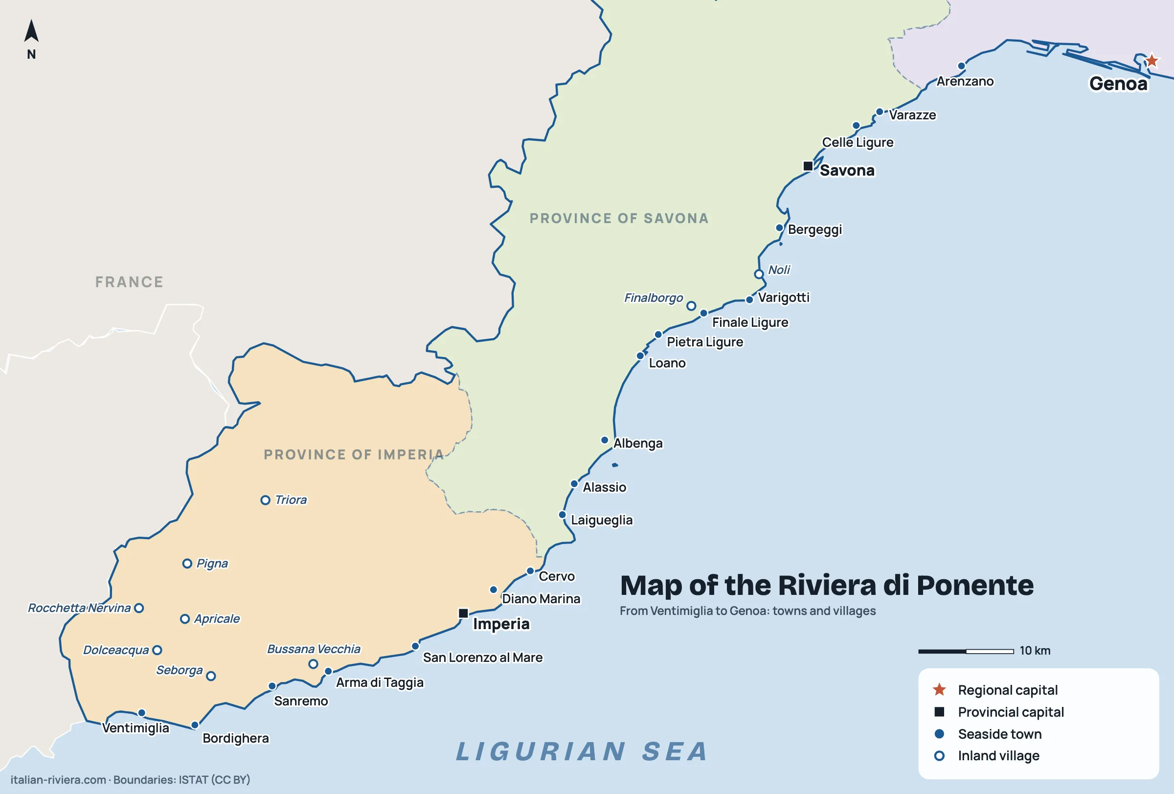
The Riviera di Ponente runs from Ventimiglia to Genoa. It alternates cliffs with wider beaches, often sandy, and is the coast for families and longer stays. Its western end, the province of Imperia up to Capo Mimosa at Cervo, is called the Riviera dei Fiori; the Savona coast is often called the Riviera delle Palme. More in our guide to the Riviera di Ponente.
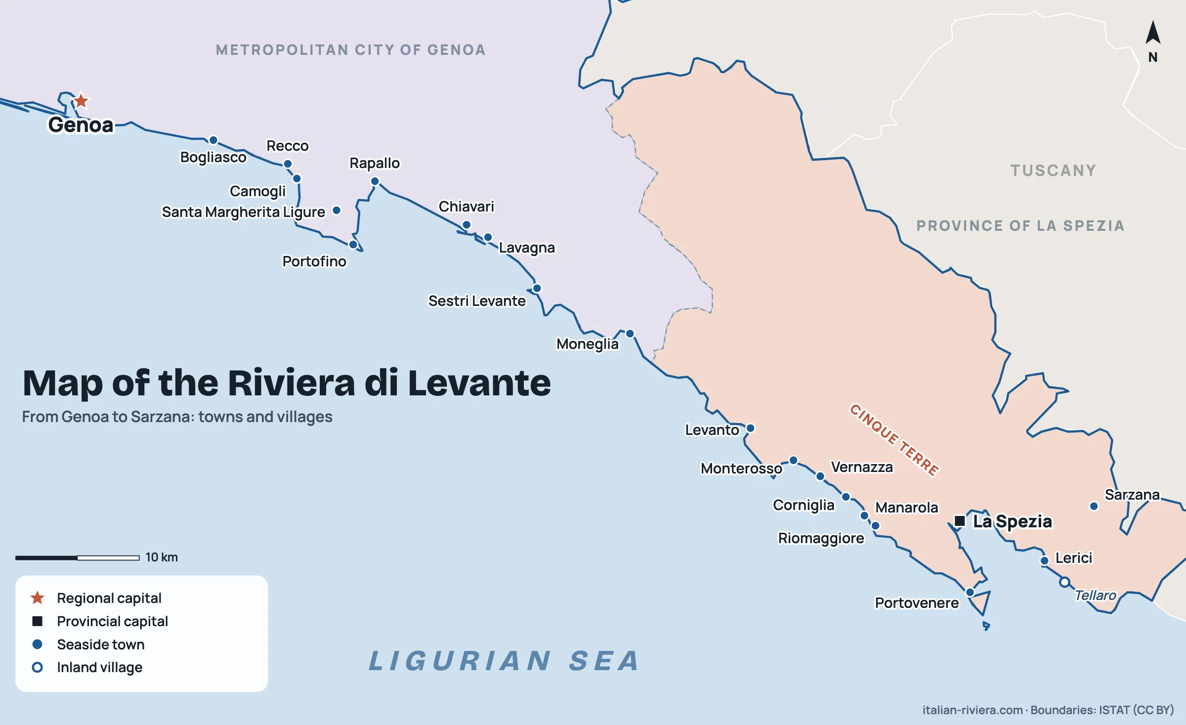
The Riviera di Levante runs from Genoa to the Tuscan border. The coast is higher and more rugged, with bays and villages clinging to the rock: the Golfo Paradiso, the Tigullio from Portofino to Sestri Levante, the Cinque Terre and the Gulf of Poets. All the details are in our guide to the Riviera di Levante.
Distances and travel times
Indicative times, without traffic and on direct regional trains. In summer and at weekends allow extra time on the coast.
| Route | By car | By train |
|---|---|---|
| Genoa – Savona | about 40 km | about 1 hour or less |
| Genoa – Finale Ligure | about 70 km | about 1 hour |
| Genoa – Sanremo | about 140 km | over 2 hours |
| Genoa – Camogli | about 25 km | about 30 minutes |
| Genoa – Cinque Terre (Monterosso) | about 1.5 hours | 1 h 15 to 2 hours |
| La Spezia – Riomaggiore | narrow road, not recommended | about 10 minutes |
| Sanremo – Nice airport | about 65 km, about 1 hour | change at Ventimiglia |
To choose the right base with these times in mind, read where to stay in Liguria; for the full list of places see our guide to towns and villages in Liguria.
Frequently asked questions
How many provinces does Liguria have?
Four: Imperia, Savona, Genoa (metropolitan city) and La Spezia, from west to east.
Where does the Riviera di Ponente end and the Riviera di Levante begin?
At Genoa: everything west of the city is Ponente, everything east is Levante.
Where are the Cinque Terre on the map?
At the eastern end of Liguria, in the province of La Spezia, between Levanto and La Spezia.
Do I need a car to explore Liguria?
Not for the coast: the train links almost every seaside town. For inland villages a car is far more convenient.
How long does it take to cross Liguria?
From Ventimiglia to the Tuscan border it’s about three hours by motorway without traffic, longer by train.
Where can I find a printable map of Liguria?
Right here: the map of Liguria with provinces and towns opens at full resolution (2,400 pixels wide), and you can save or print it for personal use. There are also detailed maps of the Riviera di Ponente and the Riviera di Levante.