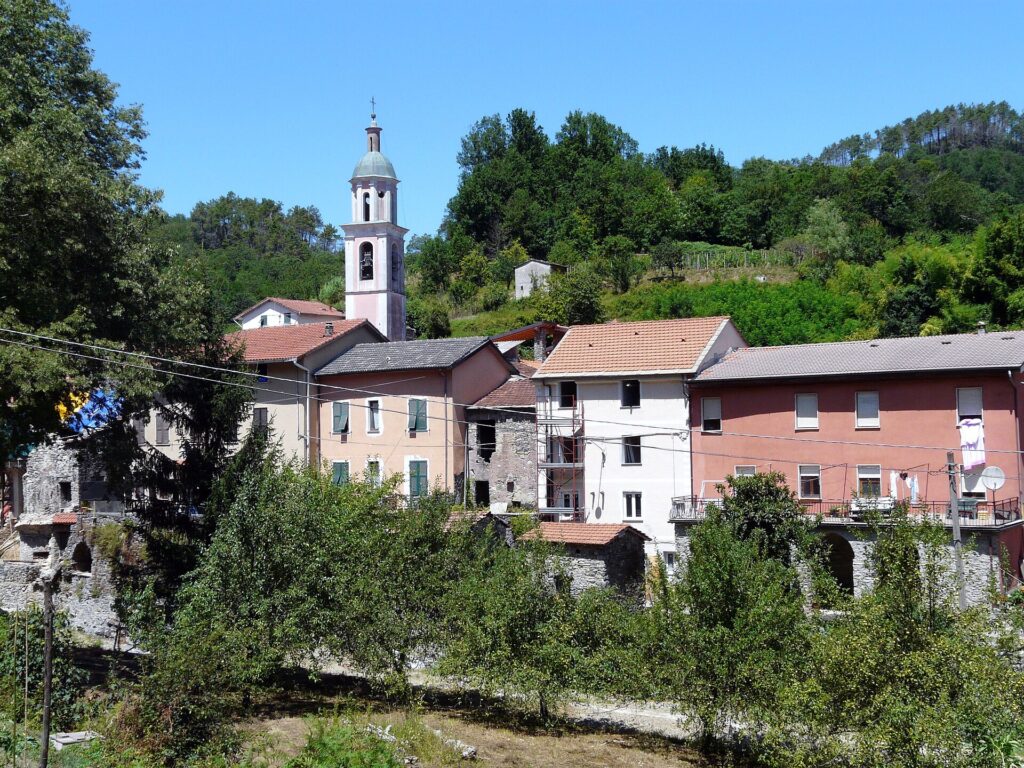
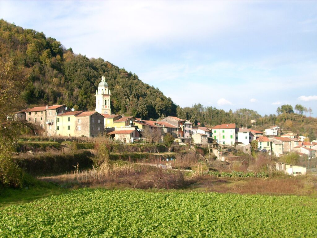
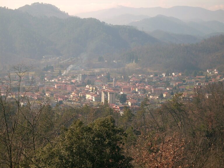
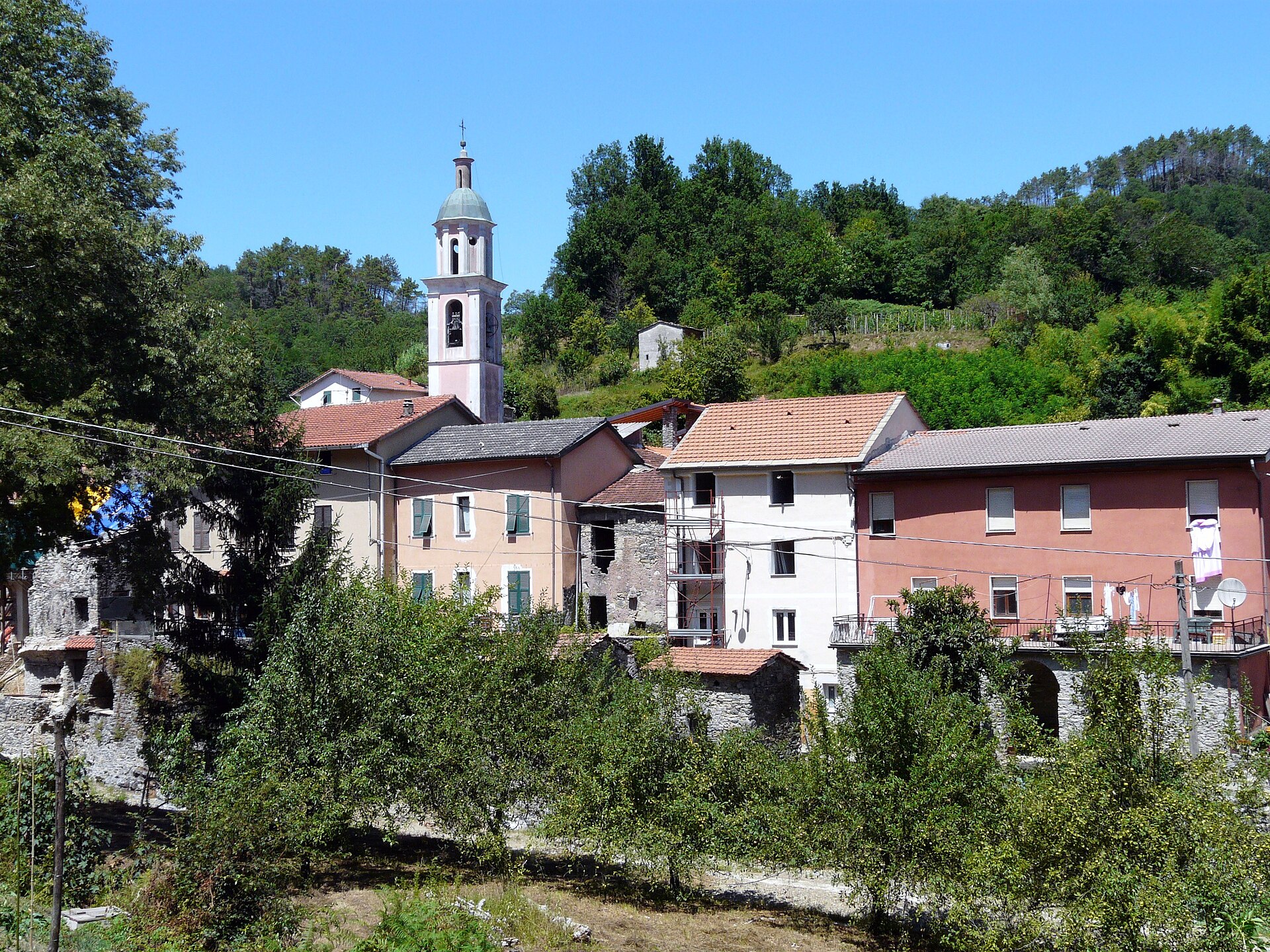
Pignone (La Spezia) is a stone village in the Val di Vara, at 189 metres above sea level and about 12 kilometres as the crow flies from La Spezia. It borders Levanto, Monterosso and Vernazza but sits on the inland side of the ridge: about 520 people live here, spread between the main village and the hamlets of Casale, Villa, Faggiona, Monti, Cappelletta and Catornola. It should not be confused with Pigna, in the Val Nervia, or with the Pignone district of Florence, which often turn up in the same searches.
The village holds the Touring Club’s Orange Flag and stands on the old road that linked the Val di Vara to the Cinque Terre coast. The centre keeps its medieval layout: narrow lanes, a stone loggia, the parish church of Santa Maria Assunta with a bell tower made from an older tower, and the bridge over the stream. On the hill opposite is the Castellaro, where traces of the Bronze and Iron Ages have been found, and along the road to Casale the karst caves open up.
Pignone can be seen in half a day and pairs well with a trip from Levanto or the Cinque Terre when you want a place without the crowds. It has no beaches, no railway station and no hotels: the sea, the trains and most of the beds are on the coast. What is worth the climb are the potatoes, onions and beans that the village has grown for generations: if they interest you, read our guide to the typical products of Pignone.
By Italian Riviera editorial team·Updated on ·11 min read
Where is Pignone?
Pignone is in Liguria (Riviera di Levante, province of SP).
You can walk through the centre in a few minutes, but with stops it takes a couple of hours. Start from piazza Marconi: the lanes to the parish church, the bridge and the road to Casale all start here.
The old town and piazza Marconi
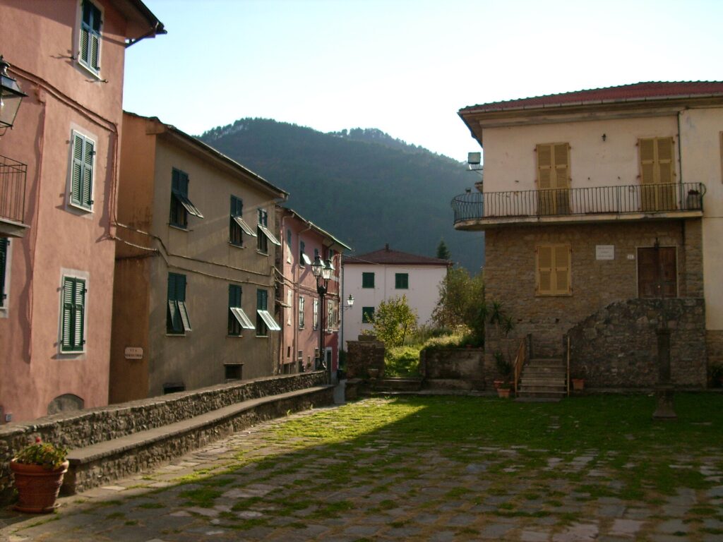
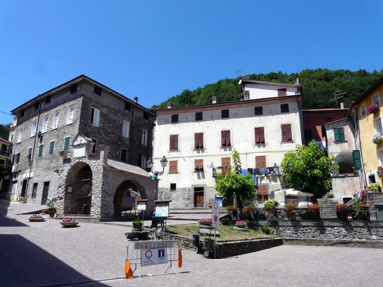
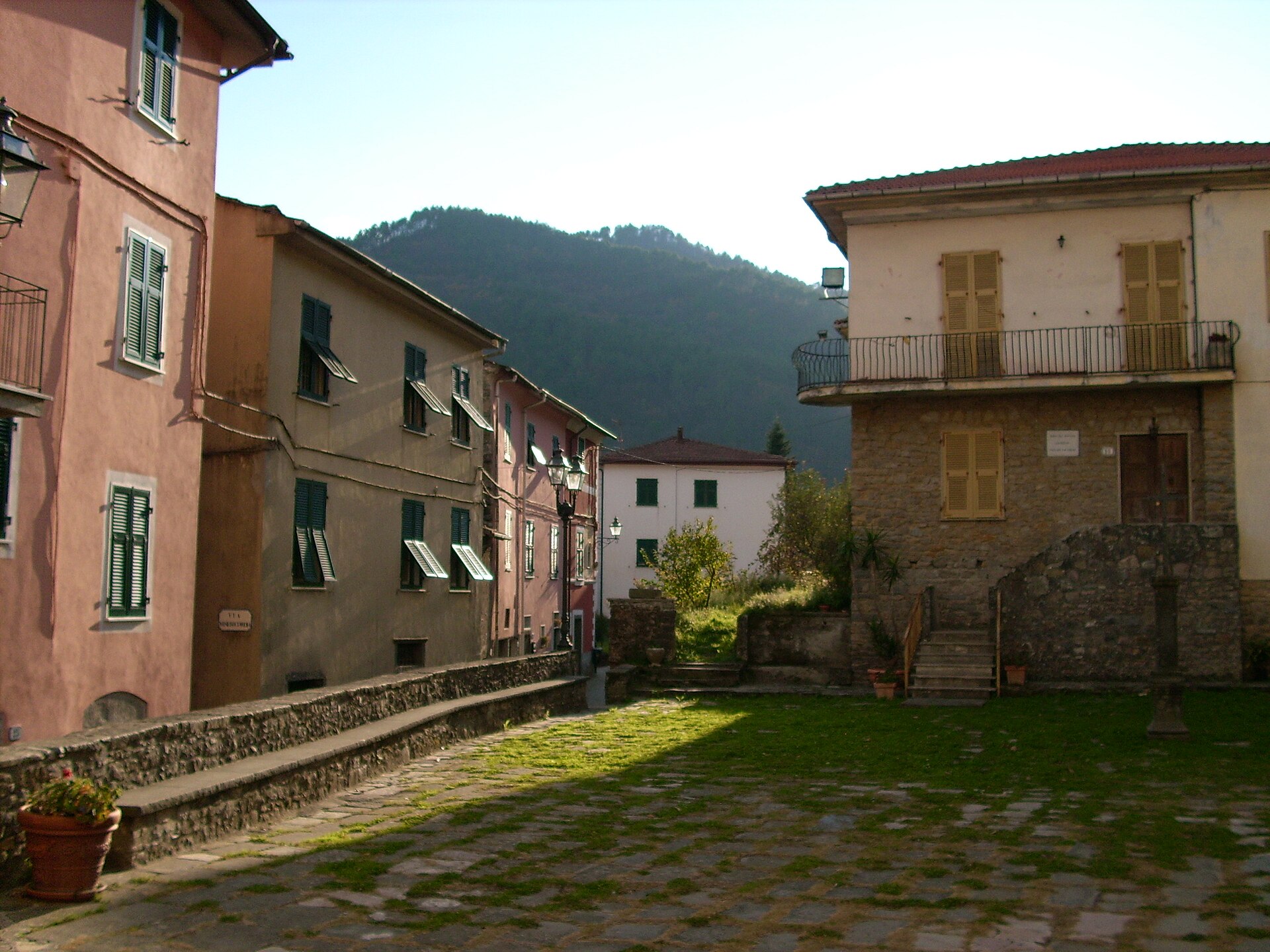
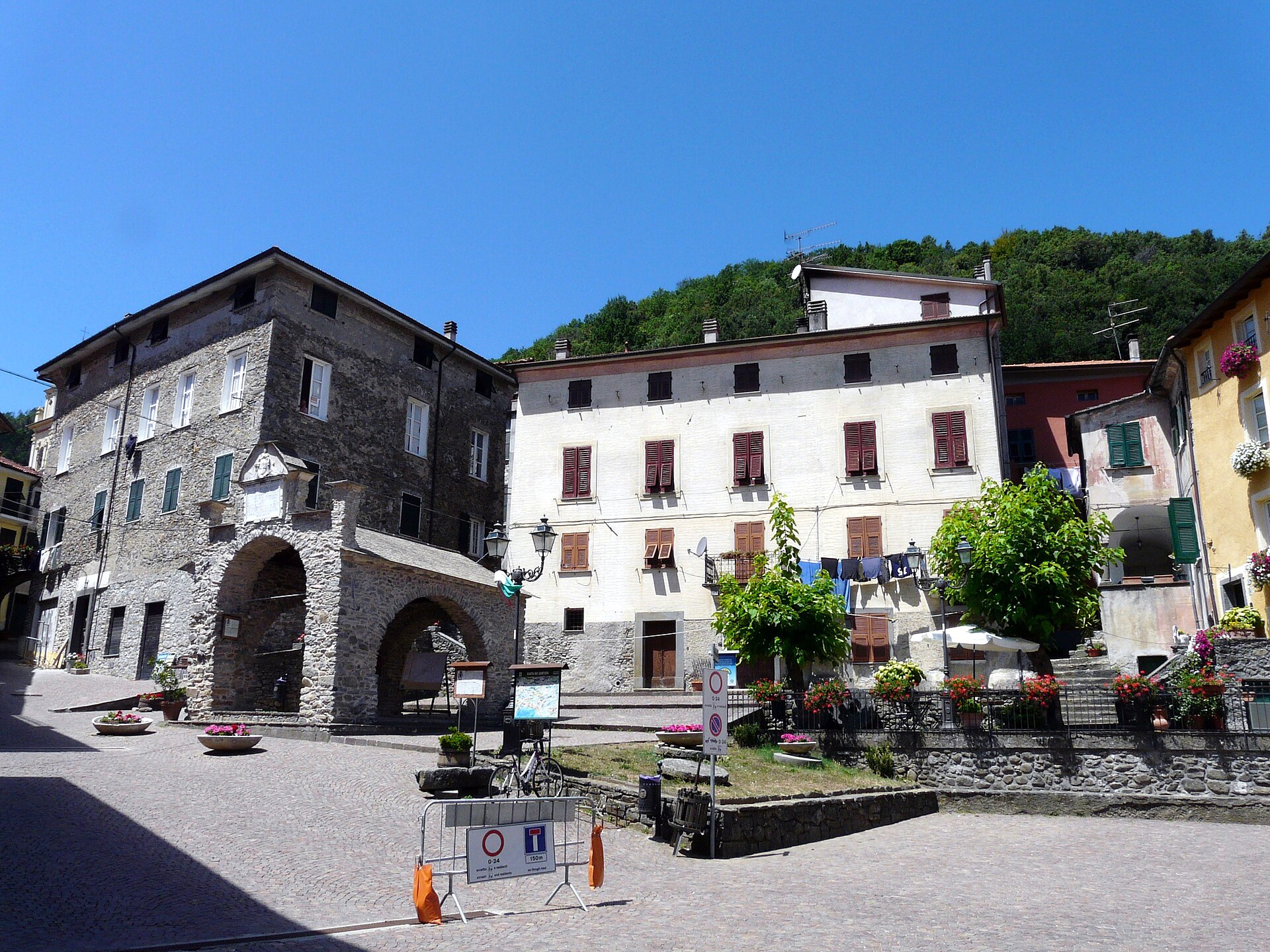
Piazza Marconi used to be the foro boario, the space where the cattle market was held. Today it is the village’s living room, with the war memorial, the colourful houses and the mountains behind. From the square, via Campanelle leads to the parish church, via Pradiera to the old bridge and via Casale to the Castellaro and the caves. The lanes are steep and stepped: wear shoes with a decent sole, and remember that these are lived-in houses.
The loggia and the 1604 plaque
The loggia in piazza Marconi is considered by the Comune to be the village’s most important monument. It is a medieval stone structure with large arches which, according to some sources, was rebuilt in the seventeenth century next to an older, fourteenth-century loggia. On the wall is a plaque dated 1604 recalling the old road between Sestri Levante and Sarzana, proof that the village stood on an important route. The date the loggia was built is not confirmed.
The parish church of Santa Maria Assunta
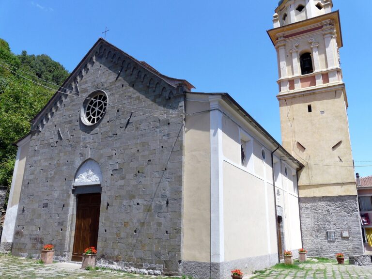
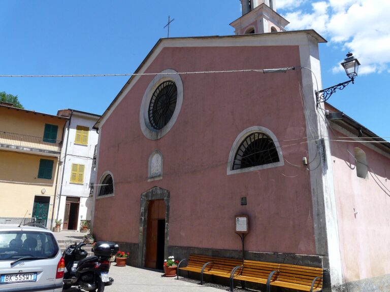
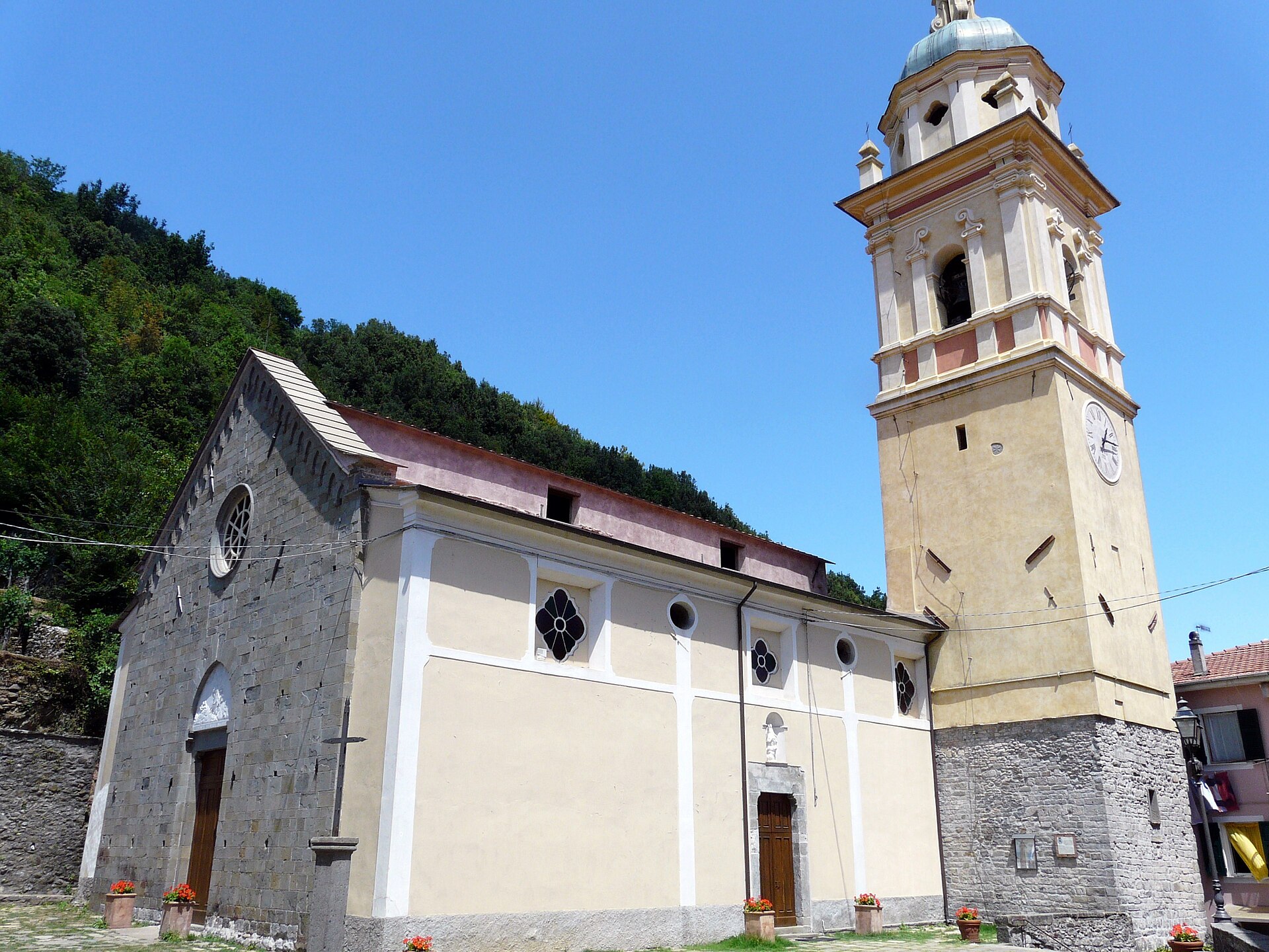
The parish church stands on the western side of the village. The facade, pillars and part of the presbytery come from a church of 1339, as an inscription on one of the pillars says; the bell tower was made from a square tower that some scholars date to the ninth century. Inside, at the left-hand altar, is a marble crucifix attributed to Giovanni Antonio Amadeo, a Lombard sculptor, and dated to the last quarter of the fifteenth century: it comes from a shrine of the church of the Madonna del Ponte. A recent restoration brought to light the eighteenth-century colours, which had been covered over in the mid-twentieth century. The parish celebrates the Assumption on 15 August. Opening hours are not published: ask at the Comune ⚠️.
The oratory of Mortis et Orationis
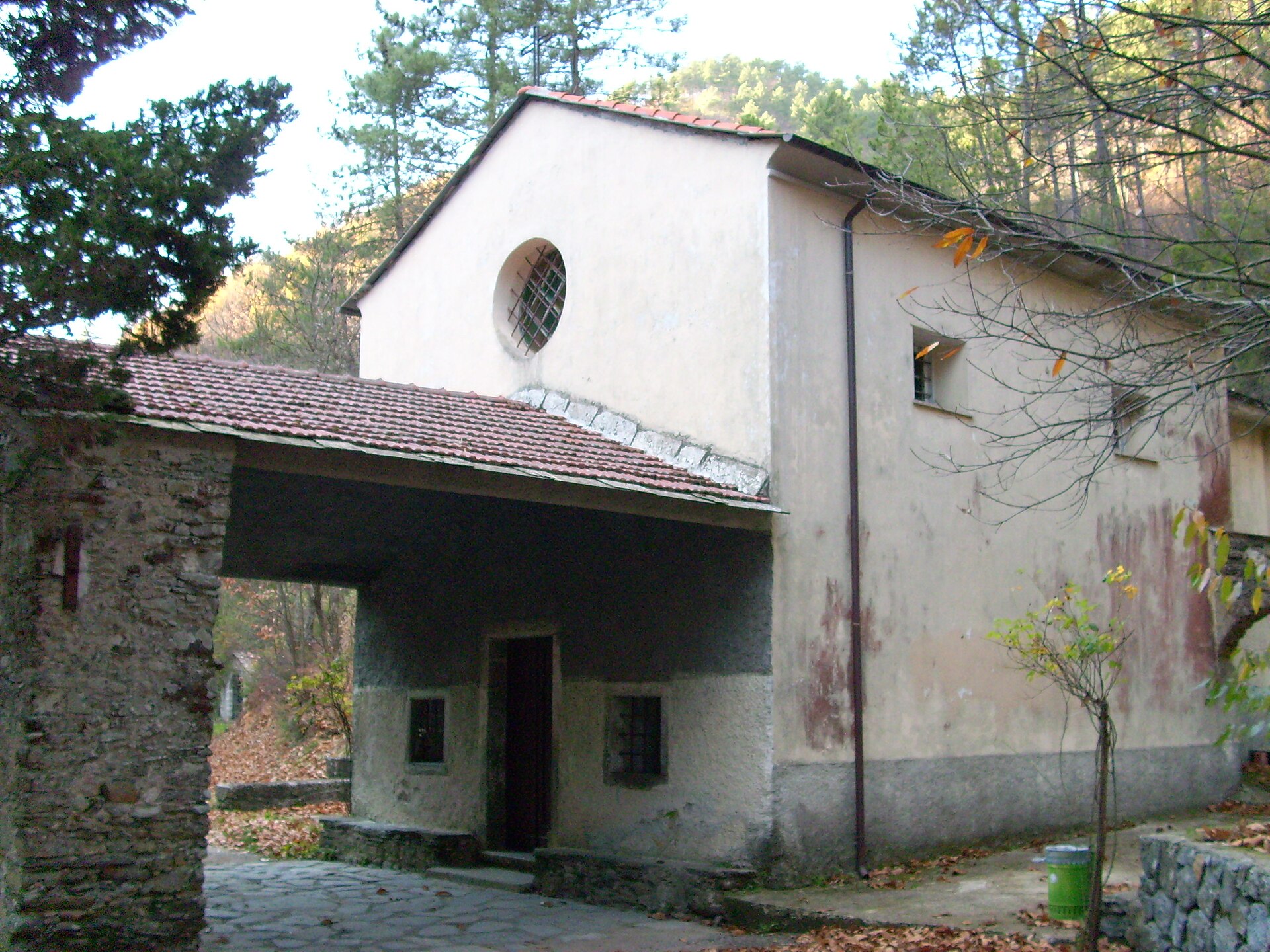
On the churchyard of the parish church, near the cemetery, stands the confraternity’s oratory, of fifteenth-century origin and modified in 1894. It is best seen from the outside, as opening times are not confirmed: if you find it closed, do not insist.
The old bridge over the stream
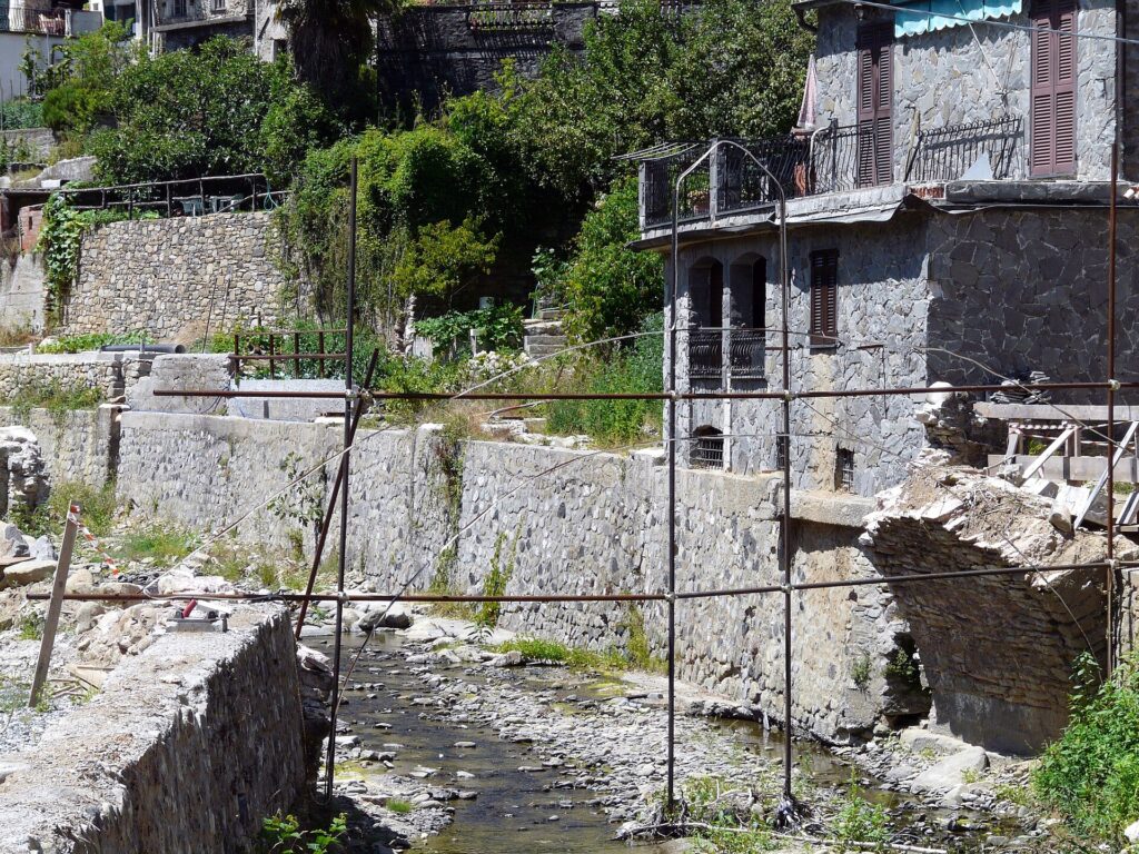
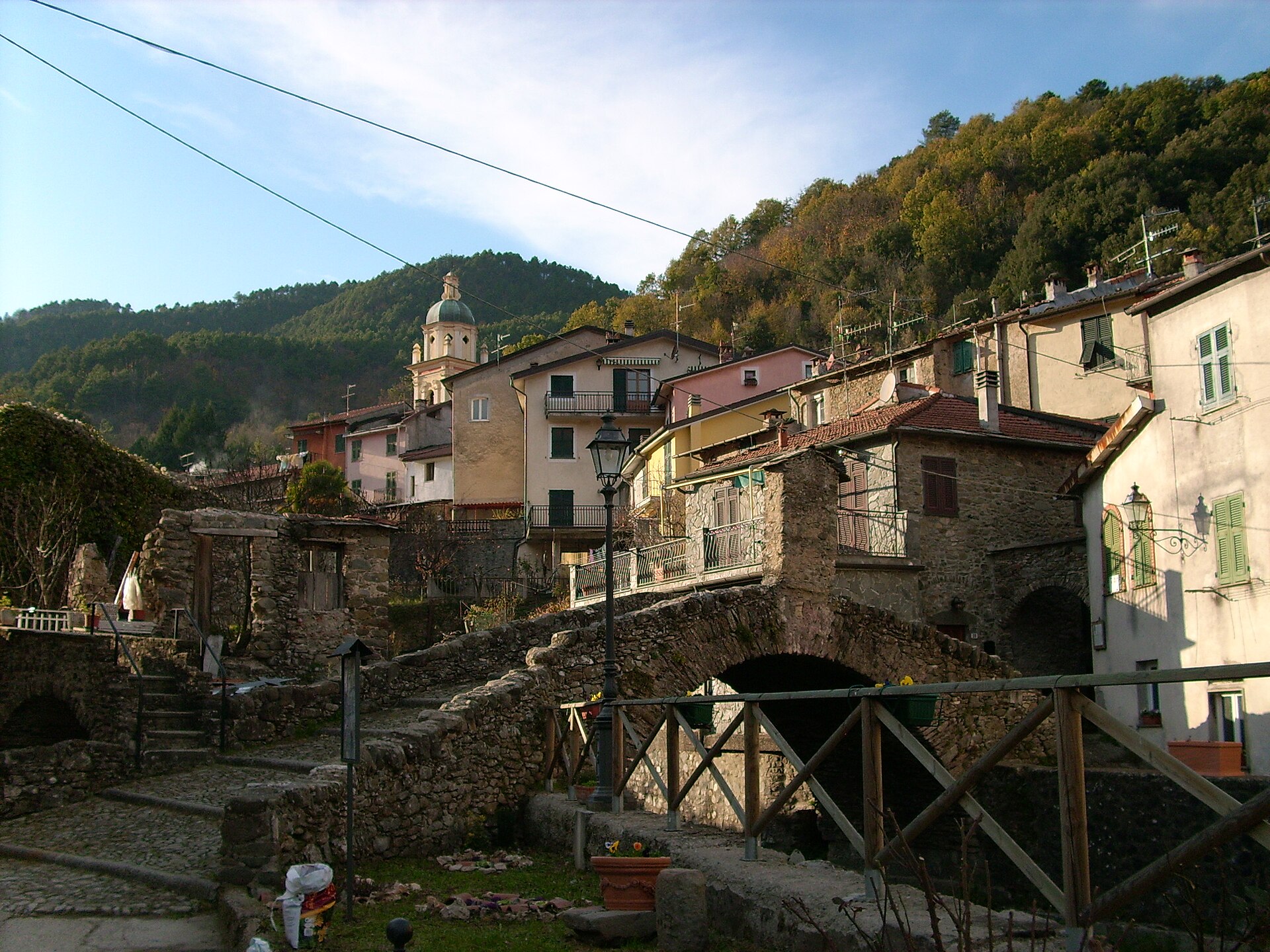
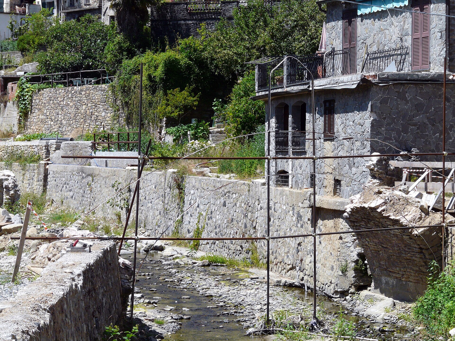
The old bridge over the Pignone stream, according to the Comune’s description, has a medieval base, a loggia of fourteenth-century design and a Maestà, a small shrine with the Madonna and Child. It is the most photographed spot in the village, but it has a hard history: the flood of 25 October 2011, which hit the whole Val di Vara and the Cinque Terre, brought down the medieval bridge in the centre and damaged houses and roads, above all at Casale. Reconstruction work was under way in 2018, but its current state is not confirmed: before going, ask at the Comune whether it can be crossed.
The sanctuary of the Madonna del Buon Consiglio
Just outside the centre, at Madonna del Ponte, stands the sanctuary of the Madonna del Buon Consiglio, also called «del Ponte», next to a seventeenth-century church. According to a local portal it stands near the spot where an older bridge, destroyed by a flood, once stood. In the same place a landslide affected the provincial road in January 2025. Opening times are not confirmed: look from the outside and do not count on going in.
The Castellaro
On the hill facing the village, towards the sea, the Castellaro is a wooded plateau with large limestone rocks and traces of dry-stone walls from different periods. The Comune describes it as a site inhabited since the Bronze and Iron Ages, linked to the Ligurian people known as the «people of the Swan»: unlike many other Ligurian castellari, this one also had defensive masonry works. The first excavations date from the 1940s and the area may be much larger than the part dug. Since 2000 it has been a Site of Community Importance for its karst system. You climb from piazza Marconi along via Casale, with two paths that the Comune calls easy: names, times and ascent are not published, so ask first.
The karst caves and the Sant'Antonino sinkhole
Along the road between Pignone and Casale opens the cave system that the Comune describes as the most complex in the province: it is about twenty metres deep and has a wide entrance above the road. At the entrance there are panels on karst and wildlife, which includes a bat colony and the Ambrosi’s cave salamander, a small amphibian that lives in caves. In 2005 a botanical trail was created with the primary school. For going into the caves there is no information on opening times, guides or safety: do not go down alone and find out first ⚠️.
Casale and the church of San Martino
A short distance from the main village, along provincial road 34, is Casale, the hamlet that suffered most in the 2011 flood. Its centre is the church of San Martino, with a large Genoese painting which, according to a local portal, hides a fifteenth-century fresco. The hamlet also has the oratory of Nostra Signora della Neve.
Faggiona and Villa
The other two hamlets each have an oratory: San Bartolomeo at Faggiona and San Sebastiano at Villa, the latter from the eighteenth century. They are places for those who drive or walk the hill roads and want to see the countryside where beans and potatoes are grown. No opening times are published.
Where to stay
Where to stay in Pignone
We found no confirmed hotels in the village: there are agriturismos in the area, but their status and availability must be checked before booking. For the widest choice it is better to sleep on the coast and come up for the day: at Levanto for the trains and the beach, at Monterosso for the Cinque Terre, at La Spezia for connections and lower prices. If you want a night among the vegetable gardens and woods, choose an agriturismo and check whether it is open in winter.
A12, exit Brugnato–Borghetto di Vara, then the Aurelia to Pian di Barca and the SP 38; check for landslides after rain ⚠️
By train
No station: train to Levanto, Monterosso or La Spezia, then an ATC bus (check the timetable) ⚠️
By plane
Pisa or Genoa, then a train to La Spezia or Levanto and a bus or taxi ⚠️
By car
The most used route is the Brugnato–Borghetto di Vara exit of the A12, then the Aurelia state road towards La Spezia as far as Pian di Barca, where you turn for Pignone and Levanto. From Monterosso you can climb by provincial road 38. Exact distances and times are not confirmed: in any case expect a hill road with bends. After heavy rain check that provincial road 38 is open on the website of the Province of La Spezia.
By train
There is no station in the municipality. Get off at Levanto, Monterosso or La Spezia Centrale, on the coast line, and continue by bus or taxi.
By bus
According to Wikipedia there is an ATC service from La Spezia with daily runs to Pignone and its hamlets. The line and 2026 timetable are not confirmed: check the ATC Esercizio website before setting out ⚠️.
By air
The handiest airports are Pisa and Genoa: from either you continue by train towards La Spezia or Levanto and then as above.
Parking
There is no information on car parks or the number of spaces: leave the car outside the centre and continue on foot, because the lanes are narrow. On festival days it can be hard to find a space ⚠️.
Pignone’s cooking is peasant food built around a handful of products. The Comune lists them: the Pignone red onion, the potato, the Cenerino bean, the dell’Aquila bean (a variety found only here) and the Lupinaro bean. The potato goes into gnocchi, potato cake and «pan di patate»; there are also sausages with beans, polenta with cabbage and home-made ravioli. For years these products were the currency of exchange with the seaside villages, Levanto and the Cinque Terre.
The village festival is «Gli Orti di Pignone», a late-summer market and exhibition with produce, food and music. The Comune gives two different periods (the last weekend of August or the first week of September) and in 2026 it was held on 30 and 31 August: the date changes, so ask the Comune before planning your trip. At the summer festivals they also serve asado, Argentine-style grilled meat, which recalls emigration to Latin America. What is grown, when it is harvested and how to buy the products are covered in our guide to the typical products.
There are only a few places to eat in the village and their opening hours are not published: if you want lunch, call ahead ⚠️. Otherwise eat at Levanto, at Monterosso or in your base on the coast.
Walks and hikes
The village is good walking country, but it is important to separate what is documented from what is not. The climb to the Castellaro and the route around the Sant’Antonino caves are the short walks that the Comune mentions in its pages; for times and difficulty, ask at the Comune.
For the long walks towards the coast, the official trails of the Cinque Terre National Park do not start from Pignone: provincial road 38 climbs towards Il Termine and the Colle di Gritta, and from there the Sentiero Verde Azzurro starts, leading to Sant’Antonio Mesco and Levanto. The Park gives the waymark as 591 and indicates about an hour and a half from Il Termine to Sant’Antonio Mesco, then about two hours and a quarter to Levanto. There are also unofficial tracks linking Pignone to Levanto or Monterosso along the ridges: they are not verified, so we do not recommend them; ask at the Comune or at the CAI in La Spezia, and check the state of the trails on the website of the Cinque Terre National Park. For everything else, see the page on the Cinque Terre trails and the Sentiero Azzurro.
Among the places mentioned in guides is the Mulino Calzetta, a hikers’ refuge since 2003: it is not confirmed whether it is open today or how to reach it, so do not plan a stop there without asking first. Carry water and do not set out when the forecast is unsettled: after rain, roads and paths can have landslides.
When to go to Pignone
The best seasons are spring and autumn, with mild temperatures and clear light. At 189 metres the climate is about one degree cooler than on the coast (estimate). In summer the evenings are pleasant; August is the month of festivals, with the Assumption on the 15th and the Orti market. In winter the village is quiet and many places may be closed: call ahead. Heavy rain is more frequent in autumn, and after a weather alert provincial road 38 may be closed by landslides, as happened in January 2025. For the ten-day forecast and the climate month by month see the Pignone weather page.
Day trips from Pignone
Levanto: the beach, the old town and the handiest station for visitors arriving from elsewhere, just over the ridge.
Monterosso: the first of the Cinque Terre, with the sea and the Sentiero Azzurro.
Vernazza: the village on its little harbour, a short distance away as the crow flies.
Corniglia: the Cinque Terre village without a seafront, on its headland.
La Spezia: the provincial capital, with the port, museums and trains along the whole coast.
Bonassola: a quieter beach near Levanto, with its cycle path.
Weather
Weather and best time to visit Pignone
Spring and autumn; the Gli Orti di Pignone market in late summer
☀️
18°CNow · wind 22 km/h
Sat 24🌤️18° 6°
Sun 25⛅16° 6°
Mon 26⛅18° 6°
Tue 27⛅19° 9°
Wed 28🌧️17° 9°1 mm
Thu 29☀️19° 9°
Forecast: MET Norway (Yr), CC BY 4.0 licence. Updated hourly.
Panorama di Pignone con il campanile della pieve e l'orto in primo pianoIl ponte sul torrente Pignone e le case del centro storico, con una passerella di legnoUna piazzetta del centro storico di Pignone con le case colorate e i monti dietroPiazza Guglielmo Marconi a Pignone con il monumento ai cadutiLa piazza della Loggia a Pignone con le arcate della loggia in pietraLa loggia comunale di Pignone, con grandi archi in pietraLa lapide del 1604 sulla loggia di Pignone, con lo stemma e l'iscrizione latina
FAQ
Frequently asked questions about Pignone
Where is Pignone?
In the Val di Vara, in the province of La Spezia, about 12 km as the crow flies from the provincial capital and right behind Levanto, Monterosso and Vernazza. It is at 189 metres above sea level.
Is Pignone one of the Cinque Terre?
No: it is an inland municipality bordering Levanto, Monterosso and Vernazza. It is not part of the National Park and you do not need the Cinque Terre Card to visit it.
Is Pignone in the Montemarcello-Magra-Vara Park?
Not as a Park municipality: the official list puts it among the municipalities with «areas of relation».
How long does it take to visit Pignone?
A couple of hours for the centre; half a day if you add Casale, the Castellaro and the caves.
How do you get to Pignone without a car?
By train to Levanto, Monterosso or La Spezia, then by ATC bus: the line and timetable are not confirmed, so check beforehand.
Can you visit the Sant'Antonino caves?
The entrance and the information panels are along the road to Casale, but there is no information on hours or visits inside: ask at the Comune.
When is the Orti di Pignone festival?
At the end of summer: in 2026 on 30 and 31 August. The Comune’s sources give different periods, so the date changes and must be checked every year.
What can you buy in Pignone?
Local potatoes, onions and beans, such as the dell’Aquila bean, found only here. Where and when to buy them is not published: ask at the Comune or at the festival.
Can you walk from Pignone to Levanto or the Cinque Terre?
The Park’s official trails start from the Colle di Gritta and Il Termine, not from Pignone. Unofficial tracks are not verified: ask the Comune or the CAI.
Where should you stay near Pignone?
It is better to stay on the coast: Levanto, Monterosso or La Spezia. There are agriturismos in the area, but they need to be checked.