You can hike in the Cinque Terre all year round, but in autumn 2026 the most famous trail is shut: since 10 September the National Park has closed the Sentiero Verde Azzurro between Monterosso, Vernazza and Corniglia pending geological checks, with no reopening date. Still open are the Via dell’Amore between Riomaggiore and Manarola (ticketed, with booking), the Via Beccara, the high route through Volastra and the Levanto–Monterosso trail over Punta Mesco.
Below you’ll find distances, walking times, elevation gain and status as of 8 October 2026 for each trail, plus what you need to know about cards, footwear and safety. Trail status changes often, sometimes overnight with weather alerts: always check the notices of the Cinque Terre National Park before you set off.
- Closed: Sentiero Verde Azzurro Monterosso–Vernazza–Corniglia (since 10 September 2026) and the coastal Corniglia–Manarola section
- Open with a ticket: Via dell’Amore, only from Riomaggiore towards Manarola
- Open and free: Levanto–Monterosso, Corniglia–Volastra–Manarola, Via Beccara, sanctuary trails
- Cards: Trekking Card from €10 a day; Train Card from €22 with trains included (2026)
- Longest hike: Riomaggiore–Portovenere, 12–15 km, 5–6 hours
- Before you go: Park notices and weather alerts, every day
Trail map: how the network works
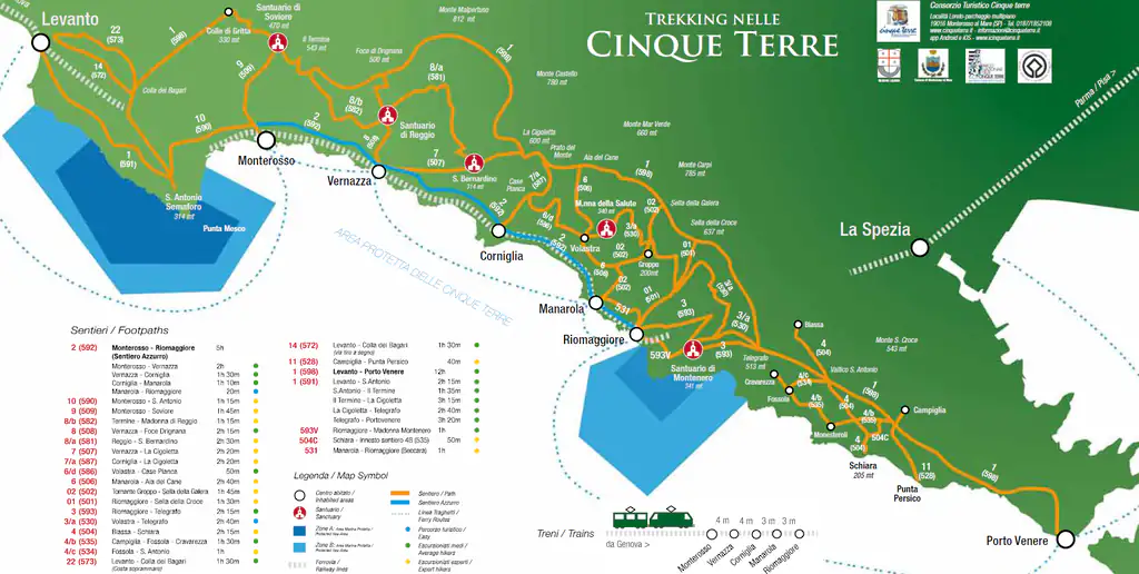
The network has three levels. Low down, close to the sea, runs the Sentiero Verde Azzurro (number 592), the old Blue Trail (Sentiero Azzurro, also called the Blue Path) that linked the five villages from Monterosso to Riomaggiore: it is the best known and the busiest, and today most of it is closed. Halfway up are the sanctuary trails, climbing from the villages to the hillside churches through vineyards and dry-stone walls. Along the ridge runs the Alta Via delle Cinque Terre, from Levanto to Portovenere.
Dozens of connecting paths drop between these levels, nearly all of them stepped. Use the Park’s numbering (592, 531, 506…) to find your way: it’s what the signposts show. The old single-digit numbers in outdated guides and maps no longer match.
Distances, times and status in October 2026
| Trail | Distance | Time | Ascent | Status |
|---|---|---|---|---|
| Monterosso–Vernazza (592-4) | 3.7 km | about 2 h | 217 m | closed since 10/9/2026 |
| Vernazza–Corniglia (592-3) | 4.1 km | about 1 h 30 | 269 m | closed since 10/9/2026 |
| Corniglia–Manarola coastal (592-2) | 2.2 km | 1 h 15 | low | closed (landslides) |
| Corniglia–Volastra–Manarola (587, 586, 506) | about 5.5 km | about 3 h | about 350 m | open |
| Via dell’Amore, Riomaggiore→Manarola (592-1) | about 1 km | 20–25 min | almost flat | open, ticketed |
| Via Beccara, Manarola–Riomaggiore (531) | 1.5 km | about 1 h | 202 m | open |
| Levanto–Punta Mesco–Monterosso (591, 590) | about 6 km | 2 h 45–3 h | about 350 m | open |
| Riomaggiore–Telegrafo–Portovenere (593, 598-1) | 12–15 km | 5–6 h | 700–800 m | open |
Times and elevation gain are approximate, for a fit walker without stops. The status of open trails comes from an unofficial site updated on 1 October and from Park notices: in heavy rain or an orange alert the trails are closed, including those listed as open.
Hotels, B&Bs and rooms in the Cinque Terre villages: compare prices and availability.
Sentiero Verde Azzurro: Monterosso–Vernazza–Corniglia
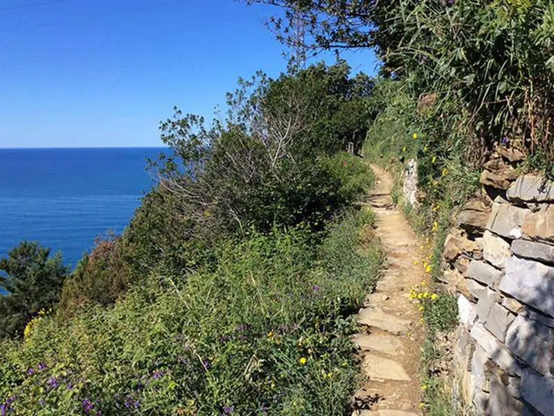
This is the stretch everyone wants to do: an hour and a half to two hours from Monterosso to Vernazza, arriving above the little harbour, then another hour and a half to Corniglia via Prevo, the highest point. Both sections are graded for experienced hikers: tall steps, uneven ground, narrow passages above the sea. When open, access is paid with the Cinque Terre Card, and in peak seasons the Monterosso–Vernazza section has been one-way in the middle of the day.
Since 10 September 2026 the Park has listed it as “closed and not passable” pending geological checks, with no reopening date. Some websites and apps still show it as open: the Park notice is what counts. If you’re here in these months, Vernazza and Corniglia are a few minutes away by train; for the view down over Vernazza, walk up to the Reggio sanctuary on trail 508.
Tips for when it reopens
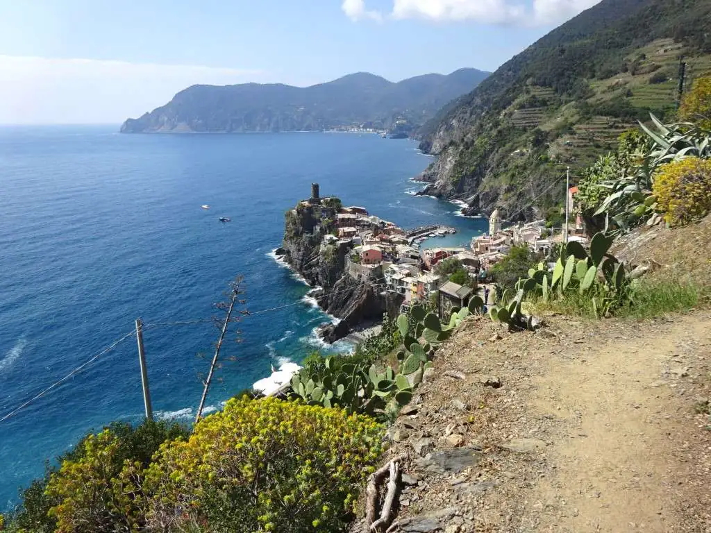
Start early, before 9am, and walk Monterosso–Vernazza in the direction with the best view, towards Vernazza. At Corniglia, arriving from the trail puts you straight into the village; if you start there, remember the village sits on the headland with the station below, linked by the Lardarina stairway or the bus.
Corniglia–Manarola: the high route via Volastra
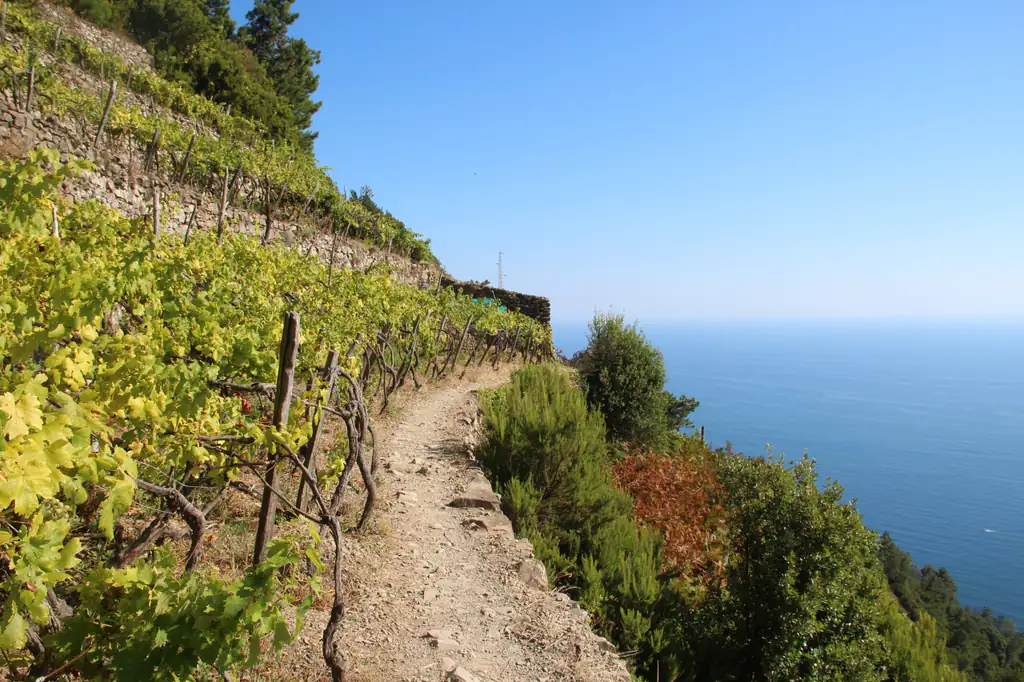
The coastal section between Corniglia and Manarola (592-2) has been closed for years because of landslides, and no reopening is expected soon. The alternative is longer but, for many, more beautiful: from Corniglia climb trail 587 towards Case Pianca, continue on the level along 586 through terraced vineyards and dry-stone walls to Volastra, then drop down to Manarola on 506, all steps. It’s about 5.5 km with 350 m of ascent: allow a good three hours.
Volastra is a tiny hamlet among the vines, with the Romanesque sanctuary of Nostra Signora della Salute. To skip the climb, take the Park bus from Manarola to Volastra (about ten minutes, included in the card) and walk the route downhill to Corniglia.
Via dell’Amore and Via Beccara: Manarola–Riomaggiore
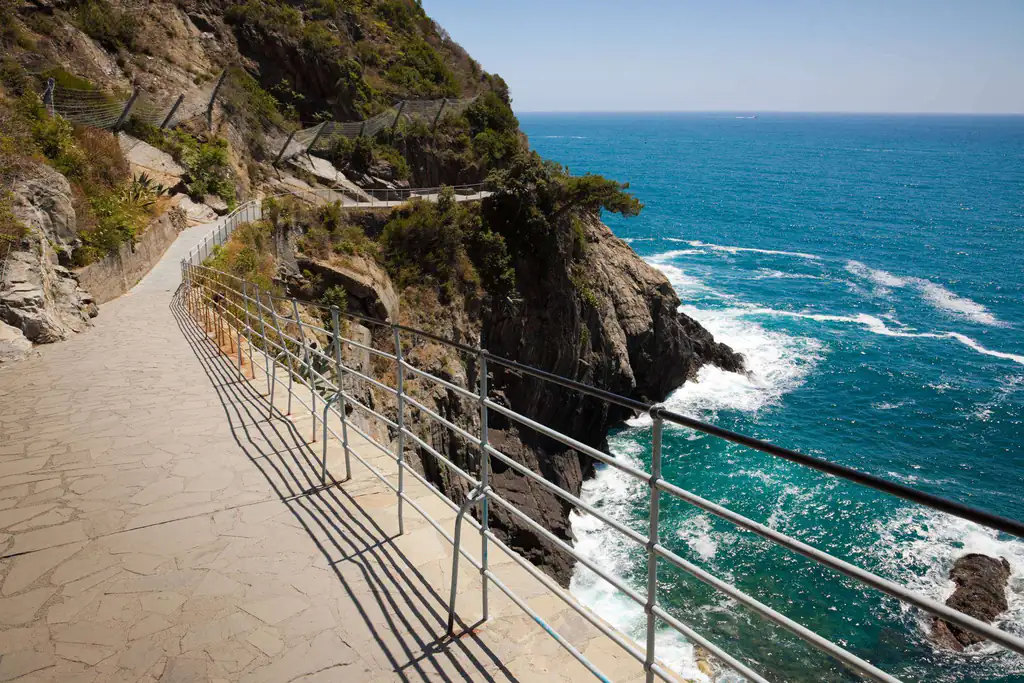
The Via dell’Amore, the paved path hanging above the sea, reopened in August 2024 with new rules: one-way only from Riomaggiore towards Manarola, with a ticket from €10 and a booked time slot. In 2026 it’s open 9am–9pm until 24 October and 9am–6pm from 26 October. Prices, hours and booking details are in our Via dell’Amore guide.
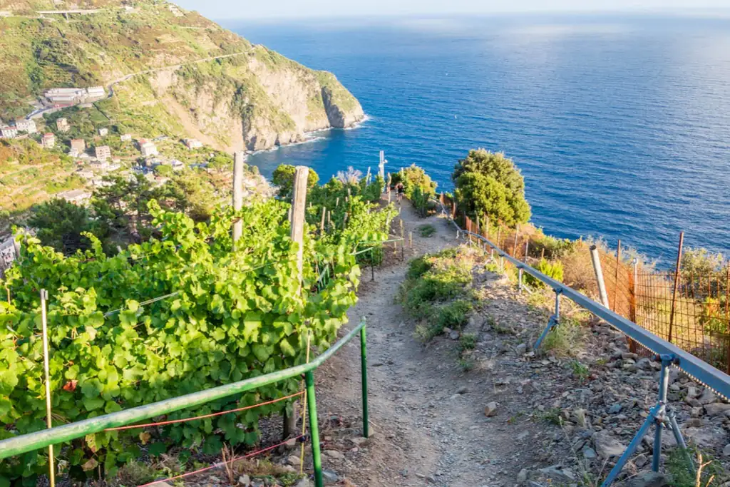
To walk back from Manarola to Riomaggiore there’s the Via Beccara (531), the old mule track over the hill: just 1.5 km, but 200 m of ascent and steep sections, about an hour. It’s the best viewpoint over Manarola’s illuminated nativity scene at Christmas; bring a torch in the evening.
Levanto–Monterosso over Punta Mesco
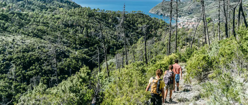
Right now this is the open trail we’d recommend most. From Levanto, trail 591 climbs to the ruined hermitage of Sant’Antonio on the Punta Mesco headland, then 590 descends towards Monterosso with the whole Cinque Terre coastline ahead of you. About 6 km and 350 m of ascent, nearly three hours. Normally no card is needed.
Start from Levanto: the climb is gentler, while the Monterosso side has a long staircase. At the end you have Fegina beach for a swim and a five-minute train ride back.
Riomaggiore–Portovenere and the Alta Via
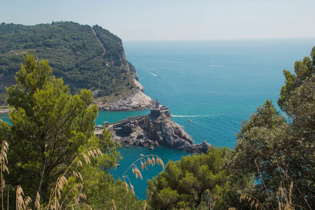
The longest route leaves the Cinque Terre: from Riomaggiore climb to Telegrafo, then follow the first stage of the Alta Via (598-1) via Campiglia down to Portovenere. Between 12 and 15 km depending on the variant, 5–6 hours on foot and 700–800 m of climbing; the Muzzerone section is exposed, high above the sea. Carry plenty of water and start in the morning. From Portovenere, return to La Spezia by bus or, in season, by boat.
The full Alta Via delle Cinque Terre (AV5T) follows the ridge from Levanto to Portovenere for more than 30 km: walk it over two or three days, dropping down to sleep in the villages.
Sanctuary trails
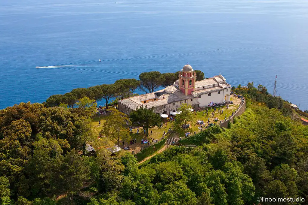
Each village has its own hillside sanctuary, and the paths up are much quieter than the coast. From Monterosso, trail 509 climbs to Soviore (2.5 km, about an hour and a half up); from Vernazza, 508 reaches Nostra Signora di Reggio, paved and lined with Stations of the Cross; from Riomaggiore, 593V climbs in 55 minutes to the Montenero sanctuary, with one of the widest views of the coast. None of them requires the card.
Cinque Terre Card: when you need it
You need the card for the Sentiero Verde Azzurro between Monterosso and Corniglia (when open) and for the Via dell’Amore, which also requires booking a time slot. All other trails are free. The Trekking Card costs €10 a day per adult, €15 on peak days, and also covers the Park buses in the villages and the station toilets. The Train Card adds unlimited trains between Levanto and La Spezia: in 2026 it costs €22, €29.50 or €35 a day depending on the fare band.
With the Verde Azzurro closed, the card pays off mainly if you use the train a lot or the bus to Volastra. Prices, fare bands and the maths are on our Cinque Terre trains page; to plan your days from the city, read the Cinque Terre from La Spezia.
Safety and gear
- Shoes: hiking shoes with a good grip. Flip-flops and sandals slip on the steps.
- Water: at least a litre each; there are no fountains on the high trails.
- Weather: trails close during orange or red alerts. After rain the sandstone is slippery.
- Timing: in summer walk early in the morning; the exposed slopes get very hot.
- Bail-out: every village has a station, so if you’re tired, cut it short and take the train.
For the bigger picture, where to stay and when to go, see our Cinque Terre guide.
Frequently asked questions
Is the Blue Trail open in 2026?
The Monterosso–Vernazza–Corniglia section has been closed since 10 September 2026 for geological checks, with no reopening date. Corniglia–Manarola is closed because of landslides; the Via dell’Amore between Riomaggiore and Manarola is open with a ticket and booking.
Which trail should I hike if the Verde Azzurro is closed?
Levanto–Monterosso over Punta Mesco, about three hours, or Corniglia–Volastra–Manarola through the vineyards, also about three hours. For a short walk, the Via Beccara between Manarola and Riomaggiore.
Do you have to pay to hike in the Cinque Terre?
Only for the Sentiero Verde Azzurro between Monterosso and Corniglia and for the Via dell’Amore, with the Cinque Terre Card (Trekking Card from €10 a day). All other trails are free.
How long does it take to walk all five villages?
The low coastal route used to take about five hours. With sections closed you can’t do it all along the coast today: combine open trails with the train, which takes a few minutes between villages.
Where can I check trail status?
On the Cinque Terre National Park website, in the notices section, and at the Infopoints in the stations. Also check the Liguria weather alerts on the day.
Can I walk the Via dell’Amore from Manarola?
No: for visitors it’s one-way from Riomaggiore towards Manarola. From Manarola back to Riomaggiore, take the train or walk the Via Beccara.
Do I need hiking experience?
You don’t need to be a mountaineer, but many sections are graded for experienced hikers: lots of steps, narrow passages and little shade. Bring hiking shoes, water and a reasonable level of fitness.