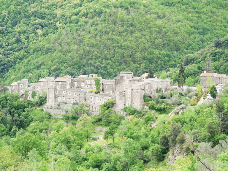
Il castello dei Clavesana e le case di Castelvecchio di Rocca Barbena

Castelvecchio di Rocca Barbena

Stone village of the Val Neva: the Clavesana castle (private), Orange Flag, alleys, Rocca Barbena and the path to Zuccarello. 18 km from Albenga.

Il castello dei Clavesana e le case di Castelvecchio di Rocca Barbena
Area
Riviera delle PalmeRiviera di Ponente · Province of SV
Ideal for
Stone villageviews, quiet walks, an inland day
Beaches
None in the villagethe nearest sea is Ceriale/Albenga (about 18–19 km)
Best time to go
April–June and September–Octoberwinters are cold and snow is possible higher up
By train
No station in the village: the nearest is Albengaabout 18 km), then a car or taxi (bus not confirmed) ⚠️
By car
A10exit Albenga, then the SP 582 towards Garessio: about 18 km, 25 minutes
Airport
Genoaabout 97 km) or Nice (about 132 km
How long to stay
Half a daya full day with the Rocca Barbena or the path to Zuccarello

Welcome to Castelvecchio di Rocca Barbena

Castelvecchio di Rocca Barbena

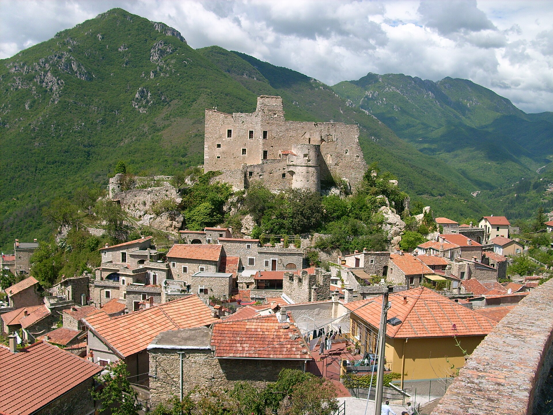
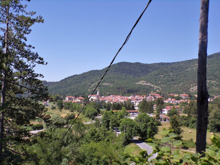
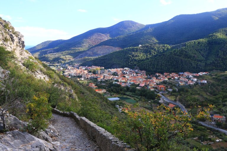
Castelvecchio di Rocca Barbena is a stone village clinging to a rocky spur of the Val Neva, in the hinterland of Albenga, in the province of Savona. It has barely more than a hundred residents (132 according to ISTAT figures for May 2026), stands at about 420 metres and takes its name from the limestone mountain rising behind it, the Rocca Barbena (1,142 metres). On top of the rock above the houses sits the Clavesana castle: it is the first thing you see as you arrive and the reason most people stop.

The village is described as the oldest feudal settlement in the Val Neva. It was a fief of the Clavesana marquises, then passed to the Del Carretto family, was contested between Savoy and Genoa, and in 1672 the castle was besieged by Genoese troops and badly damaged. Castelvecchio is a member of the Borghi più belli d’Italia (Italy’s most beautiful villages) and holds the Touring Club Italiano’s Bandiera Arancione (Orange Flag), confirmed for the 2024–2026 period. Its neighbour Zuccarello, often confused with it, is also one of the most beautiful villages but does not have the Orange Flag.

One thing needs saying up front, because many guides leave it vague: the castle is private and cannot be visited. The municipality’s own page says you cannot go in. You can, however, walk up to its foot through stairways and courtyards, and the real attraction is the village itself, with its alleys, arches and views over the valley. Half a day is enough; add a walk up the Rocca Barbena or along the path to Zuccarello and it becomes a full day. The mountain has its own page: The Rocca Barbena.

Where is Castelvecchio di Rocca Barbena?

Castelvecchio di Rocca Barbena is in Liguria (Riviera di Ponente, Riviera delle Palme, province of SV).

Map: where Castelvecchio di Rocca Barbena is in LiguriaPIEDMONTLOMBARDYEMILIA-ROMAGNATUSCANYFRANCERIVIERA DI PONENTERIVIERA DI LEVANTELIGURIAN SEASavonaImperiaSanremoLa SpeziaCastelvecchio di Rocca Barbena
Boundaries: ISTAT, Natural Earth · Interactive map →

What to see

What to see in Castelvecchio di Rocca Barbena

Il castello dei Clavesana e le case di Castelvecchio di Rocca Barbena

The centre takes one or two hours, stops included. It is a village on a slope, with cobbles, steps and narrow lanes: wear shoes with a good sole, and note that the route is not suitable for pushchairs or wheelchairs. A sensible order: leave the car at the entrance, walk down to the square, stop at the church and then climb towards the castle.

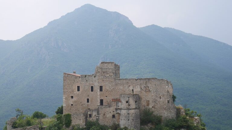
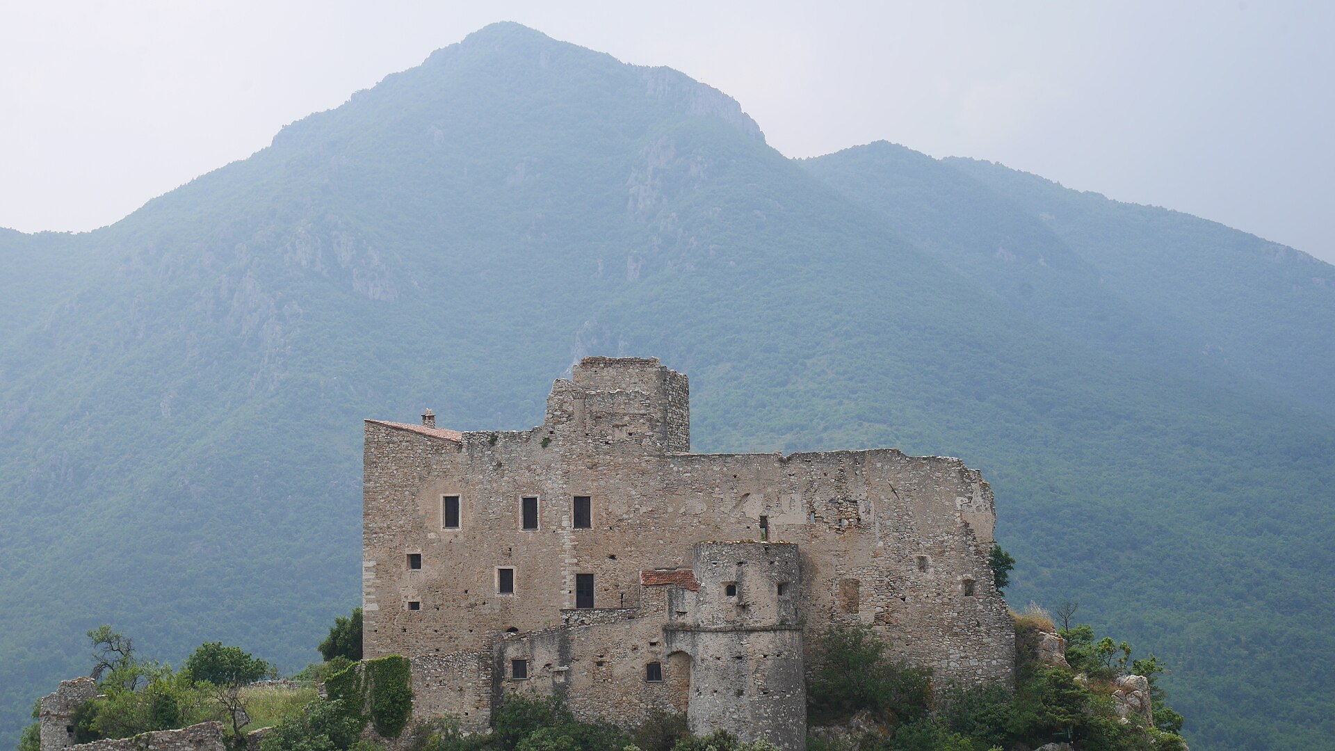
Il castello dei Clavesana con la montagna alle spalle

The Clavesana castle

The castle stands on the top of the spur and dominates the valley. Sources date it to the 11th century, first a stronghold of the Clavesana, later of the Del Carretto. It is a quadrangular military fortress, and its present state is the result of collapses and bombardments during the sieges, above all the Genoese one in 1672. It is privately owned and has been restored by its owners. The municipality’s page says it cannot be entered, while Wikipedia says it opens only for some cultural events, for which we could not find a calendar. There are therefore no opening hours or tickets. You can walk up to its base and see the walls close up, and the best view of it is from the village and from the sanctuary on the hill.

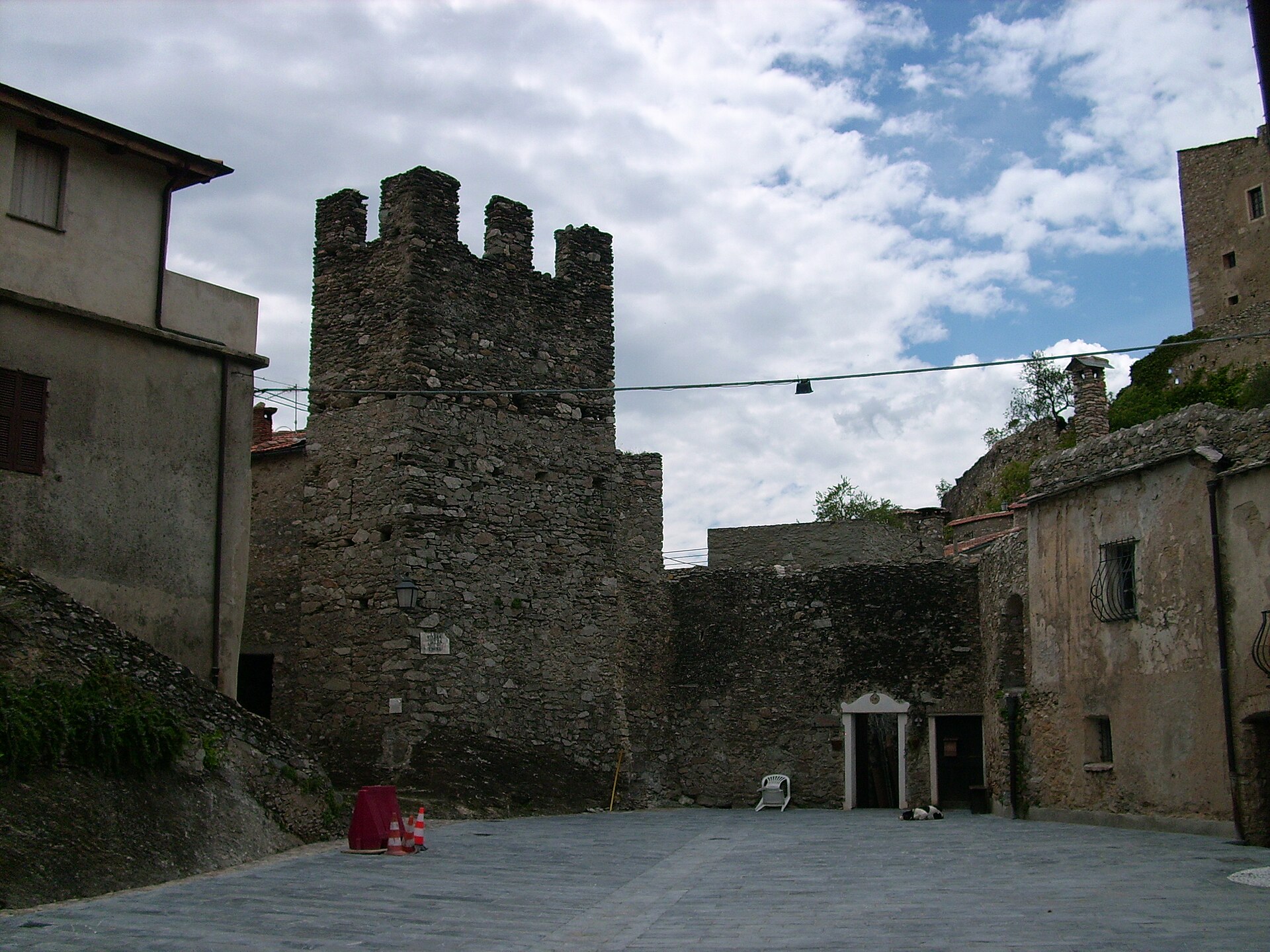
La torre merlata e la piazza nel centro del borgo

Piazza della Torre

This is the heart of the village, a small square with a medieval tower and stone houses around it. The climb to the castle starts from here, and it gives the best idea of what the fortified village was like: buildings packed tight, few open spaces, mountains behind the roofs.

Una piazzetta del borgo con un edificio religioso dal campanile a vela

The Oratorio dei Disciplinanti

Next to the square stands the Oratorio dei Disciplinanti, dedicated to Santa Maria Maddalena. You recognise it by its small sail-shaped bell gable and a fresco of the saint. Inside it is Baroque and it houses a confraternity that is still active. Opening hours are not published: do not assume you can go in.

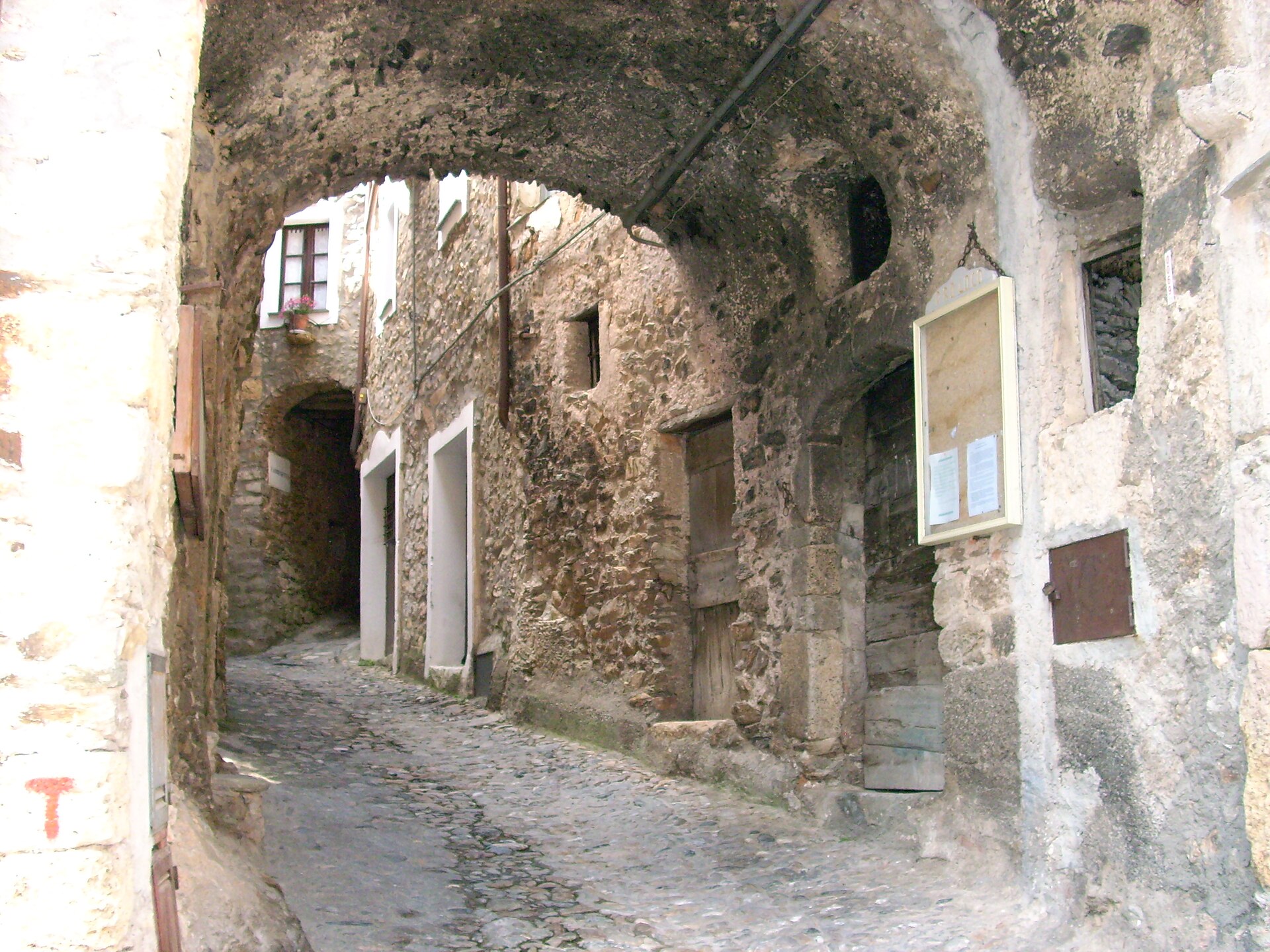
Un vicolo coperto da archi in pietra nel centro storico

The pointed-arch gate and the stone alleys

At the entrance to the old core there is a pointed-arch gate, the Porta Soprana according to the local press, and beyond it the village is a maze of alleys, arches and covered passages. According to guides, the houses are linked by interior arches that also had an anti-seismic function. Getting lost here is part of the visit: every lane ends in a courtyard or a viewpoint over the valley.

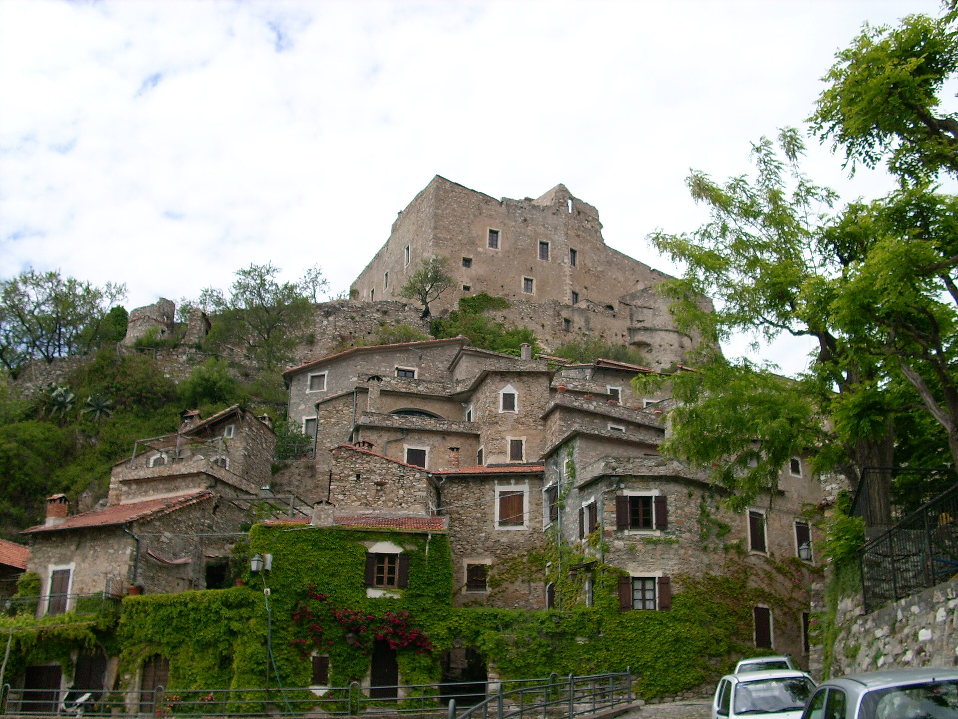
Le case di pietra addossate sotto il castello

The fortress-houses

Look at the architecture: fortress-houses in stone, packed together under the castle, with terraced roofs, arched attics where mushrooms and figs were dried, bread ovens that jut out of the walls and white frames around the windows. These are details of everyday life more than monuments, but in a few minutes they explain how people lived in a hilltop village.

Fountain, portico and wash-houses

Among the alleys you find a stone fountain and a portico with seats, good for a rest, and the old wash-houses, restored. They are not postcard stops, but they are where you see that the village is cared for; remember that people still live here all year round.

La chiesa parrocchiale dell'Assunta con il campanile e i tetti del borgo

The parish church of the Assunta

The parish church of Nostra Signora Assunta stands lower down, on a meadow below the castle. The structure dates from the 15th century, with a Baroque rebuilding from the 17th; the interior is Baroque. From the meadow you get a good view of the castle and, according to a 2022 guide, there is also a small play area, handy with children. Opening hours and Mass times: not confirmed.

Il borgo e il castello visti dal santuario di Nostra Signora delle Grazie

The sanctuary of Nostra Signora delle Grazie

On a hill above the village, along the road to the cemetery, stands the sanctuary of Nostra Signora delle Grazie, a heart-shaped building, 17th-century according to one tourist guide. It is worth the climb mainly for the view: from here the castle and the houses can be seen together. Opening times and feast days: not confirmed.

Piazza Cavour and Björn Afzelius

In Piazza Cavour a wrought-iron plaque remembers the Swedish singer-songwriter Björn Afzelius, who died in 1999, loved these places and drew on the village for his song «Notte in Liguria». One source mentions a Scandinavian community that visits the village. It is a curiosity to look for calmly, not a stop to plan around.

Vecersio and the surrounding area

The only hamlet of the municipality is Vecersio, with the church of Nostra Signora della Neve. The municipal territory also includes the localities of Giro di Loano, Cascina d’Aglio and Scravaion, the pass towards Bardineto. At Cascina d’Aglio, in the so-called «necropolis of Erli», Roman-era finds have been made, from which the origin of the village is dated to the 1st century: there is nothing to see for an ordinary visitor, but it shows how old human presence here is. The municipality borders Bardineto, Zuccarello, Toirano, Balestrino and Erli.

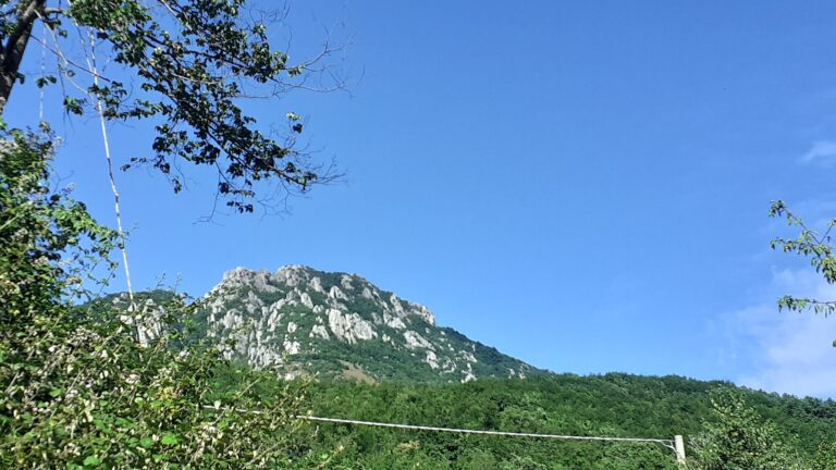
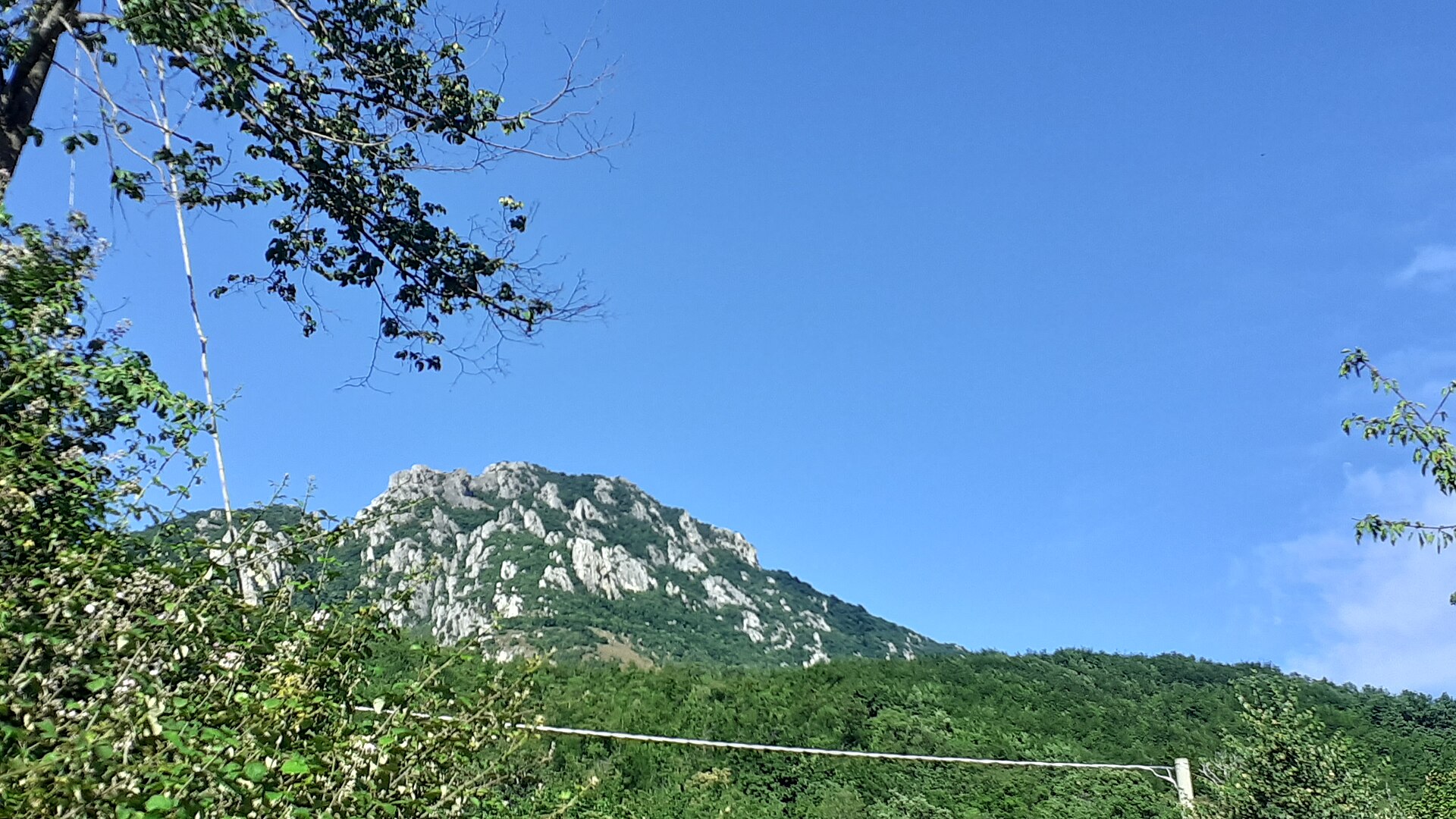
La Rocca Barbena vista da Castelvecchio

The Rocca Barbena

Above the village, to the north, rises the Rocca Barbena: 1,142 metres of limestone with pinnacles and rock walls, a watershed between the Ligurian Sea and the Po basin, and part of a Natura 2000 site (Monte Ravinet – Rocca Barbena). From the Colle Scravaion, at about 814 metres, starts the shortest waymarked path, graded E (hiking) but with steep sections. The summit has a cross and a summit register. All the details, and the variant along the Alta Via dei Monti Liguri, are on the page The Rocca Barbena.

Il castello dei Clavesana e le case di Castelvecchio di Rocca Barbena

Where to stay

Where to stay in Castelvecchio di Rocca Barbena

The number of beds in the village is limited and we found no reliable data: look separately and book early. Sleeping in the village means silence, cool nights and no sea; it is the right choice if you want to walk and have a car. For more choice also look at Zuccarello and the Val Neva, where countryside accommodation can be found. If you travel by train, the most convenient base is Albenga, with station, restaurants and the sea. For beach by day and village by evening, choose Ceriale, Loano or Alassio.

Getting there

How to get to Castelvecchio di Rocca Barbena

By car

A10, exit Albenga, then the SP 582 towards Garessio: about 18 km, 25 minutes

By train

No station in the village: the nearest is Albenga (about 18 km), then a car or taxi (bus not confirmed) ⚠️

By plane

Genoa (about 97 km) or Nice (about 132 km)

By car

Leave the A10 at Albenga and follow the SP 582 of the Colle di San Bernardo towards Garessio: Castelvecchio is on the same road, beyond Zuccarello. From Albenga it is about 18 km and 25 minutes (estimate based on OpenStreetMap data), from Zuccarello about 6 km. It is a mountain road with bends: drive with care.

By train

There is no station. The nearest is Albenga, on the Genoa–Ventimiglia line. From there you need a bus or a private vehicle.

By bus

We found no reliable bus timetable to Castelvecchio: the line and the runs are not confirmed. Check the website of the provincial local transport operator and, without a car, plan the return very carefully, or consider a taxi from Albenga.

By air

The most convenient airport is Genoa Cristoforo Colombo, about 97 km by road (roughly an hour and a half). Nice is about 132 km away. In both cases you take the motorway and pass through Albenga.

Parking

According to unofficial tourist sources there is a panoramic car park at the entrance to the village, from which a short walk downhill leads to the central square. Spaces, charges and rules are not confirmed. The municipality has in the past published notices on regulating access to the historic centre: if in doubt call the switchboard (0182 78042, the number shown on the municipality’s website in October 2026) or check the notices on the website.

Castelvecchio di Rocca Barbena44.1305, 8.1155
Open in Google Maps →Interactive map →

The guide

Walks and hikes

Castelvecchio is a good starting point for anyone who likes walking without crowds. There is little official data on the routes: most of the information comes from hikers’ reports, so treat it as indicative and carry a map or a GPS track.

  • Sentiero di Ilaria: the old way linking Zuccarello and Castelvecchio, about 3 km and a little over an hour according to guides (one says an hour and a half). Between the two villages there are about 300 metres of height difference (420 m against 115–130 m), so from the Castelvecchio side it is all downhill and the return is uphill. The path crosses oaks, holm oaks, chestnuts and olive trees, with wild thyme in spring. The story of Ilaria Del Carretto is on the Zuccarello page: Ilaria Del Carretto and Zuccarello.
  • «Du Castagneu» loop: a circular path around the village and castle, mentioned by Wikipedia. Length and times are not confirmed.
  • Rocca Barbena from the Colle Scravaion: the classic ascent, waymarked with three solid red dots; according to one hiker’s report about three quarters of an hour up and half an hour down (unofficial figure). See the dedicated page.
  • Alta Via dei Monti Liguri: the long-distance trail crosses the municipal territory and passes the Colle Scravaion.
  • Sentiero delle Terre Alte: according to a tourist guide it leads towards Toirano and Balestrino, the abandoned village. We found no official description.
  • Mountain bike and road bike: the area has a network of MTB routes of varying difficulty, and the climb from Zuccarello to the Colle Scravaion is a classic for cyclists.

For the longer walks towards Monte Carmo see the Bardineto guide, with the page hiking from Bardineto.

What to eat and buy in Castelvecchio

The cooking is that of the Savona hinterland. The village presents itself as a stop on the Strada del Vino e dell’Olio (the wine and oil route), with traditional production of chestnuts, olive oil, mushrooms and figs. Among things to buy, Wikivoyage mentions cold-pressed extra virgin olive oil and Ligurian wines such as Pigato and Vermentino. There is no official list of Castelvecchio’s typical products, so nothing is guaranteed as «typical of the village»: ask locally.

Which places are open changes from season to season and sources are not up to date, so we do not name any. If you want to eat in the village, ask whether it is open first and book at weekends; in Zuccarello and Albenga you will find more choice.

Events in Castelvecchio

The patron saint’s feast is that of Santa Maria Assunta, on 15 August. A single source mentions a music festival in the second half of July, linked to the Scandinavian community and to Björn Afzelius: dates, programme and organisers are not confirmed ⚠️. The municipality’s website does not publish a fixed calendar. A useful note: since summer 2025 a municipal ordinance bans ball games and activities that may disturb or damage property in the squares and streets of the historic centre. Check the news on the municipality’s website.

Day trips from Castelvecchio di Rocca Barbena

  • Zuccarello, about 6 km: the village of arcades and gates, on foot along the Sentiero di Ilaria.
  • Toirano, about 15 km (estimate): the caves, the village and the nativity scenes.
  • Bardineto, about 14 km (estimate): woods and paths towards Monte Carmo.
  • Albenga, about 18 km and 25 minutes: old town, baptistery and the sea.
  • Castelbianco, about 17 km: another hinterland village, in the Val Pennavaira.
  • Ceriale, about 19 km, and Loano, about 21 km: the nearest beaches.
  • Alassio, about 24 km and 28 minutes: the classic coast with its promenade and centre.
  • Finale Ligure, about 37 km.

A half-day combination: morning in Castelvecchio among the alleys and the sanctuary, lunch in Zuccarello and afternoon by the sea at Albenga. For a full day, add the path between the two villages.

Weather

Weather and best time to visit Castelvecchio di Rocca Barbena

April–June and September–October; winters are cold and snow is possible higher up

🌤️
17°CNow · wind 12 km/h
  1. Sat 24⛅17° 8° 
  2. Sun 25⛅15° 7° 
  3. Mon 26⛅17° 8° 
  4. Tue 27☀️17° 9° 
  5. Wed 28⛅17° 10° 
  6. Thu 29☀️20° 9° 

Forecast: MET Norway (Yr), CC BY 4.0 licence. Updated hourly.

Castelvecchio di Rocca Barbena weather: 10-day forecast and climate →

Weather across Liguria →

MonthJanFebMarAprMayJunJulAugSepOctNovDec
SeaOff seasonOff seasonOff seasonOff seasonPossiblePossiblePossiblePossiblePossibleOff seasonOff seasonOff season
Sightseeing and hikingPossiblePossibleGoodIdealIdealIdealIdealIdealIdealIdealPossiblePossible
CrowdsQuietQuietFew peopleFew peopleFew peopleFew peopleBusyVery busyFew peopleFew peopleQuietQuiet
Don't missMusic festival ⚠️Feast of the Assumption (15)

IdealGoodPossibleOff season

Crowds:QuietFew peopleBusyVery busy

Gallery

Photos of Castelvecchio di Rocca Barbena

FAQ

Frequently asked questions about Castelvecchio di Rocca Barbena

Can you visit the castle of Castelvecchio di Rocca Barbena?

No: it is privately owned and the municipality says you cannot go in. According to Wikipedia it opens only for some cultural events. You can walk up to its foot and see it from outside.

Does Castelvecchio have the Orange Flag?

Yes, from the Touring Club Italiano, confirmed for 2024–2026. It is also one of the Borghi più belli d’Italia.

How long does it take to see the village?

One or two hours for the centre, half a day with the sanctuary and a stop. With the Rocca Barbena or the path to Zuccarello, a full day.

How do you get from Zuccarello to Castelvecchio?

By car it is about 6 km along the SP 582. On foot there is the Sentiero di Ilaria: about 3 km and a little over an hour, uphill from Zuccarello.

Can you get there without a car?

With difficulty: by train to Albenga, then you need a bus (timetable not confirmed) or a taxi. A car is better.

How high is the Rocca Barbena?

1,142 metres. The shortest ascent starts from the Colle Scravaion (about 814 m) and is a waymarked path graded E, with steep sections.

Are there beaches near Castelvecchio?

No. The nearest sea is at Ceriale and Albenga, about 18–19 km away.

When is the best time to go?

April–June and September–October for walking. In winter the valley is cold and on the Rocca Barbena snow and ice can make the steep sections dangerous.

Are there events in the village?

The patron saint’s feast is on 15 August. Other events are not confirmed: check the municipality’s website.

Can you eat in Castelvecchio?

Yes, but opening times change and sources are not up to date. Ask and book first, especially at weekends and out of season.

Nearby

What to see near Castelvecchio di Rocca Barbena

2 km as the crow flies

Zuccarello

Medieval village in the Val Neva: arcades, gates with towers, a bridge and a castle. Ilaria Del Carretto and the…

Discover →

4 km as the crow flies

Castelbianco

Colletta, the telematic village, Veravo and Vesallo: churches, castle ruins, trails and climbing in the Val Pennavaire. 17 km from…

Discover →

7 km as the crow flies

Bardineto

Mountain village at 711 m in the Alta Val Bormida: Monte Carmo, Rocca Barbena, Romanesque churches, mushrooms and the real…

Discover →

7 km as the crow flies

Toirano

Village in the Val Varatella with the Toirano Caves: prehistoric footprints, medieval lanes, an ethnographic museum and cribs, 3–4 km…

Discover →
Photos: Pacetti antonella (CC BY-SA 4.0) · Moleskine (CC BY 4.0) · Davide Papalini (CC BY 2.5) · Davide Papalini (CC BY 2.5) · Davide Papalini (CC BY 2.5) · Davide Papalini (CC BY 2.5) · Davide Papalini (CC BY 2.5) · Arbenganese (CC BY-SA 4.0) · Arbenganese (CC BY-SA 4.0) · Arbenganese (CC BY-SA 4.0) · Davide Papalini (CC BY 2.5) · Arbenganese (CC BY-SA 4.0) · Davide Papalini (CC BY-SA 3.0) · N.Longo (CC BY-SA 4.0) · Benjamin Smith (CC BY-SA 4.0) — Wikimedia Commons
Scroll to Top