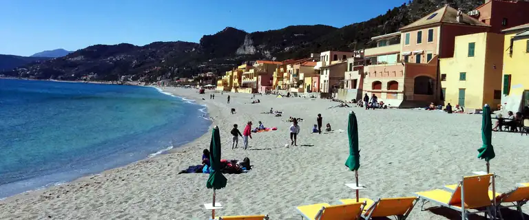
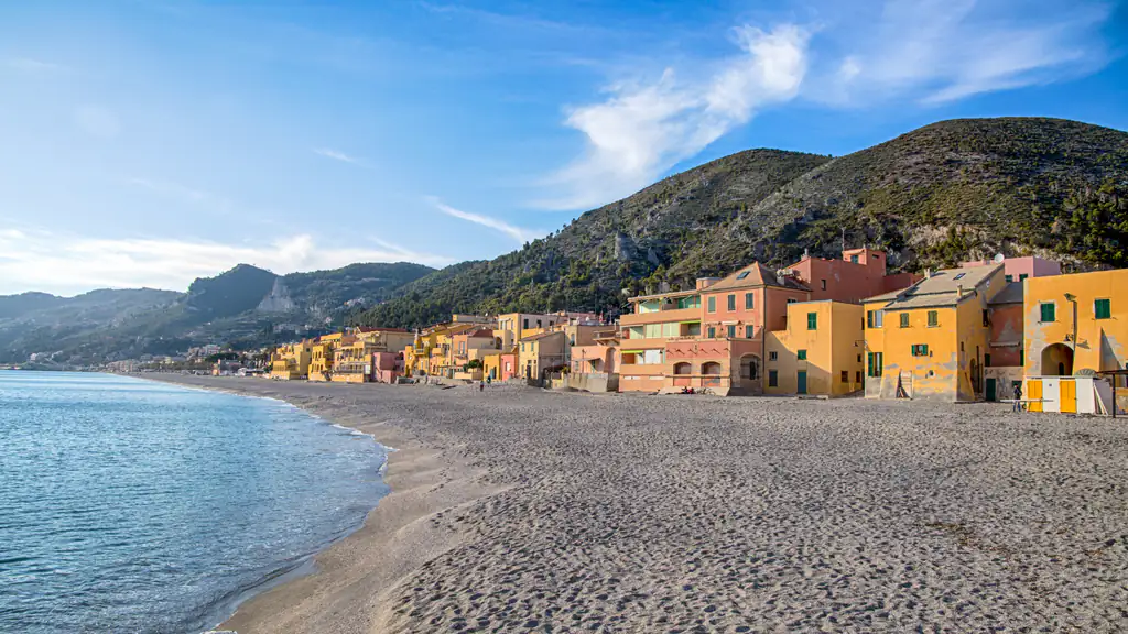
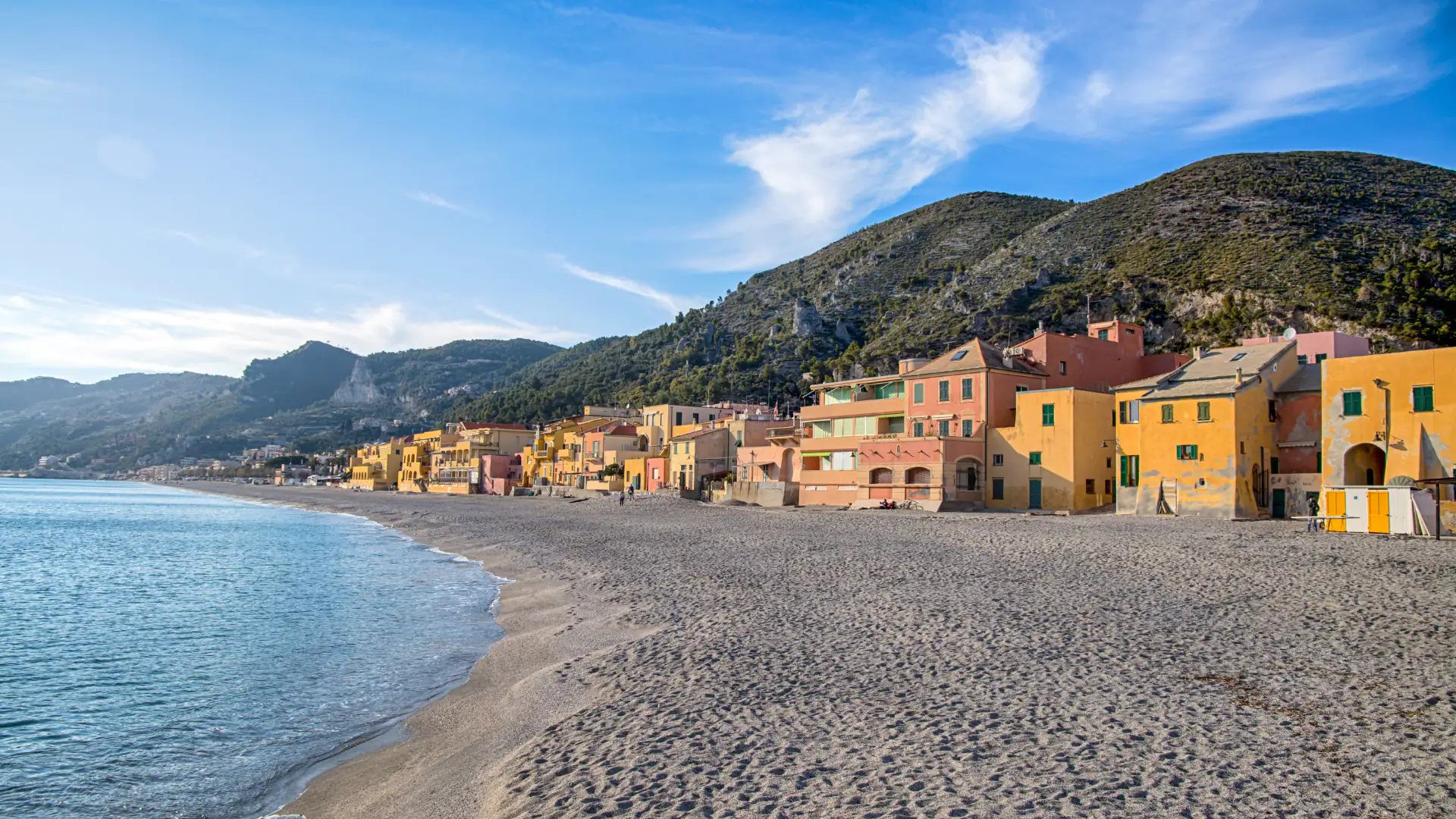
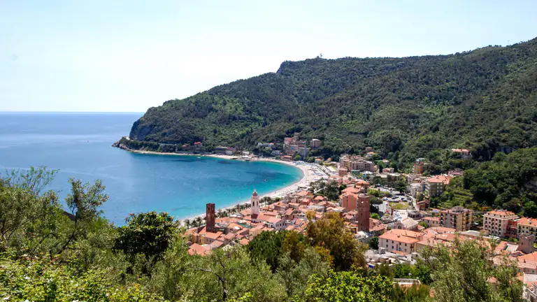
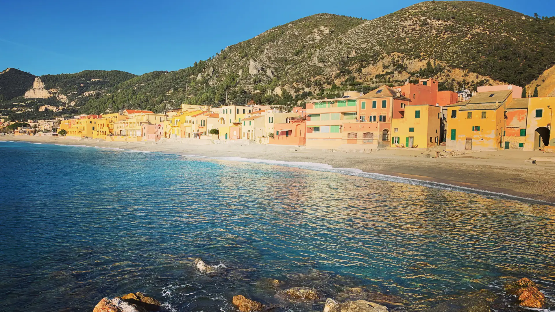
The bay of Varigotti with its colourful houses

Varigotti

The Saracen village near Finale Ligure: coloured houses on the beach, Punta Crena and its Byzantine fort, the Baia dei Saraceni and the Pilgrim's Path.

The bay of Varigotti with its colourful houses
Area
Riviera delle PalmeRiviera di Ponente · Province of Savona
Ideal for
Couples and families at the beachsnorkellers, hikers, lovers of seaside villages
Beaches
Village beach and Malpasso are Blue Flag 2026Baia dei Saraceni is almost all free
Best time to go
June and September for the seaspring and autumn for the Pilgrim's Path
By train
No station: get off at Finale Ligure Marina and take the TPL Linea busa few minutes
By car
A10, Finale Ligure exit, then the Via Aurelia east past Finalpiacentre is a ZTL
Airport
Genoa Cristoforo Colombo (about 70 km)Nice about 140–150 km
How long to stay
One day for the village and the traila week for a beach holiday

Welcome to Varigotti

Saracen houses and the Baia dei Saraceni

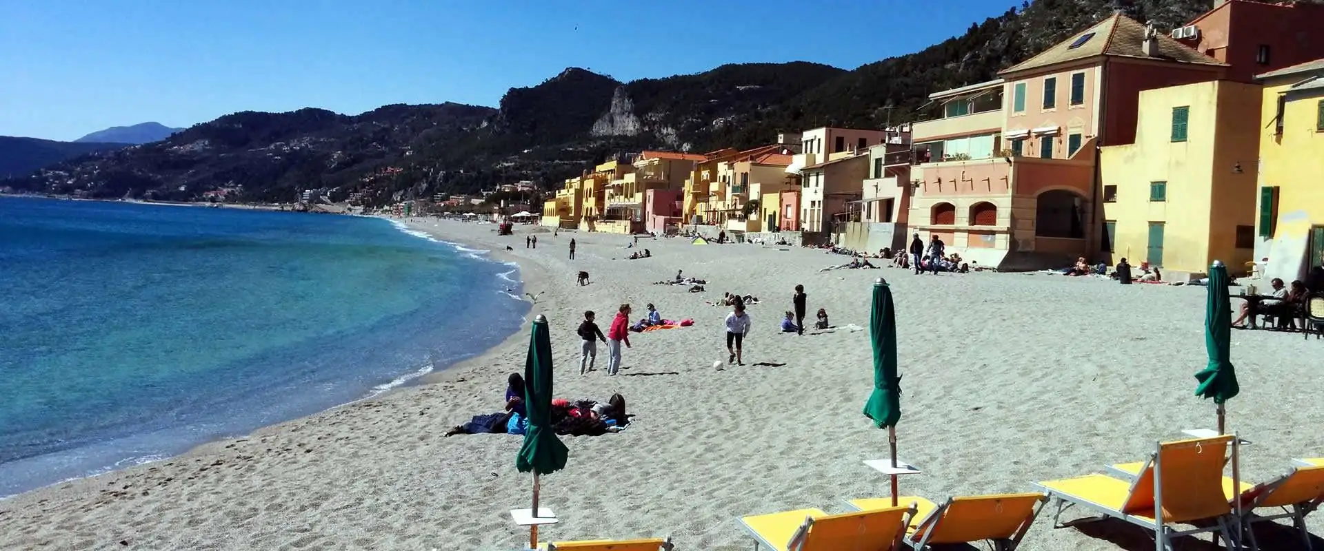
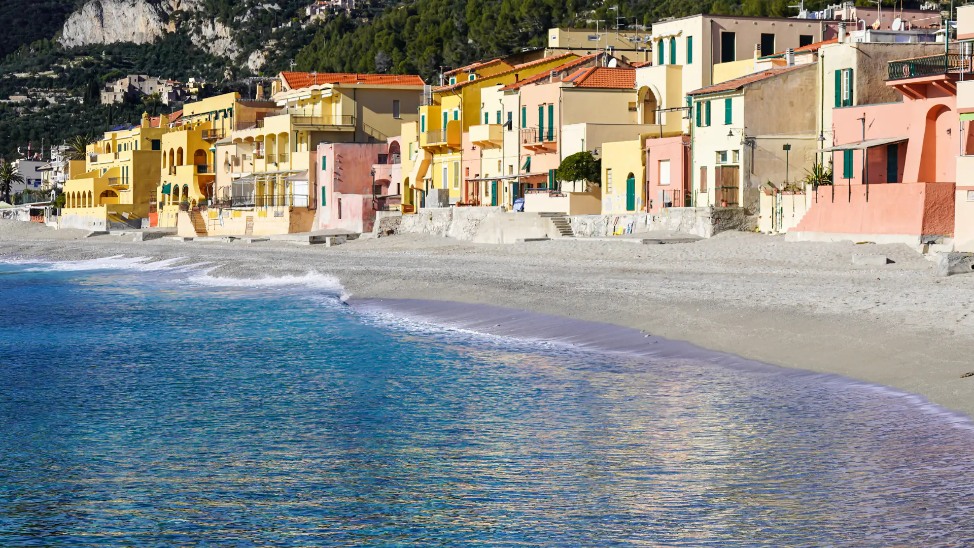
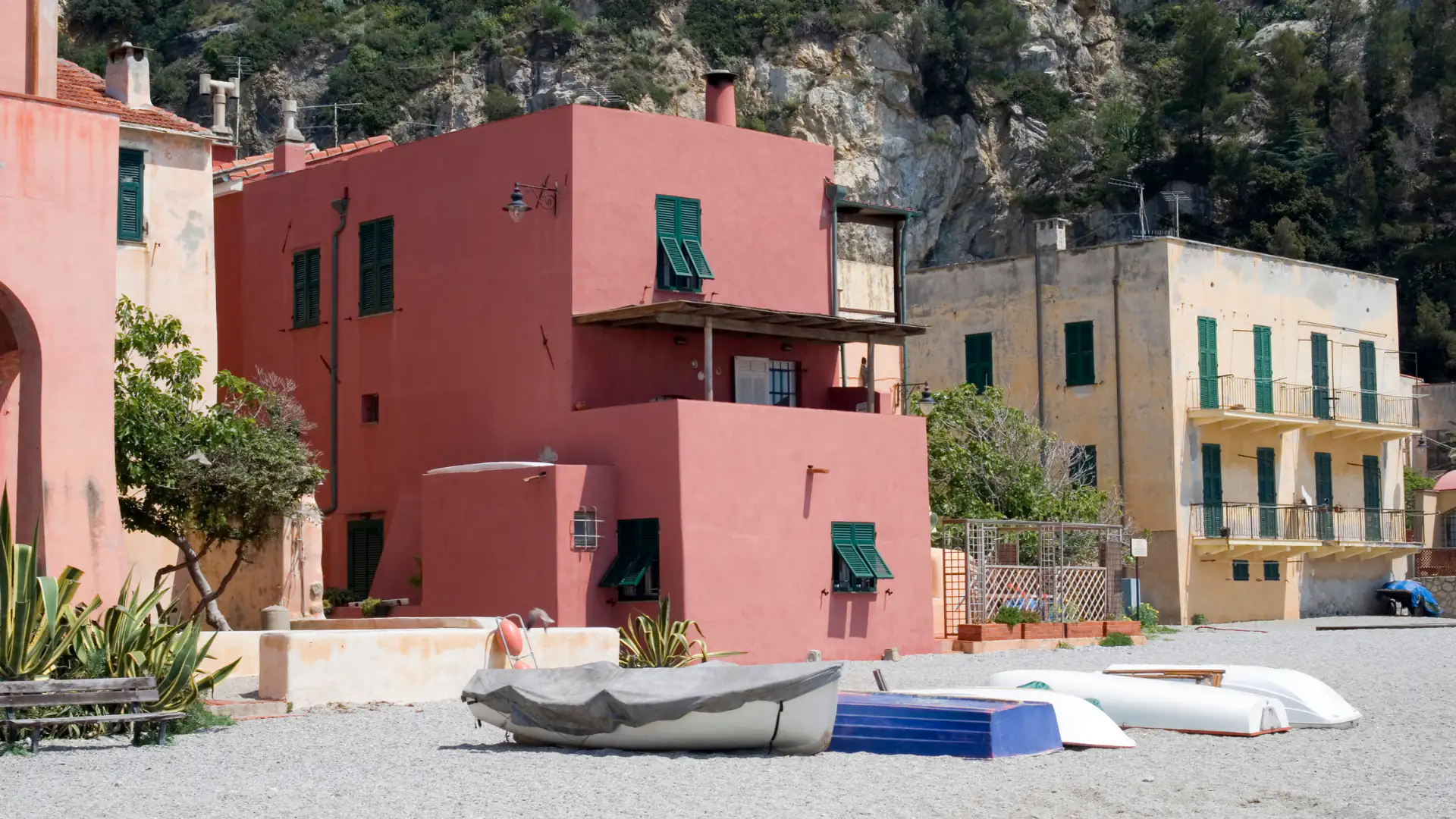
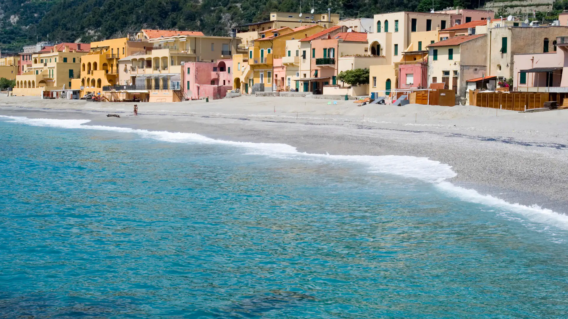
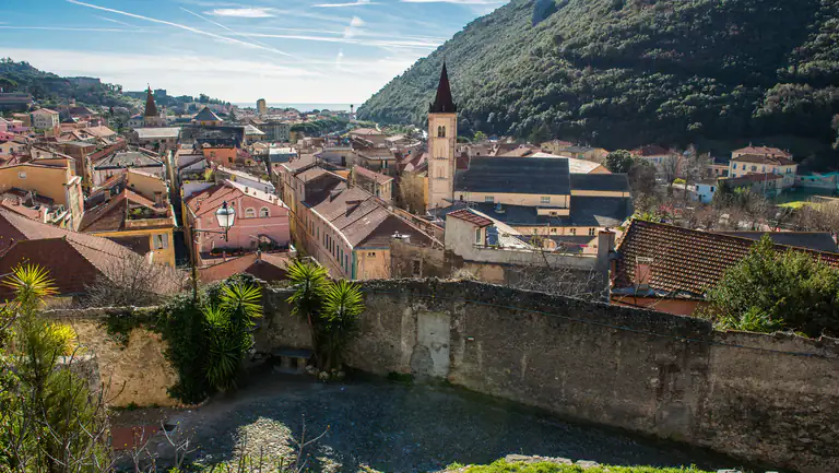
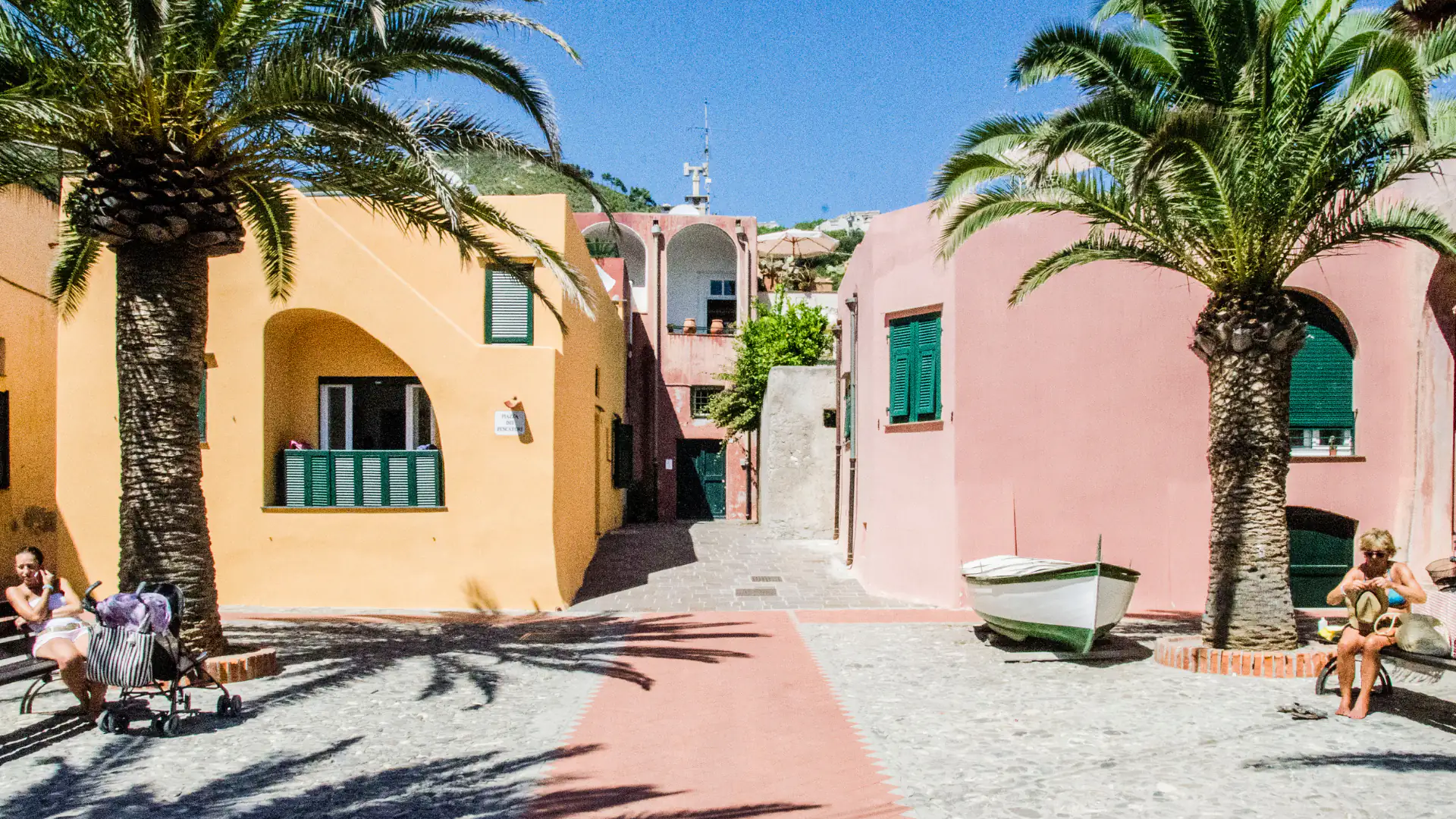
Varigotti is the “Saracen village” of the Italian Riviera di Ponente: a row of low, pastel-coloured houses built right on the sand, with fishing boats pulled up in front of the doors. It is part of Finale Ligure, in the province of Savona, and sits at the eastern end of the municipality, between the headland of Punta Crena and Capo Noli. About 500 people live here, on a strip of land a few hundred metres wide between the sea and steep hills of olive trees and scrub.

The “Saracen” nickname comes from local tradition and the look of the houses, not from historical records. The real history is older. On the headland above the village stood a Byzantine castrum guarding a natural harbour, destroyed by the Lombard king Rothari in 643. In the Middle Ages Varigotti was a castle of the Del Carretto family, fought over with Noli, until Genoa destroyed it in 1341.

Today it is above all a beach village: a Blue Flag 2026 beach in front of the old houses, the Baia dei Saraceni just to the east, and the Pilgrim’s Path walking trail over the cape to Noli. If you know the Cinque Terre, think of a much smaller and quieter version on a sandy beach, about an hour by train from Genoa. The hard part in July and August is parking.

Where is Varigotti?

Varigotti is in Liguria (Riviera di Ponente, Riviera delle Palme, province of Savona).

Map: where Varigotti is in LiguriaPIEDMONTLOMBARDYEMILIA-ROMAGNATUSCANYFRANCERIVIERA DI PONENTERIVIERA DI LEVANTELIGURIAN SEASavonaImperiaSanremoLa SpeziaVarigotti
Boundaries: ISTAT, Natural Earth · Interactive map →

What to see

What to see in Varigotti

The bay of Varigotti with its colourful houses

You can walk around the village in an hour. For the headland, the two churches of San Lorenzo and the Grotta dei Falsari, allow half a day and wear proper walking shoes.

Pastel houses of Varigotti's Saracen village

The old village and the beach houses

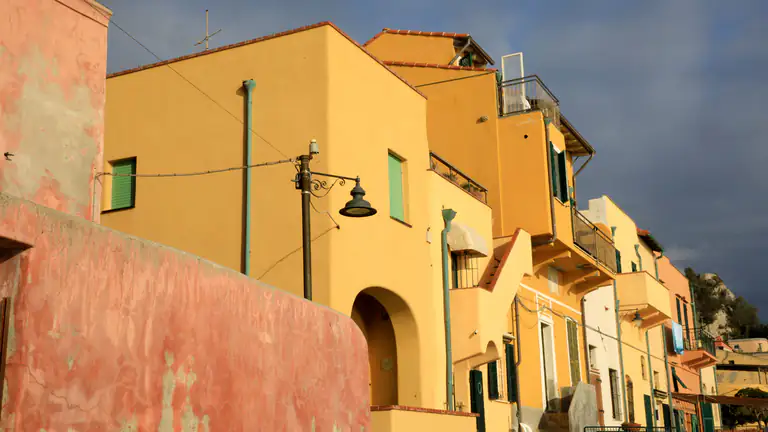
The historic centre is a compact cluster of low houses painted yellow, pink, ochre and blue, with small terraces and flat roofs. The seaward façades open straight onto the beach; behind them runs a narrow lane (carruggio) with small squares, arches and passages down to the water. It is a limited traffic zone, so it is pleasant on foot.

The classic photo is taken from the pier or the shoreline looking east, with the coloured houses and the hill of Punta Crena behind.

The pier

The small pier, named after the film director Renato Castellani, closes the village beach and is the place to see Varigotti from the sea. The fireworks for the feast of San Lorenzo in August are launched from here.

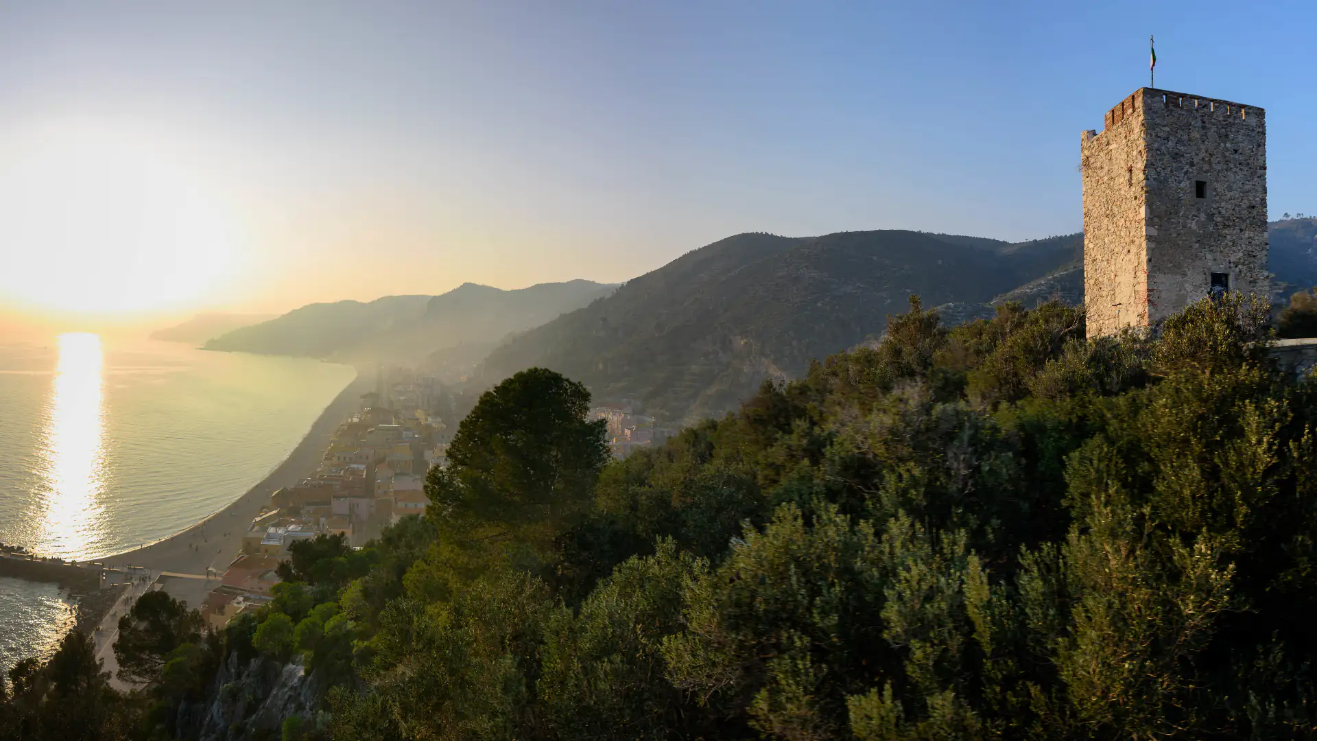
Headland with the Saracen tower of Varigotti

Punta Crena and the tower

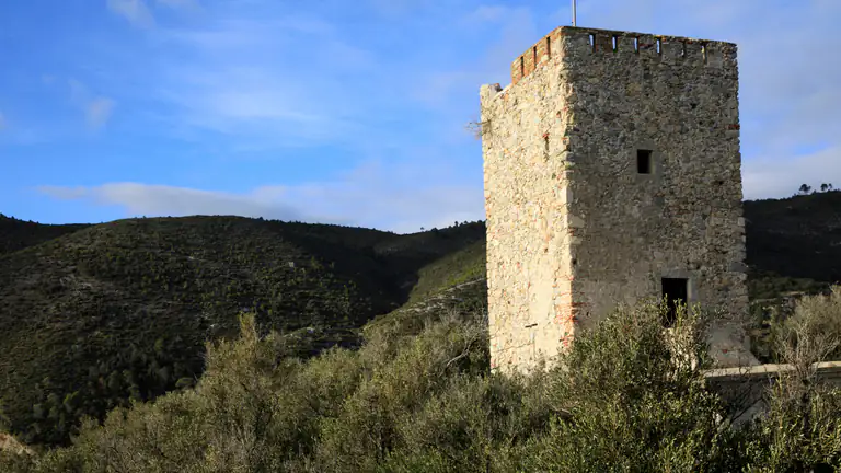
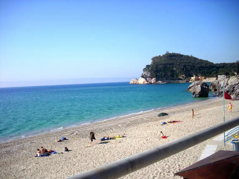
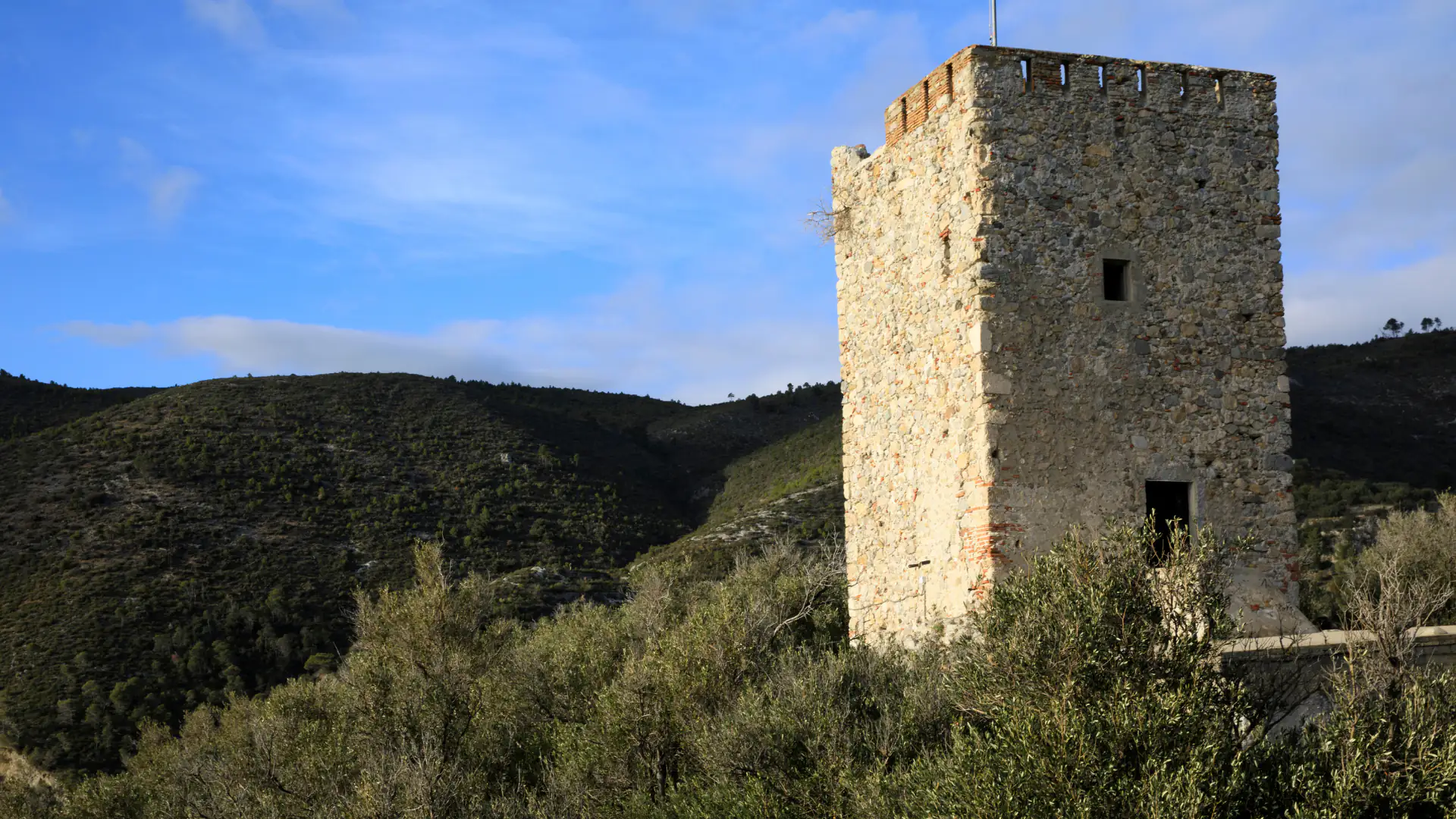
The headland closing Varigotti to the east is Punta Crena: an old olive grove above the cliffs, with a watchtower on top. The squat, square two-storey tower you see today dates from the early 19th century and was built on the remains of older towers, with a semicircular platform for cannons in front. It watched over the sea between Noli and Finale.

It is about a 15-minute walk up from the Via Aurelia, starting where the mule track to San Lorenzo begins. The path is easy but uneven: not suitable for pushchairs.

Watchtower on the hill above Varigotti

The Byzantine castrum and the castle

The plateau on the headland holds the remains of the first Varigotti. Excavations in recent decades confirmed a Byzantine castrum of the 6th–7th century and a medieval castle with several rings of walls. The castrum protected the natural harbour in the bay to the east, today’s Baia dei Saraceni. According to the chronicles, Rothari destroyed it in 643, when the Lombards took Liguria from Byzantium.

Stretches of Byzantine wall survive on the north-west side of the plateau, with 12th–14th-century walls on the east side. In the dry-stone walls you will spot large green stones, thought to have arrived as ships’ ballast. Tradition says that in 1341 Genoa destroyed the castle and filled in the harbour. Entry is free; for guided visits ask the Museo Archeologico del Finale.

Church of San Lorenzo on the Varigotti headland

Old San Lorenzo

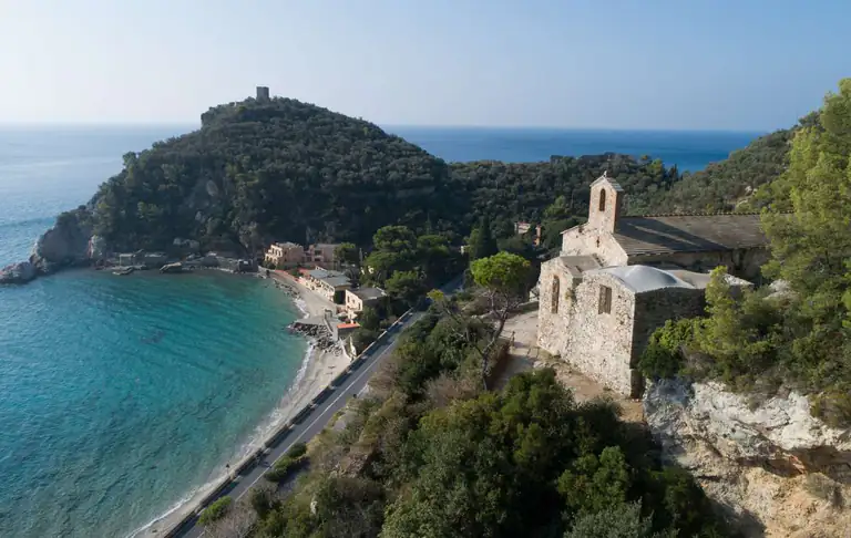
Halfway up the headland, above the Baia dei Saraceni, stands the oldest church in the area. Late Roman burials were found here, together with a 6th–7th-century inscription bearing the name Anatolius and a 4th-century Roman sarcophagus reworked in the 8th century, now on display in the Archaeological Museum in Finalborgo. In 1127 the bishop of Albenga gave the church to the monks of Lérins Abbey in Provence; it remained Varigotti’s parish church until 1586.

It takes about 20 minutes on the mule track marked with a red X, the same waymark as the Pilgrim’s Path. The church is usually seen from outside only: the interior is bare, but the position above the bay is worth the climb.

New San Lorenzo

When the village moved down to the beach for good, the parish followed. The church of San Lorenzo on the Via Aurelia was built between 1634 and 1659, under Spanish rule, and consecrated in 1690. Inside are a polyptych by a local painter dated 1584, recently restored, a gilded wooden tabernacle from 1645 and a high altar in coloured marble from 1716.

The Cerisola memorial

Along the Pilgrim’s Path, shortly after San Lorenzo, you pass a wall covered in coloured tiles and ceramics. It is not a tomb: it remembers Giuseppe Cerisola, known as “the Australian”, born in Varigotti, who lived for years in Australia and was a strong swimmer credited with saving many lives at sea.

Torre delle Streghe and Capo Noli

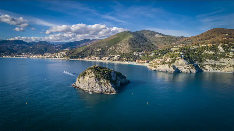
Further on, on the ridge of Capo Noli, the Torre delle Streghe (Witches’ Tower) is a Genoese tower built in 1582 on the old border between the Republic of Noli and the Marquisate of Finale. From here you look east over the Gulf of Spotorno and Bergeggi island, and west back to Punta Crena and Varigotti.

Grotta dei Falsari opening onto the sea at Varigotti

Grotta dei Falsari

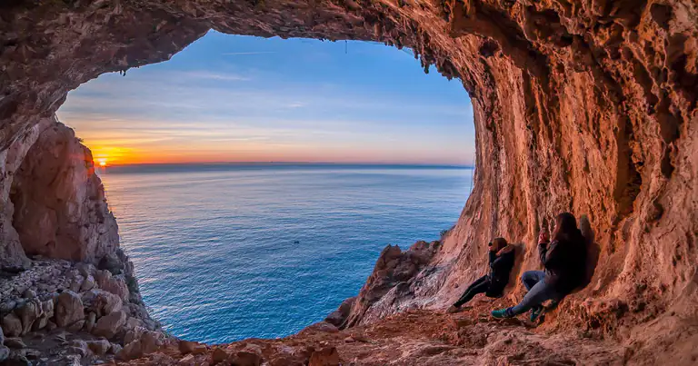
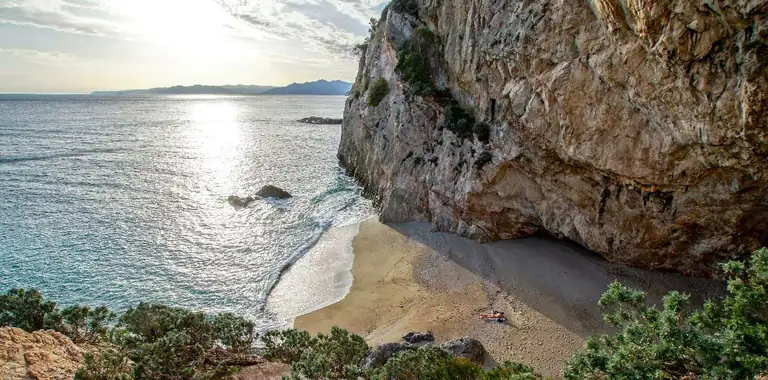
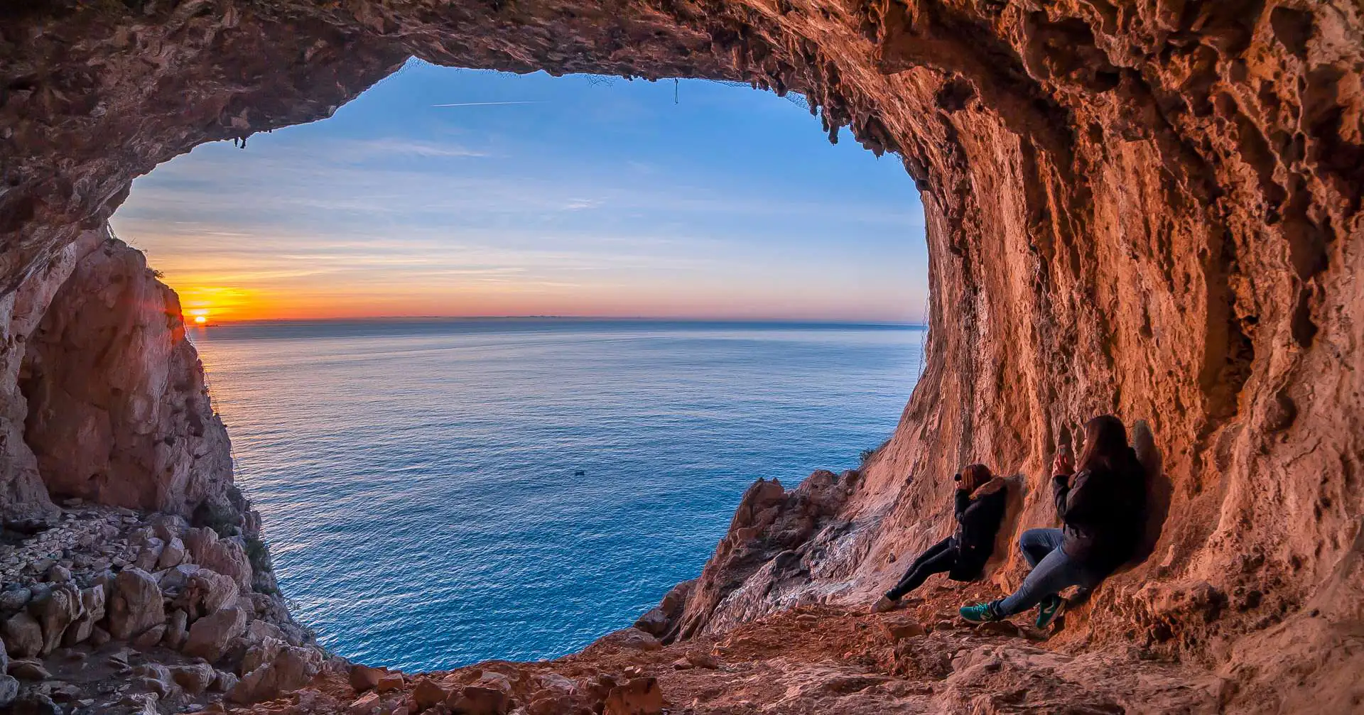
This is the headland’s signature photo: a large natural cave in the cliff, with a round opening framing the sea. Tradition says smugglers and counterfeiters hid here, hence the name (“Forgers’ Cave”); it is also called Grotta dei Briganti. It is not on the main trail: you reach it by a side path marked with unofficial painted signs, then a steep, uneven descent with fixed ropes on the trickiest parts. The drop is sheer: no beach shoes, and keep children close.

Sea

Beaches in Varigotti

The beaches run from the village beach in the west to the coves under Capo Noli in the east. For every beach in the municipality, from Finalmarina to Malpasso, see our guide to the beaches of Finale Ligure.

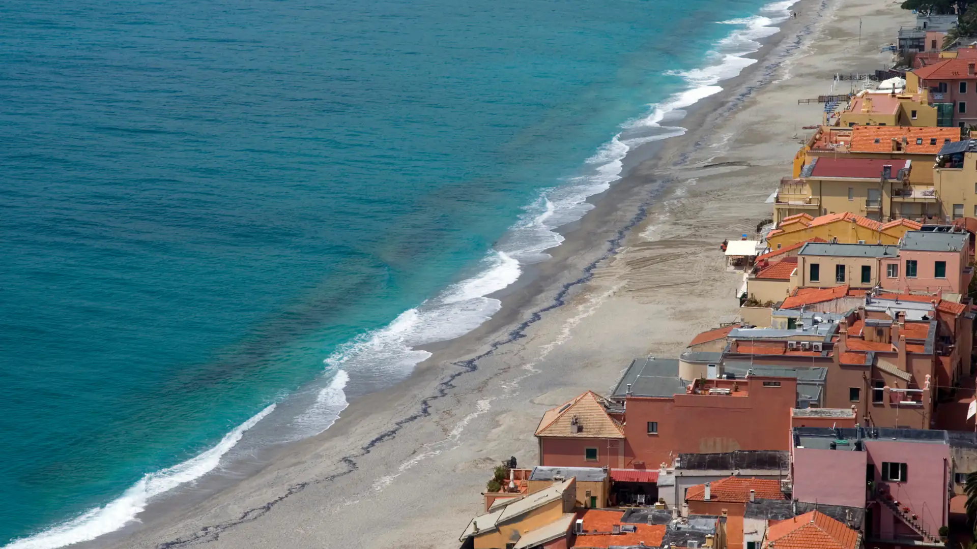
Varigotti beach and colourful houses

Varigotti beach

SandPebblesBeach clubs

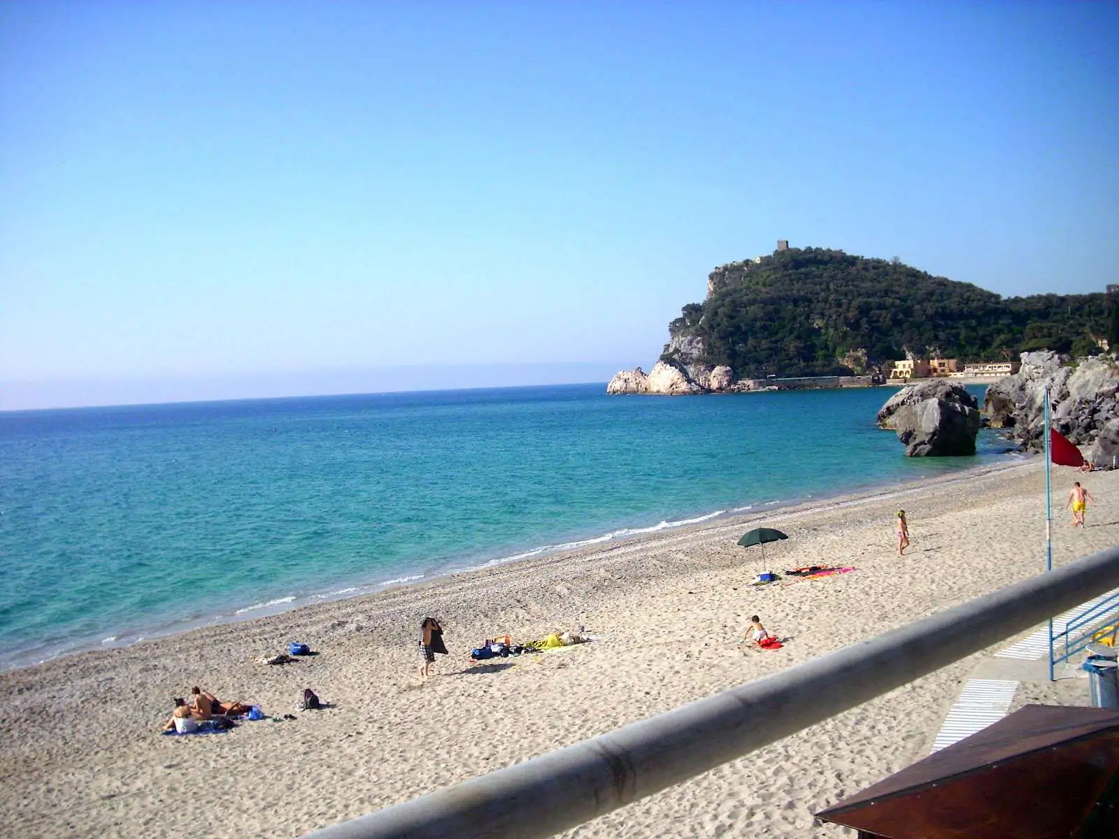
The long beach in front of the village is sand mixed with small pebbles and holds the Blue Flag in 2026. Most of it is taken by beach clubs (stabilimenti) renting umbrellas and loungers, with a few free stretches. At both ends the seabed turns rocky, good for snorkelling straight from the shore. In summer it is one of the busiest beaches around Finale: arrive early for a free spot.

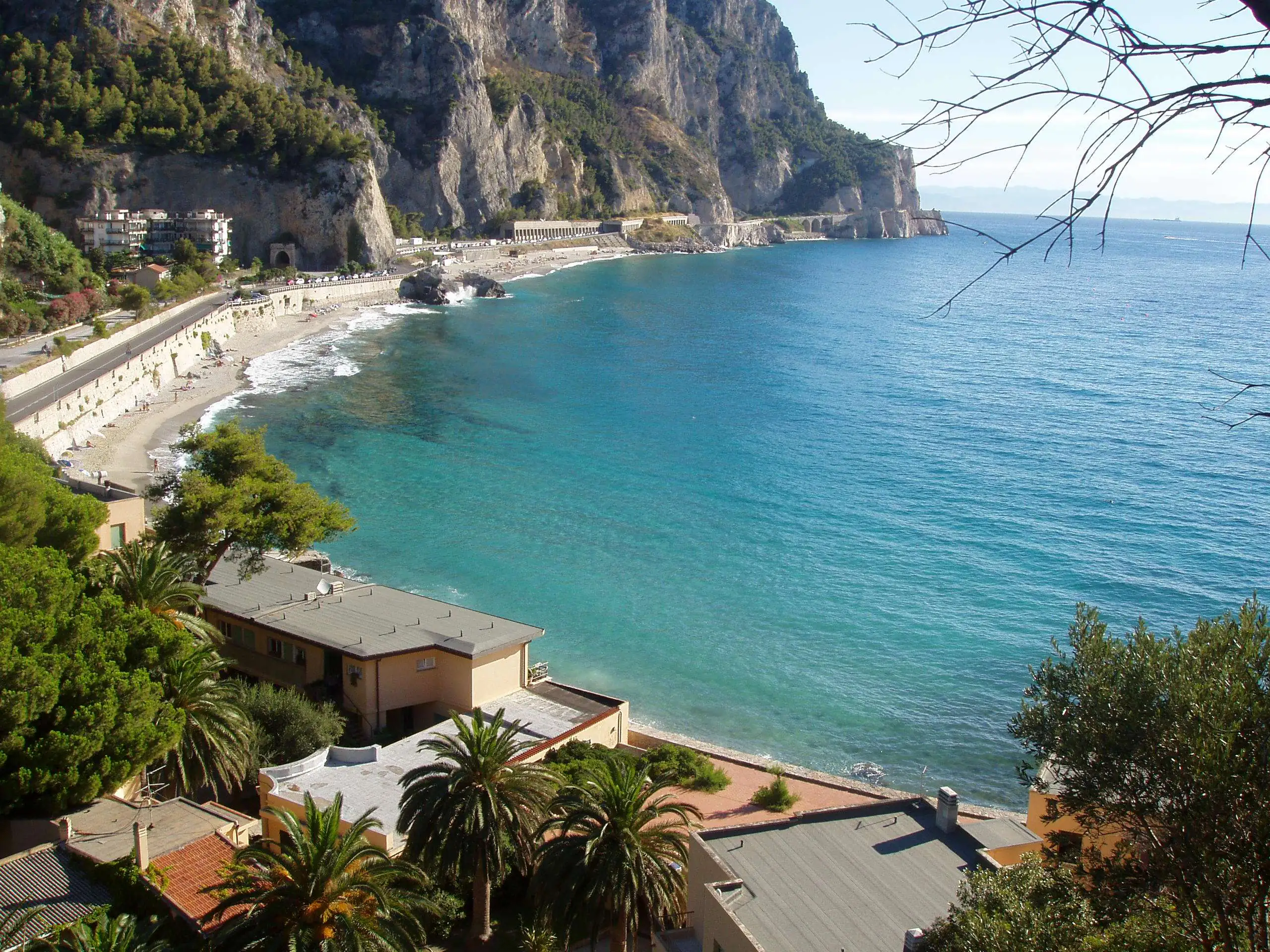
Baia dei Saraceni in Varigotti

Baia dei Saraceni

SandPebblesRocks

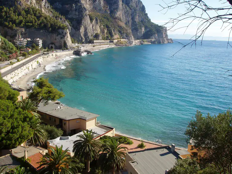
Just past Punta Crena, along the Via Aurelia towards Noli, the Baia dei Saraceni is Varigotti’s ancient harbour. It is a beach of fine sand and small pebbles between two headlands, almost entirely free, with few facilities and very clear water. Near the rocks it is good for mask and fins. Roadside parking along the Aurelia is limited and paid: in high season walk from Varigotti or take the bus.

Punta Crena beach among the rocks

Punta Crena

SandPebblesRocksFamily friendly

Below the point, between the rocks, is a tiny cove of pebbles and sand. The path down from land is steep and exposed, with one section on a rope: we do not recommend it. The right way in is from the sea, swimming if you are fit, or by kayak, SUP or pedalo from the village beach. The shallow, rocky seabed on either side is some of the best snorkelling in the area.

Malpasso beach in Varigotti

Malpasso

SandPebbles

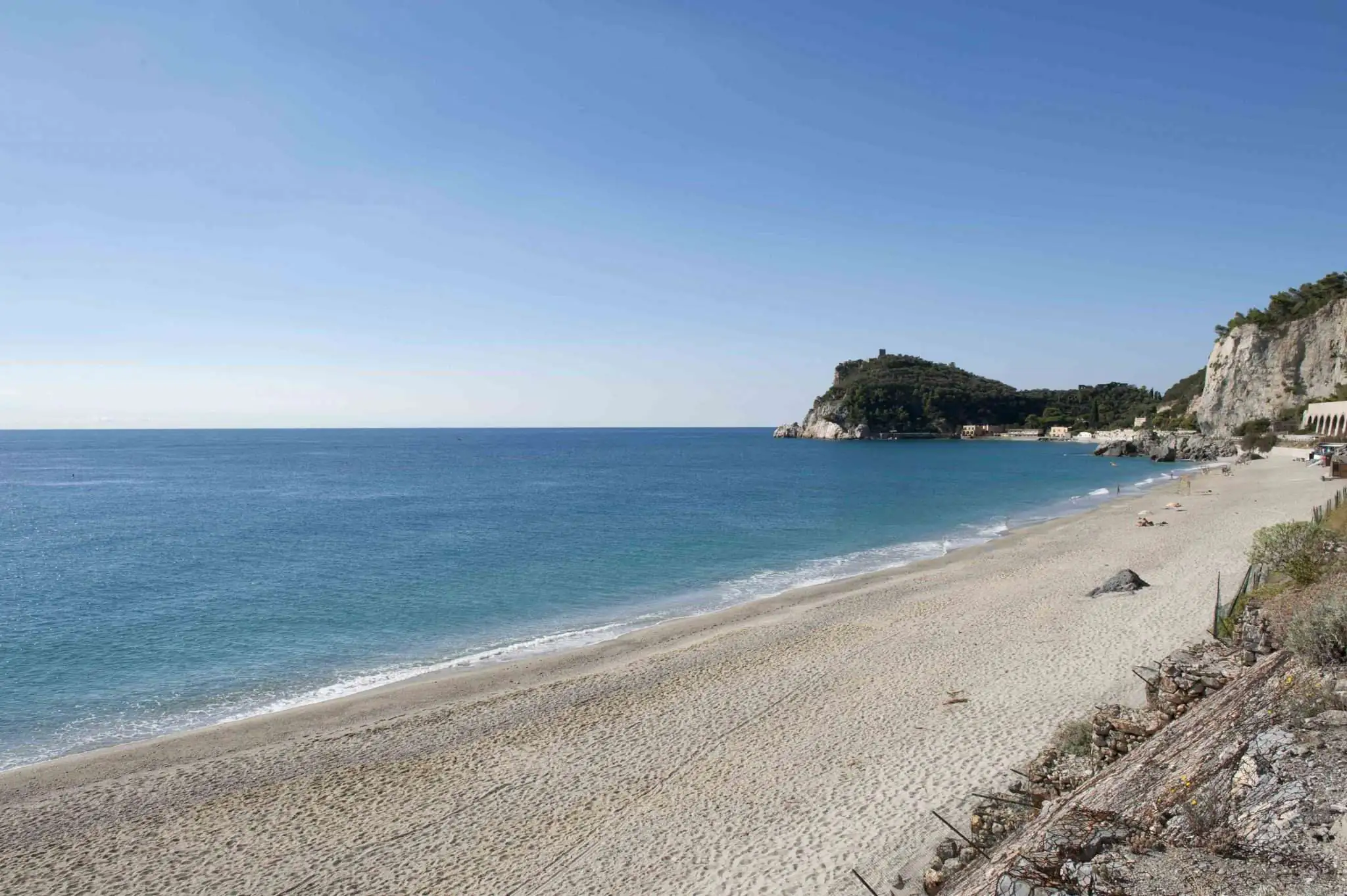
Beyond the Malpasso road tunnel, towards Capo Noli, Malpasso beach also has the Blue Flag in 2026. It is sand and pebbles under the cliff, and the TPL Linea buses stop nearby. Further on, the coves towards Capo Noli can only be reached by steep paths or by boat.

Varigotti beach and village with the hills

Where to stay

Where to stay in Varigotti

Varigotti is small and accommodation is limited: a few hotels, B&Bs, holiday homes and apartments, many of them let by the week in summer. Staying here suits couples and families who want to be on the beach and leave the car parked for days. For July and August, book months ahead.

If it is full, the widest choice is in Finale Ligure, a few minutes away by bus: Finalmarina is handy for the station, Finalborgo for evenings out. To the east, Noli is an alternative you can even reach on foot.

Getting there

How to get to Varigotti

By car

Take the A10 Genoa–Ventimiglia motorway and exit at Finale Ligure. Drive down to the sea and follow the Via Aurelia east past Finalpia: Varigotti is a few kilometres on. From Savona or Noli you arrive from the east along the Aurelia, through the Malpasso tunnel.

By train

Varigotti has no station. The nearest is Finale Ligure Marina on the Genoa–Ventimiglia line, about an hour from Genoa on direct regional trains. From the station, continue by bus.

By bus

TPL Linea buses link Finale Ligure Marina station with Varigotti and Malpasso beach, continuing to Noli and Savona. In summer this is the easiest option. Check routes, times and tickets on TPL Linea; buy tickets before boarding.

By plane

The nearest airport is Genoa Cristoforo Colombo, about 70 km away: under an hour on the motorway, or train from Genoa to Finale. Nice is about 140–150 km away.

Parking

Varigotti’s centre is a limited traffic zone (ZTL): do not drive into the old village. There are paid car parks in the village, including one on the old railway line and one on Via degli Orti, plus paid spaces along the Aurelia towards the Baia dei Saraceni. In July and August they fill early and are expensive. If you are staying in Finale, come by bus; if you drive, arrive before 9 am.
By car

A10, Finale Ligure exit, then the Via Aurelia east past Finalpia; centre is a ZTL

By train

No station: get off at Finale Ligure Marina and take the TPL Linea bus (a few minutes)

By plane

Genoa Cristoforo Colombo (about 70 km); Nice about 140–150 km

The guide

Things to do in Varigotti

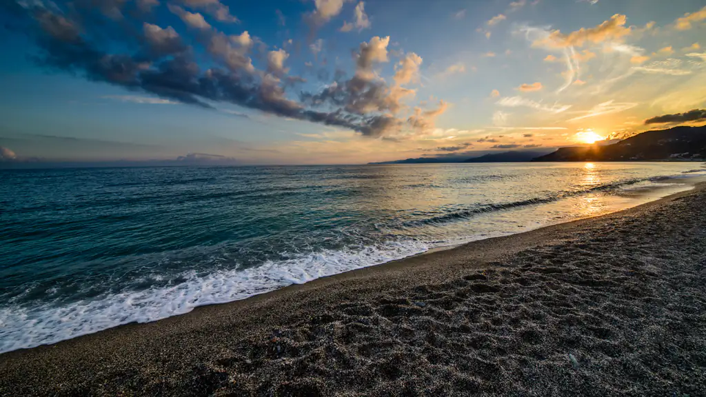
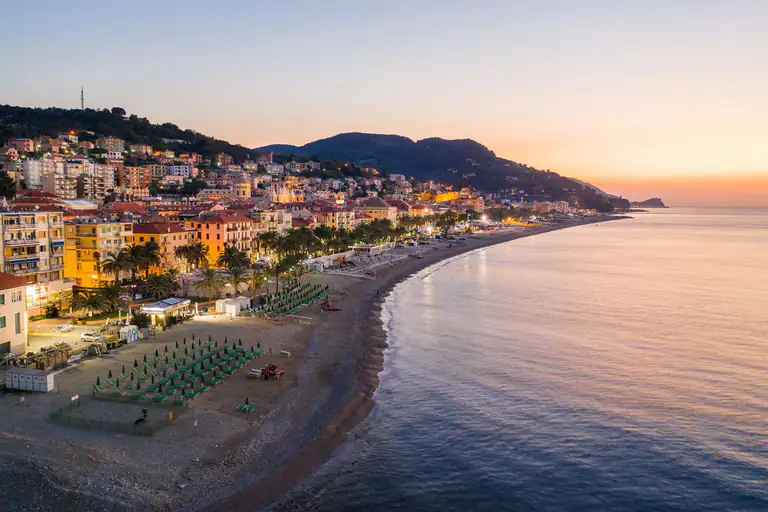
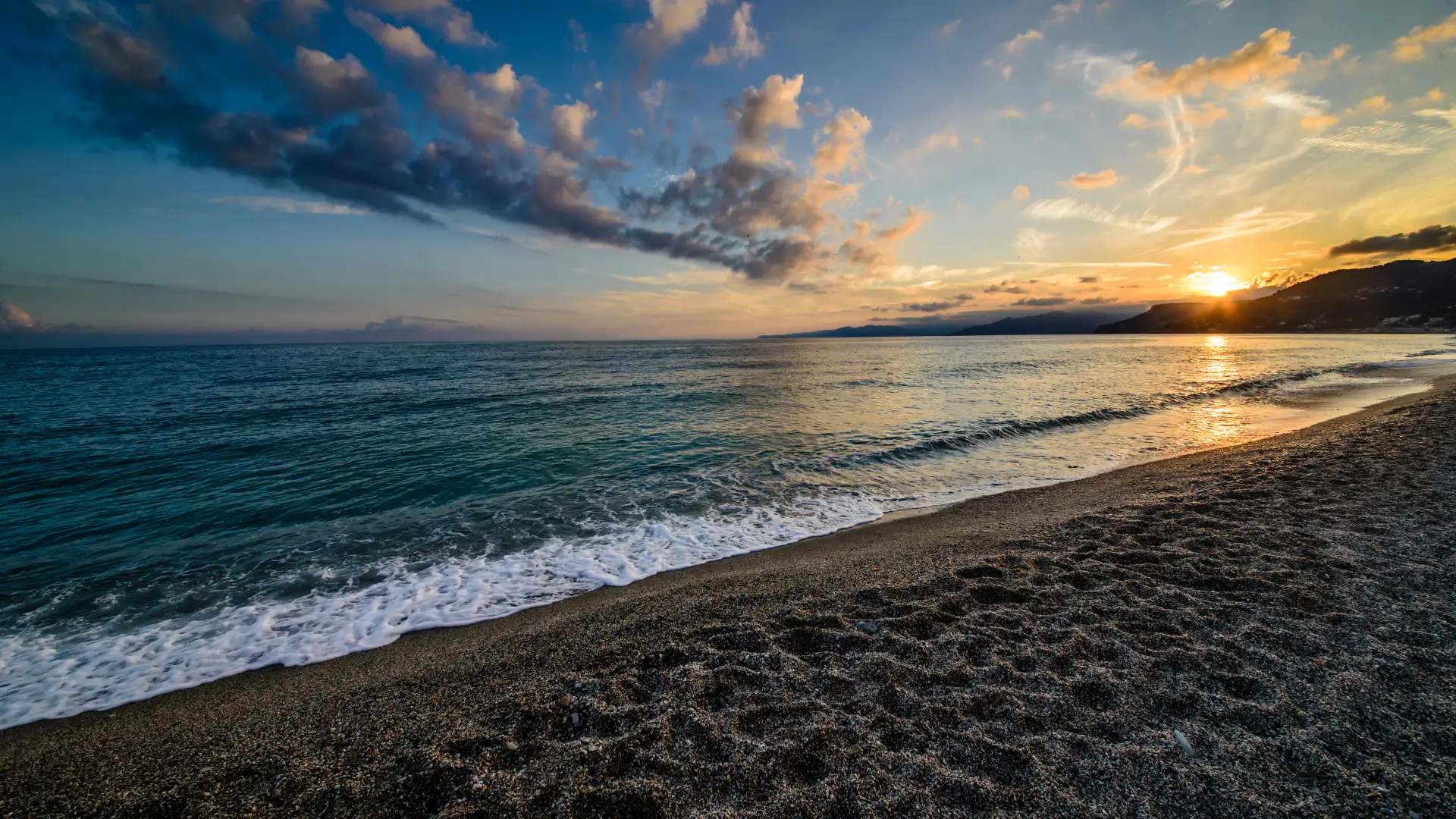
Sunset on the beach at Varigotti
  • Snorkelling: at both ends of the village beach, under Punta Crena and in the Baia dei Saraceni. Bring a mask and water shoes.
  • Kayak and SUP: paddling round Punta Crena is the best way to see the coast as far as Capo Noli.
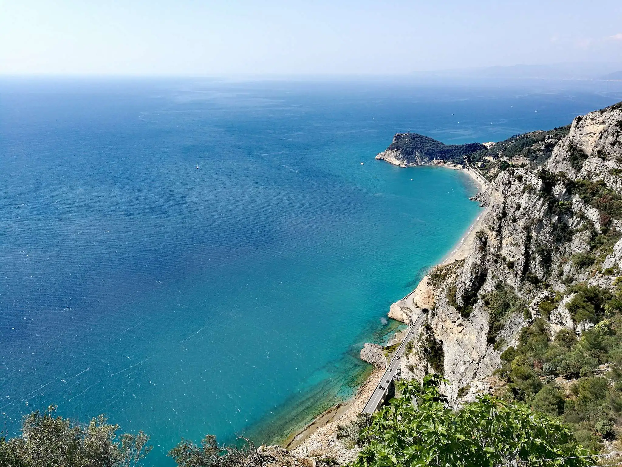
  • Pilgrim’s Path: walk from Varigotti to Noli past San Lorenzo, the Witches’ Tower and the Grotta dei Falsari. Full details in our Pilgrim’s Path guide.
  • Feast of San Lorenzo: the patron saint’s feast around 10 August, with fireworks over the sea. Check the year’s programme on the Comune di Finale Ligure website.

Walks and hikes

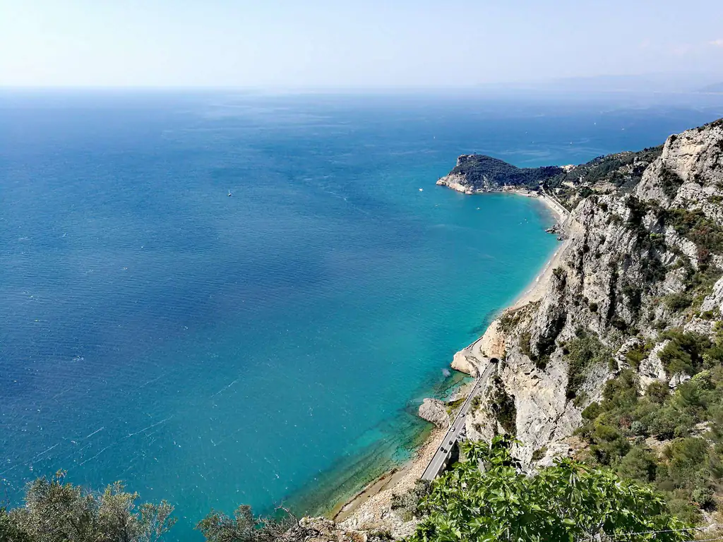
Turquoise sea from the Sentiero del Pellegrino in Varigotti

Behind Varigotti the hill climbs steeply to the Altopiano delle Mànie, a plateau of woods, fields and trails between Finale and Noli. These are the two classic walks.

  • Pilgrim’s Path (Sentiero del Pellegrino): Varigotti to Noli over Capo Noli, waymarked with a red X. About 5–6 km and roughly 300 metres of ascent: allow 2–3 hours one way. Start in Varigotti so the steepest climb comes first, and return by bus.
  • Altopiano delle Mànie: paths and dirt tracks lead up to the Arma delle Manie, a large cave inhabited in prehistoric times, and on towards Noli. The network is dense and signposting is patchy: bring a GPS track. A Varigotti–Noli–Manie loop takes a full day.

In summer avoid the middle of the day: the coastal paths have little shade.

What to eat in Varigotti

  • Focaccia and farinata: the beach snack; farinata is a thin chickpea pancake baked in copper pans.
  • Fish: anchovies, grilled or baked fish, fried seafood.
  • Trofie al pesto: the Ligurian pasta dish.
  • Vegetable pies: savoury tarts with seasonal vegetables.
  • Taggiasca olives and olive oil: from the groves on the hills around.

Day trips from Varigotti

  • Noli (about 3.5 km): the old maritime republic with medieval towers and the Romanesque church of San Paragorio. You can walk there on the Pilgrim’s Path.
  • Finale Ligure (about 4–5 km): Finalmarina with its basilica and Spanish arch, Finalpia with its abbey, and the train station.
  • Finalborgo: the walled town of the Del Carretto marquises, with the Archaeological Museum where finds from Varigotti are on show.
  • Bergeggi: the island and marine protected area beyond Spotorno.
  • Loano: to the west, a long seafront and a lively old town.
  • Savona: the city with the Priamar fortress and the port, for a change from the beach.

Weather

Weather and best time to visit Varigotti

June and September for the sea; spring and autumn for the Pilgrim's Path

☁️
16°CNow · wind 19 km/h
  1. Thu 8🌙16° 16° 
  2. Fri 9🌤️22° 14°1 mm
  3. Sat 10⛅22° 14° 
  4. Sun 11⛅22° 14°1 mm
  5. Mon 12⛅20° 15°4 mm
  6. Tue 13🌤️22° 15° 

Forecast: MET Norway (Yr), CC BY 4.0 licence. Updated hourly.

Weather across Liguria →

MonthJanFebMarAprMayJunJulAugSepOctNovDec
SeaOff seasonOff seasonOff seasonOff seasonPossibleGoodIdealIdealGoodPossibleOff seasonOff season
Sightseeing and hikingPossiblePossibleGoodIdealIdealGoodGoodGoodIdealIdealGoodPossible
CrowdsQuietQuietFew peopleFew peopleFew peopleBusyVery busyVery busyBusyFew peopleQuietQuiet
Don't missFeast of San Lorenzo

IdealGoodPossibleOff season

Crowds:QuietFew peopleBusyVery busy

Gallery

Photos of Varigotti

FAQ

Frequently asked questions about Varigotti

Is Varigotti a town of its own?

No, it is a frazione (district) of Finale Ligure, the easternmost part of the municipality, on the sea between Finalpia and Capo Noli.

Why is it called a Saracen village?

Because of local tradition and the low beach houses that look like a Mediterranean fishing village. A lasting Saracen settlement is not documented: the recorded history is a Byzantine castrum and a medieval castle.

What can I see in Varigotti in one day?

The old village and beach houses, Punta Crena with the tower and castrum remains, old San Lorenzo and the Baia dei Saraceni. With more time, continue on the Pilgrim’s Path to the Grotta dei Falsari.

Is Varigotti beach free?

Partly. In front of the village it is mostly beach clubs with a few free stretches; the Baia dei Saraceni is almost entirely free.

Does Varigotti have a Blue Flag?

Yes: in 2026 Varigotti beach and Malpasso beach both hold the Blue Flag.

Where can I park in Varigotti?

In the paid car parks in the village and along the Via Aurelia. The centre is a ZTL. In summer spaces go early: arrive in the morning or take the bus from Finale.

Can I get to Varigotti by train?

Not directly: get off at Finale Ligure Marina and take the TPL Linea bus to Varigotti.

How long is the Pilgrim's Path?

Varigotti to Noli takes about 2–3 hours one way, for about 5–6 km and 300 metres of ascent. You return by bus.

How do I get to the Grotta dei Falsari?

Via a side path off the Pilgrim’s Path near Noli, or from Noli along the Passeggiata Dantesca. The last section is steep and uneven, with fixed ropes.

When is the best time to visit Varigotti?

June and September for the sea with fewer people; spring and autumn for walking. July and August are the busiest months.

Nearby

What to see near Varigotti

3 km as the crow flies

Noli

The old maritime republic between Spotorno and Capo Noli: medieval towers, San Paragorio, Monte Ursino castle, a fishermen's beach and…

Discover →

5 km as the crow flies

Finale Ligure

Finalmarina, Finalborgo, Finalpia and Varigotti: Blue Flag beaches, Del Carretto castles, 200+ MTB trails and 4,000 climbing routes.

Discover →

6 km as the crow flies

Finalborgo

Finale Ligure's walled medieval village: 15th-century gates, San Biagio, Santa Caterina cloisters, archaeology museum and castles on the Strada Beretta.

Discover →

8 km as the crow flies

Bergeggi

Island and Marine Protected Area, sea cave, Blue Flag beaches, snorkelling, kayaking and clifftop trails between Savona and Spotorno.

Discover →
Scroll to Top