The Cinque Terre are five villages on the eastern coast of Liguria, in the province of La Spezia, between Levanto and Portovenere. From north-west to south-east they are Monterosso, Vernazza, Corniglia, Manarola and Riomaggiore: the first and the last are about 8.5 km apart as the crow flies and a quarter of an hour apart by train. All five have a station on the Genoa–La Spezia line, and four of the five have a ferry pier.
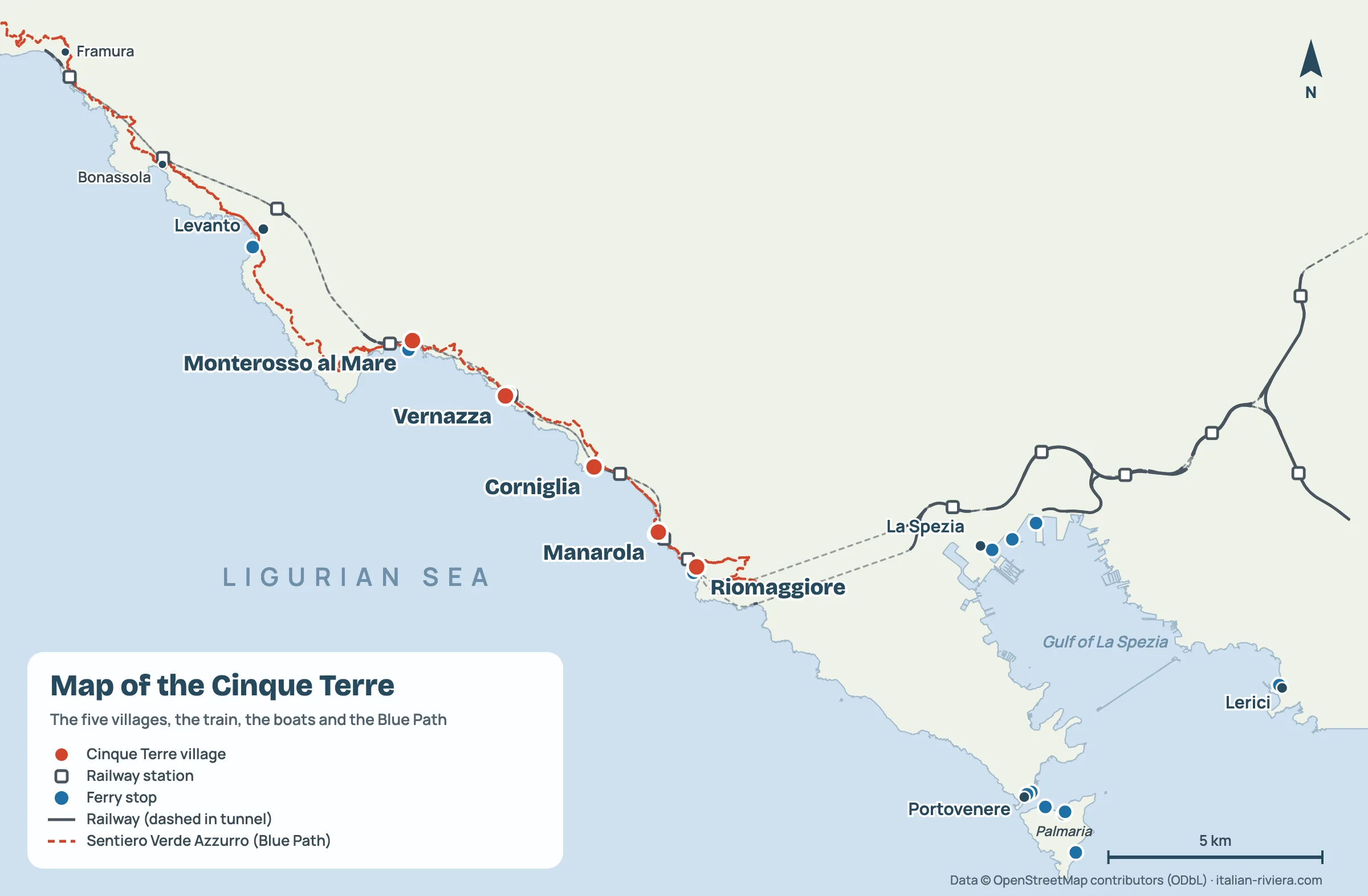
- Where: Italian Riviera di Levante, province of La Spezia, between Punta Mesco and Punta di Montenero
- Village order: Monterosso, Vernazza, Corniglia, Manarola, Riomaggiore (from north-west)
- Gateways: La Spezia to the south-east, Levanto to the north-west
- Monterosso to Riomaggiore: about 14 minutes by train, about 11 km on the coastal path
- Nearest airports: Pisa (about 1 hour’s drive from La Spezia) and Genoa (about 1 hour 30)
- Protected as: National Park since 1999, UNESCO World Heritage since 1997 together with Portovenere and the islands
Where the Cinque Terre are
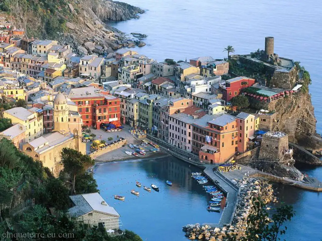
The Cinque Terre cover a steep stretch of coast with no flat land, at the far eastern end of Liguria, a few kilometres from Tuscany. The nearest city is La Spezia, about ten minutes by train from Riomaggiore. To the north-west the reference point is Levanto, the end of the line for Cinque Terre trains; to the south-east, across the gulf, is Portovenere. To see where they sit in the region, open our map of Liguria.
| From | By car to La Spezia | By train |
|---|---|---|
| Genoa | about 100 km, 1 h 30 | 1 h 15–2 h to Monterosso |
| Pisa | about 80 km, 1 h | about 1 h to La Spezia |
| Florence | about 150 km, 2 h | 2–2 h 30 to La Spezia |
| Milan | about 220 km, 2 h 30–3 h | about 3 h on a direct Intercity |
| Nice | about 295 km, 3 h 30–4 h | about 5 h, changing in Ventimiglia and Genoa |
Times are indicative, without traffic. Drivers leave the A12 at La Spezia (for Riomaggiore and Manarola) or Carrodano–Levanto (for Monterosso and Vernazza). The villages are closed to traffic and parking is scarce, so the train is the easy option. Flying into Pisa, take the train to La Spezia and change there.
The five villages on the map: distances and times
The villages sit almost in a row along the coast, 1–3 km apart. Corniglia is the only one not on the water: it sits on top of a headland, above the station.
| Stretch | Straight line | Train | On foot | Ferry |
|---|---|---|---|---|
| Levanto–Monterosso | 4 km | about 5 min | about 6 km, 3 h, via Punta Mesco | few sailings |
| Monterosso–Vernazza | 2.7 km | about 5 min | 3.7 km, 2 h (closed since 10 Sep 2026) | about 20 min |
| Vernazza–Corniglia | 2.7 km | 3–5 min | 4.1 km, 1 h 30 (closed since 10 Sep 2026) | no pier in Corniglia |
| Corniglia–Manarola | 2.1 km | 2–3 min | coastal path closed; via Volastra about 5.5 km, 3 h | Vernazza–Manarola about 25 min |
| Manarola–Riomaggiore | 1.1 km | about 3 min | Via dell’Amore, about 1 km, 30 min | about 10 min |
| Riomaggiore–La Spezia | 7 km | about 10 min | to Portovenere: 12–15 km, 5–6 h | via Portovenere, over 1 h |
Timetables and 2026 fares: see Cinque Terre trains and Cinque Terre ferries. Walking times are the Park’s and the Italian Alpine Club’s, for fit hikers.
Compare prices and availability of hotels, B&Bs and apartments, at no extra cost.
National Park and UNESCO area
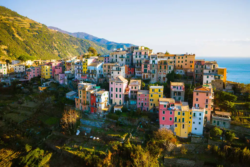
The Cinque Terre National Park was created in 1999 and covers about 3,860 hectares: the municipalities of Riomaggiore (with Manarola), Vernazza (with Corniglia) and Monterosso, plus the Tramonti area of La Spezia and the Mesco headland of Levanto. The sea in front is a Marine Protected Area with about 19 km of coastline.
The UNESCO area is larger. Since 1997 the site “Portovenere, Cinque Terre and the Islands” has also included Portovenere and the islands of Palmaria, Tino and Tinetto, listed as a cultural landscape of terraces and dry-stone walls. So Portovenere is not one of the Cinque Terre, but it belongs to the same UNESCO site and is reached by ferry. For the largest island, read our guide to Palmaria Island.
The main trails
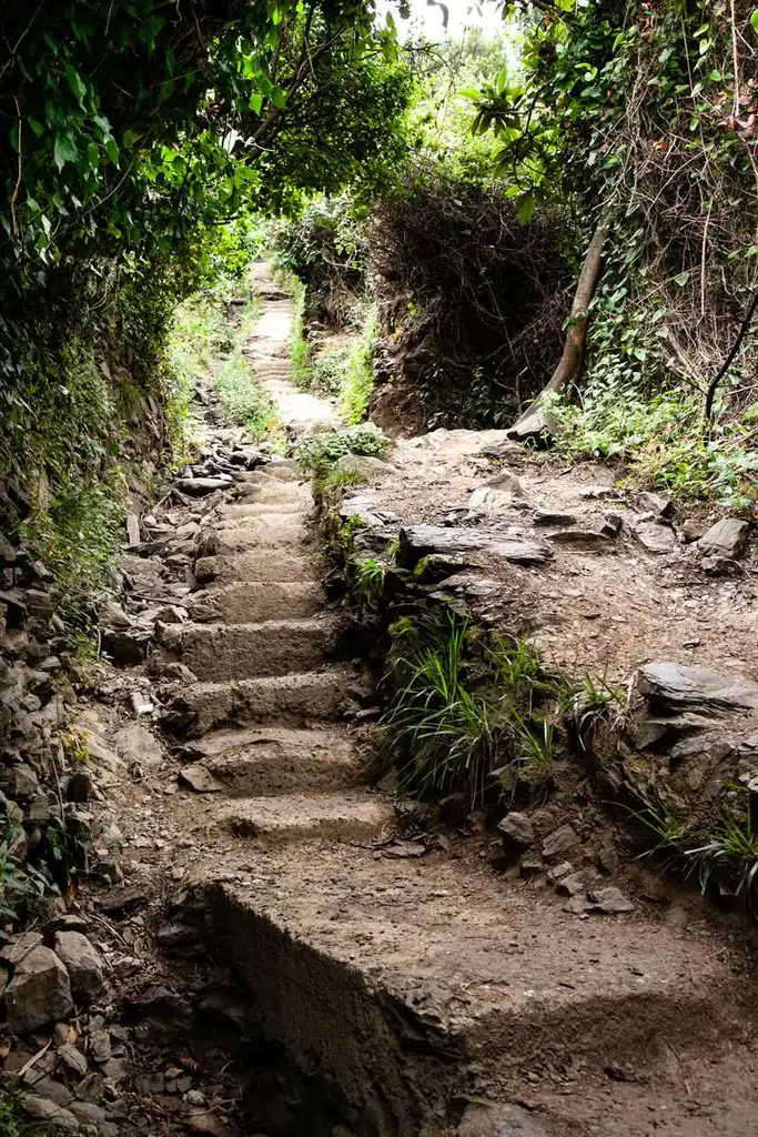
- Sentiero Verde Azzurro (592): the old Blue Trail along the coast, about 11 km from Monterosso to Riomaggiore. On 10 September 2026 the Park closed the Monterosso–Vernazza–Corniglia section for geological checks; the Corniglia–Manarola section is closed because of landslides.
- Via dell’Amore (592-1): about one kilometre above the sea between Riomaggiore and Manarola, one-way towards Manarola, with a card and a booked time slot. Details in our Via dell’Amore guide.
- Levanto–Monterosso (590 and 591): about 6 km over Punta Mesco, the walking gateway from the north-west.
- Cinque Terre High Trail (AV5T): runs along the ridge from Portovenere towards Levanto. The Park splits it into stages: Portovenere–Telegrafo about 3 h 20, Telegrafo–Cigoletta 2 h 40, Cigoletta–Il Termine 3 h 15.
- Sanctuary trails: halfway up the slopes, from the villages to the sanctuaries of Soviore, Reggio, Volastra and Montenero.
Trail status changes often, also because of weather alerts: details, times and open alternatives on our Cinque Terre hiking trails page.
Stations and ferry piers
Every village has a station, but they are not equally convenient:
- Monterosso: station in Fegina, on the beach, west of the old village; ferry pier.
- Vernazza: station in the village, a short walk from the harbour; ferry pier. See also how to get to Vernazza.
- Corniglia: station at sea level, about a kilometre by road from the village: walk up the Lardarina steps (377 steps) or take the shuttle bus. No ferry pier.
- Manarola and Riomaggiore: stations linked to the centre by pedestrian tunnels; both have a pier.
- La Spezia and Levanto: end stations of the Cinque Terre fare trains; ferries leave from Passeggiata Morin in La Spezia and from Via Semenza in Levanto.
Where to stay, map in hand
Location matters more than star rating. Monterosso is the flattest village with the largest beach; Vernazza, Manarola and Riomaggiore are the most photographed, with steps everywhere and few rooms; Corniglia is the quietest, away from the sea. La Spezia and Levanto cost less and have more trains, which makes them the practical base if you have luggage. Compare the areas in where to stay in the Cinque Terre or go straight to Monterosso, Vernazza, Corniglia, Manarola and Riomaggiore.
Useful official maps
- Park map: interactive map with villages, visitor centres, services and routes.
- Trail network: the official list of trails with number, walking time and status, open or closed (in Italian).
- Information material: the Park map, the trail map-guide and themed routes.
- Ferry piers: where to board, on the ferry operator’s site.
Don’t confuse the map with the Cinque Terre Card: that is the pass for trails and trains, not a map. For the full picture of the area, start from our Cinque Terre guide.
Frequently asked questions
Where are the Cinque Terre in Italy?
In Liguria, on the Riviera di Levante in north-west Italy, in the province of La Spezia. They lie between Levanto and La Spezia, about 100 km from Genoa and 80 km from Pisa.
How far apart are Monterosso and Riomaggiore?
About 8.5 km as the crow flies. The train takes about 14 minutes; on foot the coastal path is about 11 km, but most of it is currently closed.
Which village is closest to La Spezia?
Riomaggiore, about 10 minutes by train. Monterosso is the furthest, about 20 minutes, and the closest to Levanto.
Is Portovenere part of the Cinque Terre?
No. Portovenere is at the other end of the Gulf of La Spezia, but it shares the same UNESCO site with the Cinque Terre and the islands of Palmaria, Tino and Tinetto. You get there by ferry or by bus from La Spezia.
Can you walk between all five villages?
Not in autumn 2026: the Sentiero Verde Azzurro between Monterosso and Corniglia has been closed since 10 September and the Corniglia–Manarola section is closed after landslides. The Via dell’Amore and the high route via Volastra are open; for the rest, take the train.
Where can I find an official trail map?
On the Cinque Terre National Park website: the Park map and the Trail network page, which shows the status of each trail.