
Riviera di Ponente › Riviera dei Fiori
Vallebona
Village at 149 m behind Bordighera: Piazza dei Quattro Elementi, gates and ouge, decorated Apes, orange blossom water and walks.
Discover →
The five official routes from Vallebona compared, including the walk down to Bordighera Alta, with ascents, times and the bus back.
Walking from Vallebona is easy: the village sits at 149 metres, 6 kilometres from the sea, and the municipality has published five routes with downloadable tracks. The official pages only give figures, without saying what to expect. Here you find the data side by side, including the route that matters most if you come from Bordighera: the walk down from the village to the old town.
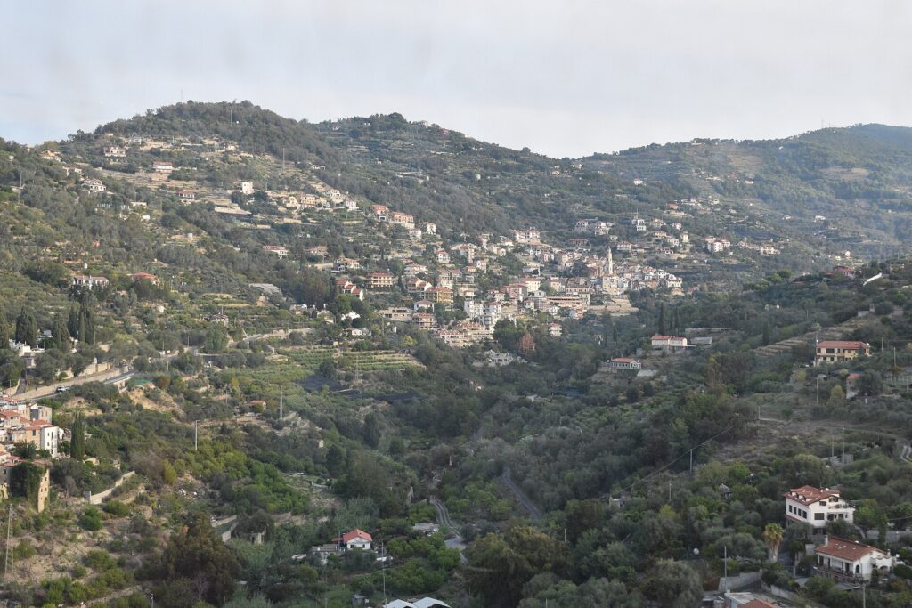
The route pages are on the Vallebona tourism website, with a map, PDF, KML and GPX files. The data come from a route platform and were updated in summer 2023, so check signage, landslides and closed paths with the tourist office (IAT, tel. +39 0184 290572) before leaving. After rain, during a weather alert or in autumn, wait for the ground to dry: forecasts are on the Vallebona weather page, and alerts on the official Allerta Liguria site. Bring water and hiking shoes.
This is the route of most interest if you stay on the coast. The village describes it as an “almost entirely pedestrian path on a trail” to reach the old town of Bordighera. It is 5.9 kilometres and about 1 hour 55: +145 metres of ascent and −251 of descent, so in practice you go down. According to the official tracks, 2.2 km are on asphalt, 0.4 on road and 3.3 on trail. The track’s name, “Sasso Beodo Bordighera”, points to the Sentiero del Beodo, the old canal that brought water to Bordighera and that Monet painted.
The page does not say where it starts; the official GPX file shows the track starting in the village and ending at Bordighera Alta, at 45 metres above sea level. It is best to confirm this with the tourist office. For the return, take bus 9 from Bordighera station to Vallebona: according to the 2026/27 winter timetable of Riviera Trasporti it runs only on weekdays. At the weekend think of a taxi, or a car left in Vallebona.
A simple loop starting and ending in the village. The village describes it as a way to cross the characteristic bridges and see the village from the front. It is 2.1 km long, takes about three quarters of an hour and climbs and descends 119 metres, between 91 and 165 metres above sea level. The tourism site mentions the Vecchie Fontane and the ruins of old forges along the country paths.
A loop of 6.5 km and about two hours, with 244 metres of ascent, on country road and footpath, between 151 and 328 metres. The page calls it easy, but does not list the chapels. Vallebona’s country chapels, each with its own feast day, are Madonna del Carmine, Madonna della Neve, San Rocco (near the cemetery), San Bernardo and San Sebastiano: we do not know which ones the route passes.
This is the long round: 13.6 km and about five hours, with 701 metres of ascent and descent between 91 and 605 metres. The village calls it a “challenging route”, starting and ending in Vallebona; the official name, “Monte Nero via Seborga_Sasso”, indicates it passes through Seborga and Sasso. It is about 0.5 km of road, 6.7 of trail, 4.3 of nature trail and 2.1 of asphalt. The village does not list refreshment stops along the way: bring food and drink. A 600-metre summit sounds small, but after 700 metres of climbing your legs notice it.
Vallebona is on a stage of the Sentiero Liguria (number 28), which has 30 stages and 675 kilometres in total. The page gives it as 26.6 km and 9 hours and lists it as suitable for trekking and mountain biking, but does not give its start and end: for fit walkers it is a long stage. The village also lists two cycle routes, the Bordighera–Dolceacqua cycle path and the Riviera dei Fiori cycle path, reachable from Vallebona in a few kilometres, without giving lengths.
The simplest combination: a morning in the old town of Vallebona (see the guide to Vallebona), lunch in the village, then a walk down to Bordighera Alta and a bus or taxi back. Anyone with a full day can do the Monte Nero trek, and families the Due Ponti loop. If you are in Bordighera, the old town and the Sentiero del Beodo can also be reached from there with a short walk: see the guide to Bordighera.
Nearby
Riviera di Ponente › Riviera dei Fiori
Village at 149 m behind Bordighera: Piazza dei Quattro Elementi, gates and ouge, decorated Apes, orange blossom water and walks.
Discover →Guide
The weather in Vallebona today, tomorrow and for the next 10 days: hourly forecast, wind, rain and the climate month…
Discover →