
Riviera di Ponente › Riviera delle Palme
Castelvecchio di Rocca Barbena
Stone village of the Val Neva: the Clavesana castle (private), Orange Flag, alleys, Rocca Barbena and the path to Zuccarello.…
Discover →
The climb from Colle Scravaion, waymarks, grade E, times and warnings for Castelvecchio's mountain.
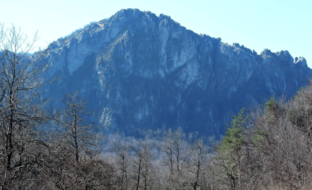
The Rocca Barbena is the mountain that watches over Castelvecchio di Rocca Barbena: a ridge of pale limestone, 1,142 metres high, with pinnacles and rock walls that can be seen from all over the Val Neva. You do not need to be a mountaineer to climb it, but the most useful guide is one that also says what is not confirmed: official data on the route is scarce and almost all of it comes from hikers’ reports.

The Rocca Barbena is a limestone peak of the Ligurian Prealps, within the territory of the municipality of Castelvecchio. It stands on the watershed between the Ligurian Sea and the Po basin: on one side the waters run towards the Val Neva, on the other towards the Bormida. It is a mountain of rock and karst, with pinnacles, sinkholes and caves, which is why the area is protected as a Natura 2000 site called Monte Ravinet – Rocca Barbena. The Colle Scravaion separates it from the neighbouring Monte Lingo (1,103 m).

The most used ascent starts from the Colle Scravaion, at about 814 metres, the pass linking Castelvecchio and Bardineto: provincial road 52 (Barreassi–Calizzano) crosses it. From Castelvecchio it is about 9 km by road in some ten minutes (estimate based on OpenStreetMap data). Near the pass there is a small picnic area; car park and number of spaces are not confirmed. The col is also a junction of the Alta Via dei Monti Liguri (AV), the long itinerary that here runs under the north walls of the mountain.

From the col the path climbs straight up, waymarked with three solid red dots, on a short but steep track. A 2010 report describes it as a quiet outing with little height gain and a short distance; another hiker took about three quarters of an hour to go up. A short stretch over rock requires a sure foot. At the top there is a cross with a metal box holding the summit register and a panoramic clearing.

The official grade is E (hikers), that of paths without mountaineering passages. That does not mean easy: the ground is rocky and in places very steep, above all on the way down.
One report suggests going up by the steep path and coming down the other side, in the woods below the north face, waymarked with a red square as far as the Sella Alzabecchi and then with the signs of the Alta Via. It is a loop that can be walked in either direction, but the report prefers climbing the steep path and descending through the woods. Beware: the north face of the Rocca drops sheer into the woods, so keep away from the edge.
From the Giogo di Toirano you can reach the Rocca by following the Alta Via to the junction with a signpost and three solid red dots. Another route follows the east ridge from the Colletto Bianco. Those who want more will find, in the Bardineto guide, the long loop of about 28 km with the Rocca, the Bric Schenasso and Monte Carmo, with poor waymarking in the first part: hiking from Bardineto.
Bring boots or trekking shoes with a good sole, water and a jacket, because the altitude changes the weather compared with the coast. Check the forecast and the ARPAL alerts before setting out. The best season is between spring and autumn: with snow or ice the exposed sections and descents need much more care and it is better to give up. For a map use the IGC 1:50,000 sheet 15, indicated by the reports. Everything else, from the history of the village to the alleys, is in the Castelvecchio di Rocca Barbena guide; for another easy walk there is the Sentiero di Ilaria.
Nearby
Riviera di Ponente › Riviera delle Palme
Stone village of the Val Neva: the Clavesana castle (private), Orange Flag, alleys, Rocca Barbena and the path to Zuccarello.…
Discover →Guide
The weather in Castelvecchio di Rocca Barbena today, tomorrow and for the next 10 days: hourly forecast, wind, rain and…
Discover →