In Liguria, you can hike between the sea and the mountains in a single day. The premier hiking trail isthe Alta Via dei Monti Liguri: over 400 km in 43 stages along the ridge, from Ventimiglia to Ceparana, marked with the abbreviation AV. Along the coast, you’ll find the most famous half-day hikes: the Cinque Terre, Portofino–San Fruttuoso, and the Sentiero del Pellegrino in Noli. Here you’ll find details on the Alta Via route, the best times to go, must-see coastal trails, the Finalese area for mountain biking and rock climbing, and safety guidelines.
- Alta Via dei Monti Liguri: over 400 km, 43 stages, from Ventimiglia to Ceparana (La Spezia)
- Trail marker: a red-and-white flag with the letters “AV”
- Highest point: Monte Saccarello, 2,201 m, the highest peak in Liguria
- When: spring and fall; in summer, it’s best at higher elevations; in winter, the coast
- On the coast: Cinque Terre, Portofino, Noli–Varigotti, Tellaro, Montallegro
- Before You Go: Regional Weather Alerts and Park Notices
Farmstay Accommodations in Liguria on Booking
The “Booking” buttons on this page are affiliate links: they don’t cost you anything extra and help support this guide.
Alta Via dei Monti Liguri: What It’s Like
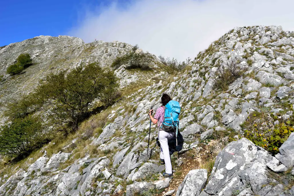
The Alta Via dei Monti Liguri (AVML) runs along the watershed between the Alps and the Apennines and crosses the entire region, from the province of Imperia to that of La Spezia. The region’s tourism website describes it as a route of over 400 km in 43 stages, from Ventimiglia to Ceparana; other sources cite 430–440 km. It alternates between hiking trails and mule tracks, almost always between 1,000 meters and the ridge, with the sea in view for much of the way.
It is marked with a red-and-white flag bearing the letters “AV” in the center. Trails leading down to the coast run along the entire route: you can do a single leg, a weekend trip, or the entire crossing, and return to the coast at many different points.
| Sector | Stages | Area |
|---|---|---|
| Val Nervia | 1–4 | inland from Ventimiglia |
| Ligurian Alps | 5–9 | Saccarello, Triora |
| Melogno | 10–15 | the hinterland of Loano and Finale |
| Beigua | 16–20 | above Varazze and Arenzano |
| Praglia | 21–26 | Genova hinterland |
| Scoffera | 27–31 | Upper Trebbia Valley |
| Zatta | 32–37 | Tigullio hinterland |
| Val di Vara | 38–43 | toward Ceparana |
The distances and elevation gains for each stage vary depending on the route options: Before setting out, download the maps and check the trail conditions on the officialAlta Via dei Monti Liguri website.
The Best Places to Start

In the Ponente region, the Alta Via passes by Mount Saccarello (2,201 m), the highest peak in Liguria: from Triora, the ascent is long—about 7 hours with over 1,400 meters of elevation gain—and between May and June, the rhododendrons are in bloom. Closer to the sea, above Loano, lies Monte Carmo (1,389 m), which can be climbed from the Giogo di Toirano.
Between Savona and Genoa, the Alta Via crosses the Beigua Park, a UNESCO Global Geopark located above Varazze and Arenzano: here, the ridge is just a stone’s throw from the coast, and the view of the sea is unobstructed. If you’re looking for an easy day hike, this is the place for you.
Must-See Seaside Trails
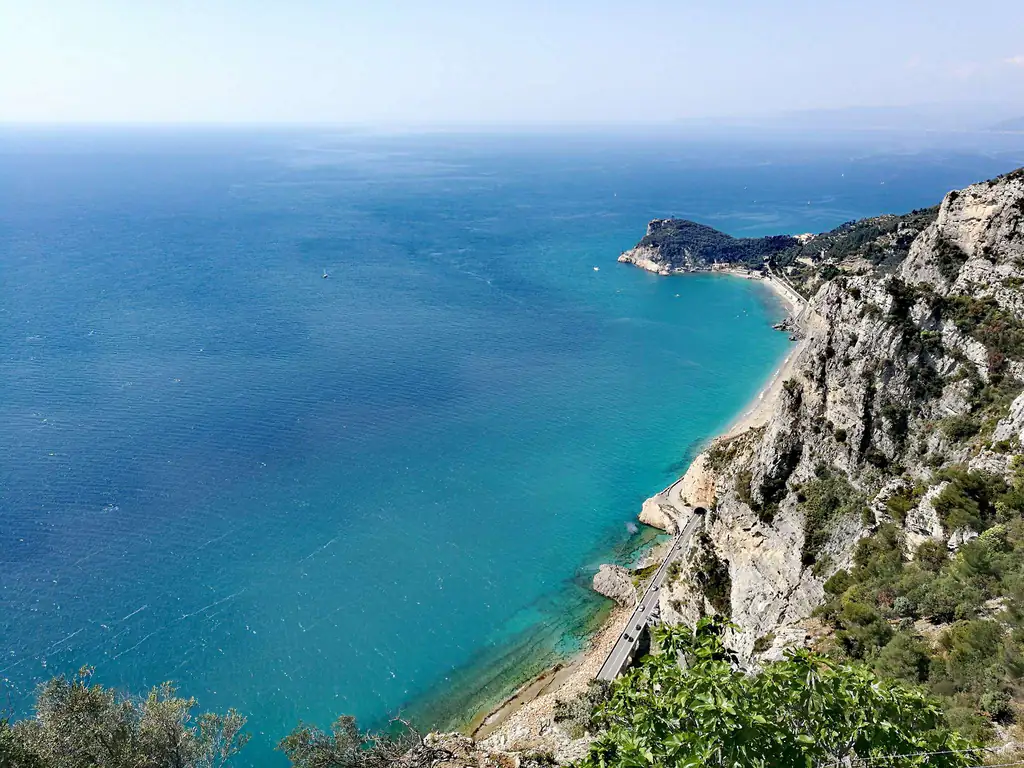
If you’re looking for hiking trails in Liguria with the sea right at your feet, here are the hikes you’ll find described in detail on the website:
- Cinque Terre: The Monterosso–Vernazza–Corniglia “Green-Blue Trail” is closed as of September 10, 2026; the Levanto–Monterosso trail via Punta Mesco (about 3 hours) remains open, the Corniglia–Volastra–Manarola trail through the vineyards, and the Via dell’Amore (ticket required). Check the Cinque Terre trail guide for current status and times.
- Portofino–San Fruttuoso: about 4 km and a good two hours through the woods on the headland, marked by two red dots. See the trail to San Fruttuoso.
- Noli–Varigotti: the Pilgrim’s Trail above Capo Noli, about 5–6 km and 2–3 hours, featuring the Grotta dei Falsari and the Torre delle Streghe. See the Pilgrim’s Trail.
- Tellaro and Lerici: trails in the Montemarcello-Magra-Vara Park through olive groves and abandoned villages, up to 3 hours. See the trails in Tellaro.
- Rapallo–Montallegro: The mule trail climbs to the sanctuary at 612 meters in about an hour and a half; you can also take the cable car down. See Montallegro.
- Riomaggiore–Portovenere: 12–15 km and 5–6 hours on the Alta Via delle Cinque Terre, including the exposed section of the Muzzerone.
Staying in Levanto, near the Cinque Terre hiking trails
On the western Riviera, in Bordighera, the Sentiero del Beodo follows an old aqueduct from Bordighera Alta into the Sasso valley, among palms and mimosas: Monet painted it in 1884. In winter, go in the morning, when it gets the sun.
Finale Ligure: Mountain Biking and Rock Climbing
Finale Ligure and its surrounding countryside are the heart of outdoor activities in Liguria. For mountain biking, there are over 200 trails stretching from the mountains to the sea; the Finalenduro was founded here in 2008, and from October 16–18, 2026, the Finale Outdoor Region will host the UCI Enduro and E-Enduro World Championships. Shuttle services are widely available to take you back up to higher elevations.
For rock climbing, the Finale area offers over 4,000 routes on limestone cliffs, such as Rocca di Perti, Monte Cucco, and Rocca di Corno, with difficulty levels up to 8c+. The Finale Outdoor Region consortium is asking for a contribution toward the maintenance of trails and climbing routes. Between climbing outings, it’s worth visiting Finalborgo and its castles.
Where to Stay in Finale Ligure
When to go
Spring and fall are the best seasons almost everywhere: mild temperatures, blooming flowers, and few people. In the summer, it gets hot along the coast: hike at dawn and avoid the midday hours, or head up to higher elevations, where it’s more comfortable on the ridgeline. The regional website lists the Alta Via as accessible year-round, but in winter, the higher sections—such as the Ligurian Alps and the Melogno—may have snow and fog; during that season, it’s better to stick to the trails near the sea.
In the fall, Liguria experiences heavy rainfall. Always check the forecast on the Liguria weather page and official alerts.
Safety and Rules
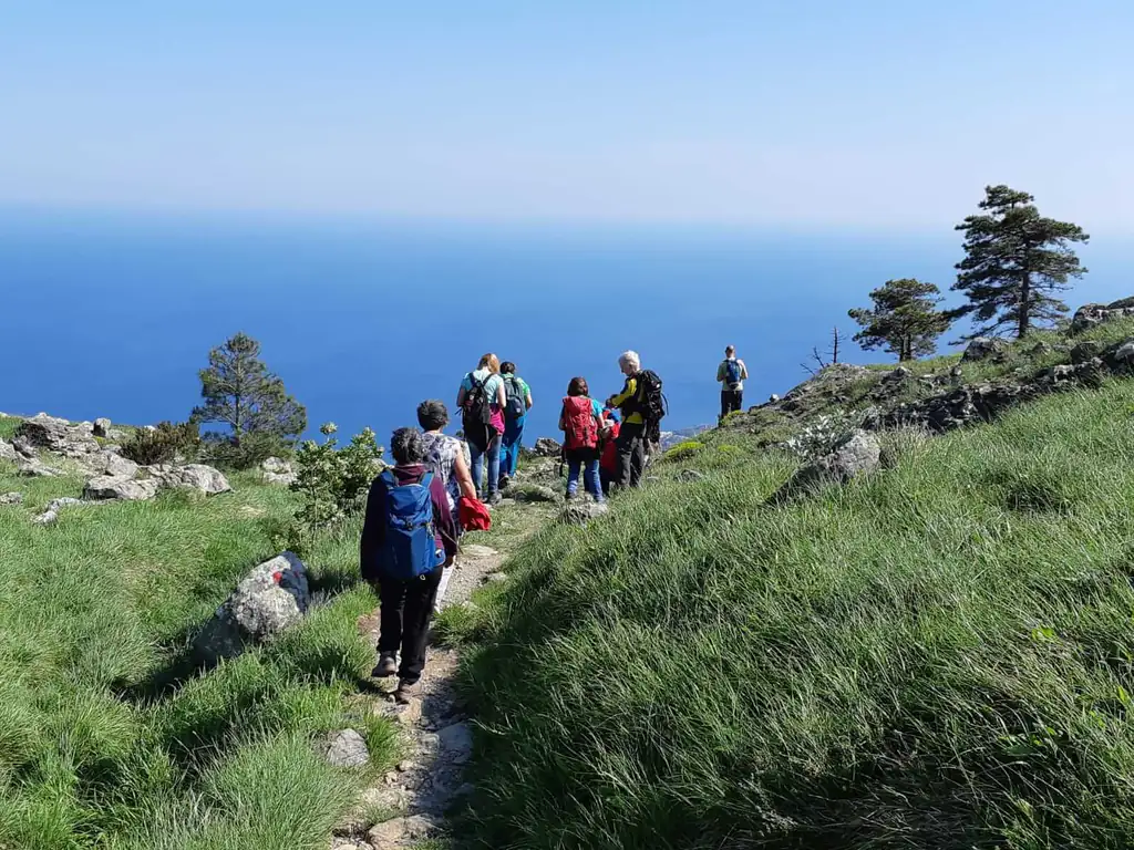
- Footwear: Since 2019, closed-toe shoes with treaded soles have been required on the trails in the Cinque Terre Park; flip-flops and sandals are prohibited, with fines of up to 2,500 euros.
- Weather alerts: In the Cinque Terre, trails are closed when an orange or red alert is in effect, and it’s best to avoid hiking anywhere; check Allerta Liguria on the day of your trip.
- Park Notices: Landslides and closures are common; follow the official notice, not the app or blog.
- Local restrictions: In Portofino, for example, Via dei Tubi and Passo del Bacio are closed to traffic.
- Water and timing: Water fountains are rare along the ridges; set out early and plan to return before dark.
- Emergencies: The single emergency number is 112.
Where to sleep
Along the Alta Via, there are places to stay and eat, but not at every stage end: often you’ll head down to a nearby town. Book in advance and ask if they serve dinner. For excursions along the coast, it’s best to have a fixed base: Levanto for the Cinque Terre, Finale for mountain biking and rock climbing, and Camogli or Santa Margherita for Portofino. If you’d like to stay in the hills, close to the trails, check out the agritourism farms in Liguria or the campgrounds.
Frequently Asked Questions
How long is the Alta Via dei Monti Liguri?
Over 400 km in 43 stages, according to the Liguria Region’s tourism portal (other sources cite 430–440 km), from Ventimiglia to Ceparana, in the province of La Spezia.
How is the Alta Via marked?
It has a red-and-white flag with the letters “AV” in the center. Many cross-country trails connect it to the coast.
What is the most beautiful seaside hike in Liguria?
With the Sentiero Azzurro closed, the most recommended routes are Levanto–Monterosso, Portofino–San Fruttuoso, and the Sentiero del Pellegrino between Noli and Varigotti.
When is the best time to go hiking in Liguria?
In the spring and fall. In the summer, go for an early walk or head up to higher elevations; in the winter, stick to the trails along the coast.
Can you wear flip-flops on the trails?
No. They have been banned in the Cinque Terre since 2019, with fines of up to 2,500 euros, and closed-toe shoes with treaded soles are required on any trail in Liguria.